.56 Acre Corner Lot in Apache
116 Co Rd 3148 Show Low Crossroads : Show Low Crossroads, AZ 85940
Apache County, Arizona
Land Description
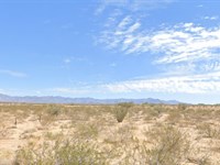
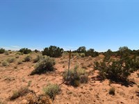
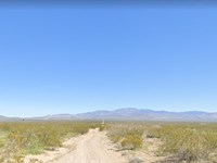
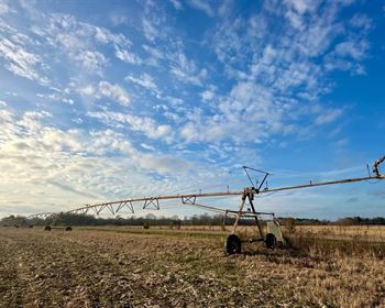
Utilities at lot line. 0.56 Acre Corner Lot in Show Low Crossroads, Apache AZ. Close to Highway 60...
Cash Price: $15,000.00 (plus 100.00 document fee)
Financing Terms (with no Credit Check...):
Deposit $1,000.00 down (Negotiable and refundable for 30 days) (plus 100.00 document fee non-refundable) secures the property
Payments would months $394.67/Month, months $297.45/Month, months $239.12/Month, months $200.23/Month
(Monthly payments include $5.79 monthly taxes and $20 HOA Fee)
(Part Of Show Low Cross Roads Hoa $20/Month)
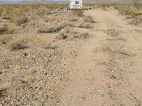
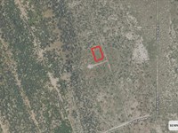
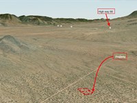
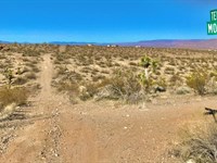
This Corner Lot property has it all. Electricity at the lot line, fire department across the street, RV storage across the street, Paved roads, Great views, great access and proximity to two different towns which have everything anyone could need. Show Low Crossroads Lot 53 - Apache County, AZ. Show Low is 14 miles to the East, Vernon is 5.2
Miles to the West, and Interstate 60 is approximately 0.22 miles to the south of this amazing property.
Lemme know if you have more questions or if you would like to speak about moving forward with the purchasing process. Just so you are aware your deposit would be refundable for 30 days, the doc fee is not refundable, but If you are unhappy in any way with the property. We have a 1-year exchange policy….where we will apply all monies paid up to that point towards another property in our inventory. This clause will be in your purchase agreement.
Property Details:
City: Show Low
Apn:106-29-053
Size: 0.56 Acre
Property Address: 116 Co RD 3148 Show Low Crossroads
Zip Code: 85940
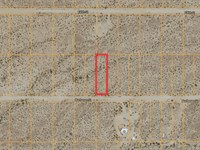
Legal Description: Lot 53, Show LOW Crossroads,
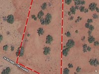
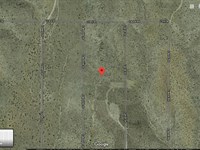
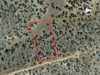
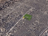
Gps Coordinates: Corners of property
Nw: 34.276886, -109.777666
Ne: 34.276881, -109.777306
Se: 34.2761, -109.7774
Sw: 34.276095, -109.777631
Google Maps Short Url:
Power: In the Area
Water: Community Well (dry at the moment)
Sewer: City provided
Gas: Buyer Responsible
Restrictions:
This property is zoned as Agriculture General. 1 (one) Dwelling or Building (or Mobile Home) per Acre in this property is the zoning restriction
Land Maps & Attachments
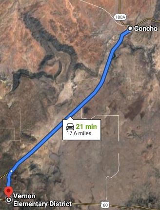
Directions to Land
Apache County
Arizona, USA
Head west on Oakridge Rd
26 min (8.9 mi)
Continue on US-191 to AZ-61 W
1 hr 26 min (87.8 mi)
Follow AZ-61 W to your destination
29 min (27.3 mi)
126 Co Rd 3148
Vernon, AZ 85940, USA
More Land Details
More Land from Paul Flanagan
 4 AC : $10K
- 3.4 AC : $12K
- 0.6 AC : $4.2K
- 0.7 AC : $6.5K
- 0.4 AC : $3K
- 2.1 AC : $12K
- 2 AC : $14K
- 0.4 AC : $4K
- 2.4 AC : $12K
- 2 AC : $9.8K
- 1.1 AC : $8.4K
- 0.4 AC : $3K


