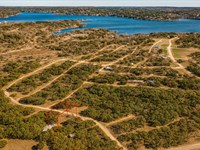
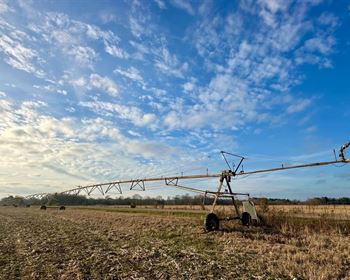
1.04 Acre Mountain Views, $150/Mo
County Road 6015 : Saint Johns, AZ 85936
Apache County, Arizona
Land Description
Owner Financing Available - This 1.04 acre lot is located in Saint Johns, Arizona and the address is County Road 6015, Saint Johns, AZ 85936.
Saint Johns is the county seat of Apache County, Arizona, United States. It is located along U.S. Route 180, mostly west of where that highway intersects with U.S. Route 191. As of the 2010 census, the population of the city was 3,480.
Features Close to town, good road access
Only $650 Down and $150/Month for 49 months $8000 or Discounted Cash Price $6497
Property Details
Apn 203-50-310
Address County Road 6015, Saint Johns, AZ 85936
County Apache
State Arizona
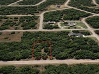
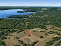
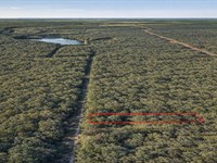
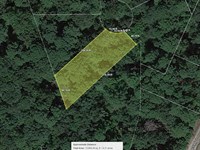
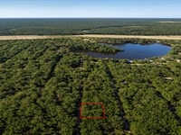
Size 1.04 Acres
Dimensions 149' x 303'
Legal Subdivision Hacienda San Juan Lot 310 Section 25 Township 013 N Range 027 E
Terrain Flat
Access Dirt Road
Power Power in the Area Power Company Navopache Electric Co-Op
Water Water in the Area Arizona Water Co Well Sunbelt Drilling Water Haul White Mountain Water Hauling
Sewer Sewer or Septic in the Area Septic B C Septic Taxes per Year $32
Hoa Fees per Year No Hoa/Poa
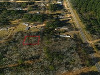
Gps Coordinates center at the road 34.497930, -109.434133
--- Northwest Corner 34.498126, -109.434640
--- Northeast Corner 34.498152, -109.433618
--- Southwest Corner 34.497720, -109.434640
--- Southeast Corner 34.497752, -109.433622
Elevation 5828
Building Information
Zoning Az-Navajo-A-General
Time Limit to Build No time limit to build
Site Built Homes Allowed Allowed. 174 min sqft
Modular Homes Allowed Allowed. 174 min sqft
Manufactured Homes Allowed Allowed
Mobile Homes Allowed Allowed
Tiny Homes Friendly Allowed. 174 min sqft
Allowable Uses
Full-Time RV Living Allowed Not Allowed
RV on the Property While I build Not Allowed
Camping in a RV Allowed Not Allowed
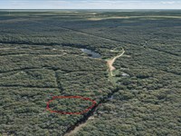
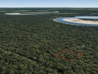
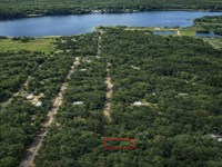
Land Maps
Directions to Land
From US-180
St Johns, AZ 85936, USA
1.Head east on US-180 E toward 6027
2.Turn right onto Co Rd 6006/County Rd 6006 - Cedar Rd
3.Turn left onto Co Rd 6016
4.Turn right at the 1st cross street onto Co Rd 6015
5.Lot is on the left
More Land Details
More Land from Benjamin Davis
 0.1 AC : $5.5K
- 0.6 AC : $17K
- 0.9 AC : $17K
- 0.1 AC : $6K
- 0.3 AC : $5K
- 0.3 AC : $10K
- 0.7 AC : $24K
- 0.3 AC : $11.5K
- 0.4 AC : $12K
- 0.3 AC : $10K
- 0.3 AC : $8K
- 0.2 AC : $7.5K