Live or Farm for $609.31/Mo
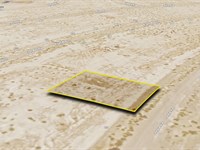
N Magnolia Dr : Dolan Springs, AZ 86441
Mohave County, Arizona
Land Description
$609.31 Down $609.31/Mo for 24 Months 0% Int
No Credit Checks. All Major Credit Cards Are Accepted.
Call or Text Us Now To Reserve.
30-Day Money Back Guaranteed.
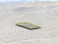
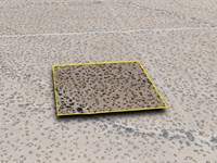
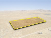
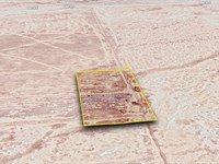
Discover tranquility with this 1-acre parcel in Dolan Springs, Mohave County, AZ. You'll be near local spots like the Mt. Tipton Wilderness and Dolan Springs Trail. The area blends privacy with proximity to community essentials, offering a balance between seclusion and convenience.
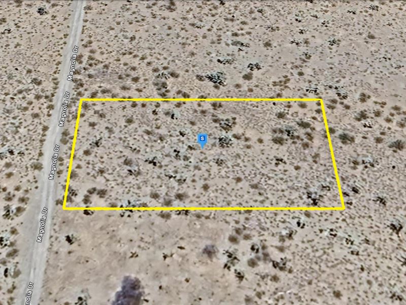
Property Location: Dolan Springs, AZ 86441
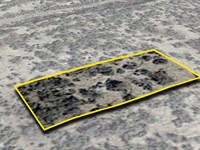
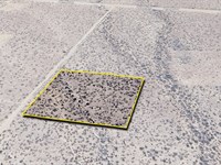
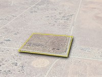
Lot Size: 1 Acre
Zoning: Residential and Agricultural Use
Electricity: YES - Power Lines are There - Just 273 Feet away from the Property
Primary Road: Dirt Road Access
Water: Would be from Alternative Sources
Make Your Move, Reserve It Now For Only $609.31. Act Now On This Sought-After Lot While You Can. Get Easy 24 Months Financing at 0% Interest, No Credit Checks, All Major Credit Cards Are Accepted.
$609.31 Down $609.31/Mo for 24 Months 0% Int
Call or Text Us Now To Reserve.
Cheap and Affordable Vacant Land For Sale in Dolan Springs
Flexible Financing Options are Available
Owner Financed Rural Land in Arizona
Undeveloped Property For Sale With Direct Road Access
For Residential and Agricultural Development in Mohave County
Buildable Land With Power Access
Desert Land With Mountain Views
Finance Land Near Entertainment Hubs
Farm and Ranch Land Ideal For Farming and Harvesting Crops, Grazing Livestock
Perfect for Hiking and Hunting Enthusiasts, Being Close to Recreational Areas
Quiet and Friendly Neighborhood
Located Near Schools, Parks, Shops, and Restaurants
Not in Flood Zone and Wetlands
Property Within Secured Subdivision
Land Maps & Attachments
Directions to Land
Center of Lot, GPS Coordinates: 35.650338, -114.247940
GPS Coordinates for Corners of the Property:
Nw: 35.650559, -114.248395
Ne: 35.650559, -114.247486
Se: 35.650120, -114.247488
Sw: 35.650119, -114.248397
More Land Details
Land Price History
More Land from Patrick Elder
 2 AC : $7K
- 2.4 AC : $5K
- 20 AC : $25K
- 1.3 AC : $7K
- 0.2 AC : $6K
- 2.4 AC : $5K
- 1.4 AC : $8K
- 14.9 AC : $275K
- 3.8 AC : $70K
- 0.2 AC : $4K
- 2.5 AC : $35K
- 0.2 AC : $50K