No Restriction Expansive Desert Lot
Arizona City, AZ 86512
Apache County, Arizona
Land Description
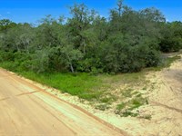
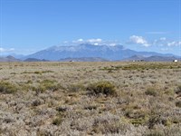
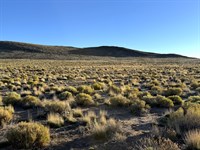
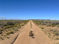
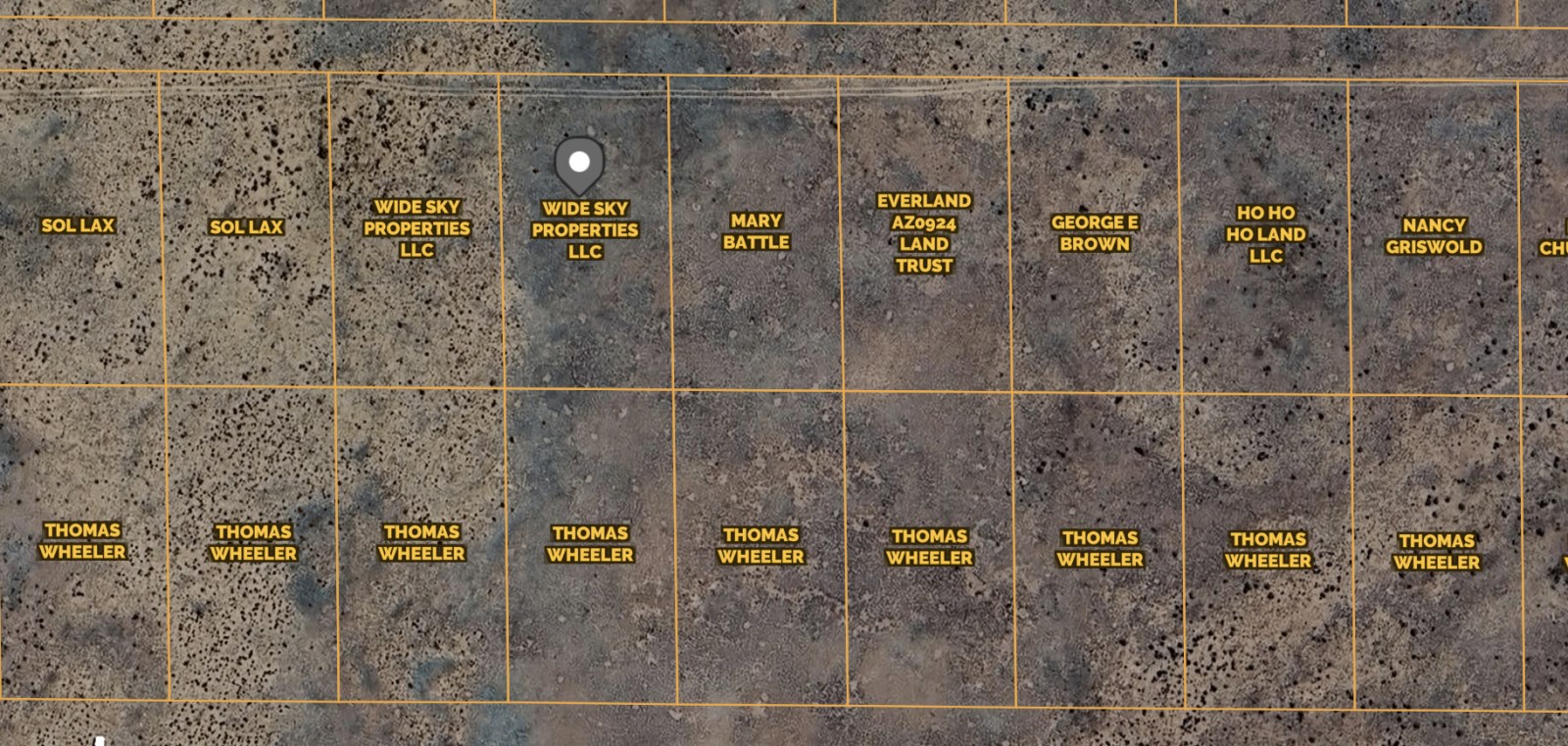
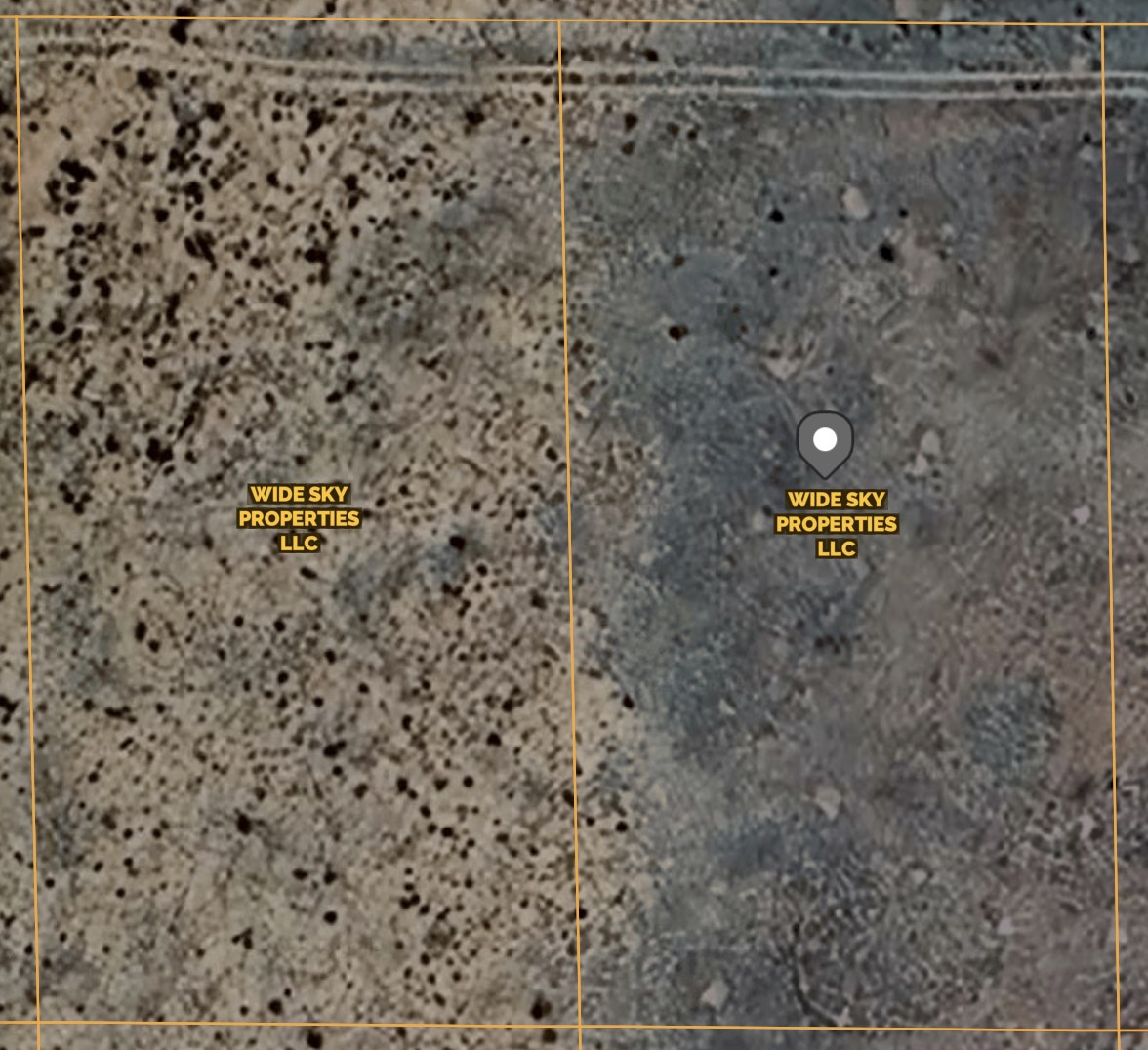
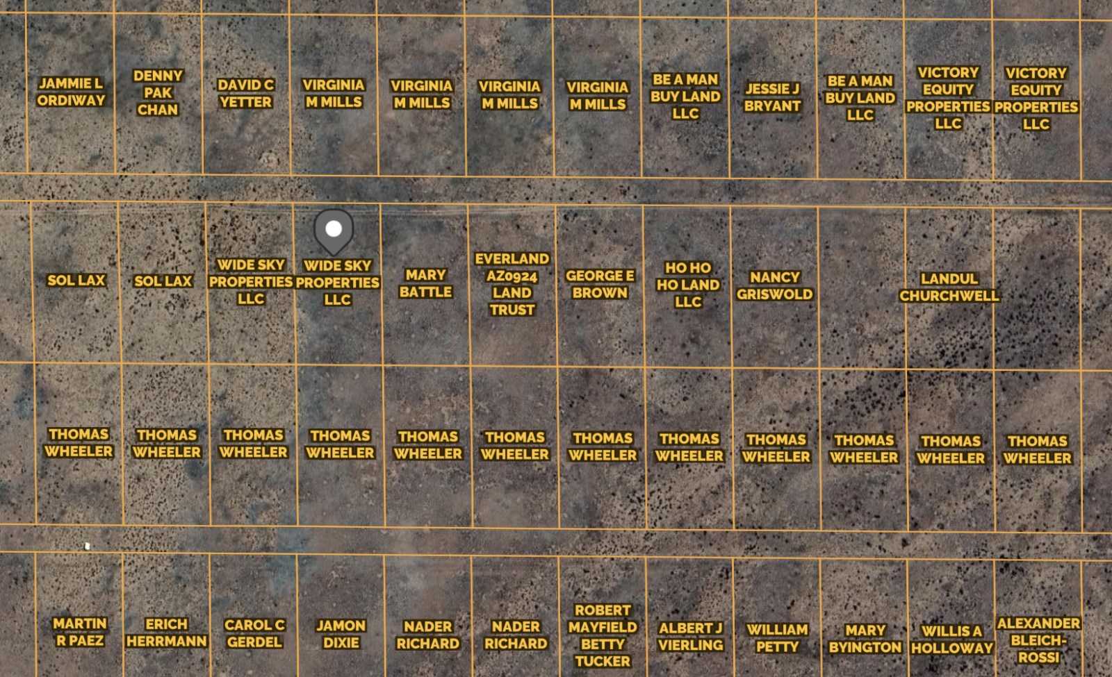
This 2.15-Acre joint lot in Petrified Forest Estates Unit 2 offers investment, residential living, and adventures. With county-maintained road access, this flat, desert terrain is perfect for building a home, setting up a manufactured home (15 years or newer), and enjoying the great outdoors. RV camping is allowed for up to 14 days, and with a septic system installation, you can stay even longer and live off the grid.
It offers easy access to major highways like US Highway 40 and Route 77, making it a prime spot for future development or recreational use. It is walking distance from the Petrified Forest National Park, Rainbow Forest Museum, and Meteor Crater. Plus, it's easily accessible from major cities like Albuquerque, Santa Fe, Phoenix, and Tucson.
We will finance it for you. No credit check is required with Low monthly payments. It's way easier than you think.
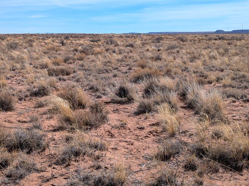
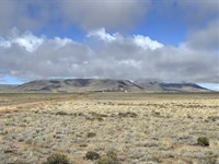
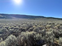
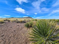
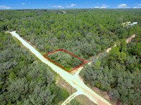
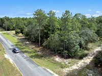
Actual Photos Of The Property
Easy Owner Financing. No credit checks and no banks are required. Contact us NOW for more details.
Property Details:
Property Address: Sanders Unified District, Arizona, 86512
Apn: 211-25-248/211-25-249
Size: 2.15 acres
Subdivision: Petrified Forest Estates Unit 2/N/A/248
Zoning: AG Agricultural General
Annual Property Taxes: $7
Hoa/Fees: None
Camping/Notes: Camping is allowed with an RV for up to 14 days, if longer than 30 days, a septic system must be installed.
RVs/Notes: You can have an RV but if you live in it longer than 30 days, it needs to be hooked to a septic system.
Mobile Homes: Mobile homes are not allowed but manufactured homes are. Age is restricted to 15 years or newer without an approved conditional use permit. A building permit is required. Conveyance: Warranty Deed
Water: Well or cistern. Contact the Health Department.
Sewer/Septic: Need to install septic. Contact the Health Department.
Electric/ Power: Solar or Contact Navopache Electric.
Gas: Use Propane tanks.
Waste: Contact Waste Management.
Access Road: N7164
Road Surface: Dirt
Terrain Type: Flat, Plain, Desert.
GPS Coordinates (4 corners): 34.989277,-109.822014
Nw: 34.989669,-109.822266
Ne: 34.989666,-109.821735
Se: 34.98886,-109.821719
Sw: 34.988863,-109.822247
Approximate Distance to Nearby Cities & Points of Interest:
Closest Highways: US Hwy-40, Rt-77.
Closest Major Cities: Albuquerque, Santa Fe, Ciudad Juarez, Tucson, and Phoenix.
Nearby Attractions:
Petrified Forest National Park, Agate House, Rainbow Forest Museum, Painted Desert Inn, and Meteor Crater Natural Landmark.
- Guaranteed Financing
- No Credit Check
- No Bank or Broker fee
- 30-day money back guarantee
- Warranty Deed
- Guaranteed free and clear title
We offer owner financing with multiple options that fit any budget. Contact us a call today and don't forget to ask about our 30-day money back guarantee.
Purchase Options:
Owner Financing: $249 down and $249/Month for 40 months for Both
Cash Price: $9,200.00
Closing Fee: $249 (due with a down payment and non-refundable)
Additional monthly fees: $10 monthly note maintenance fee and pro-rated property taxes
Reach out today
Land Maps & Attachments
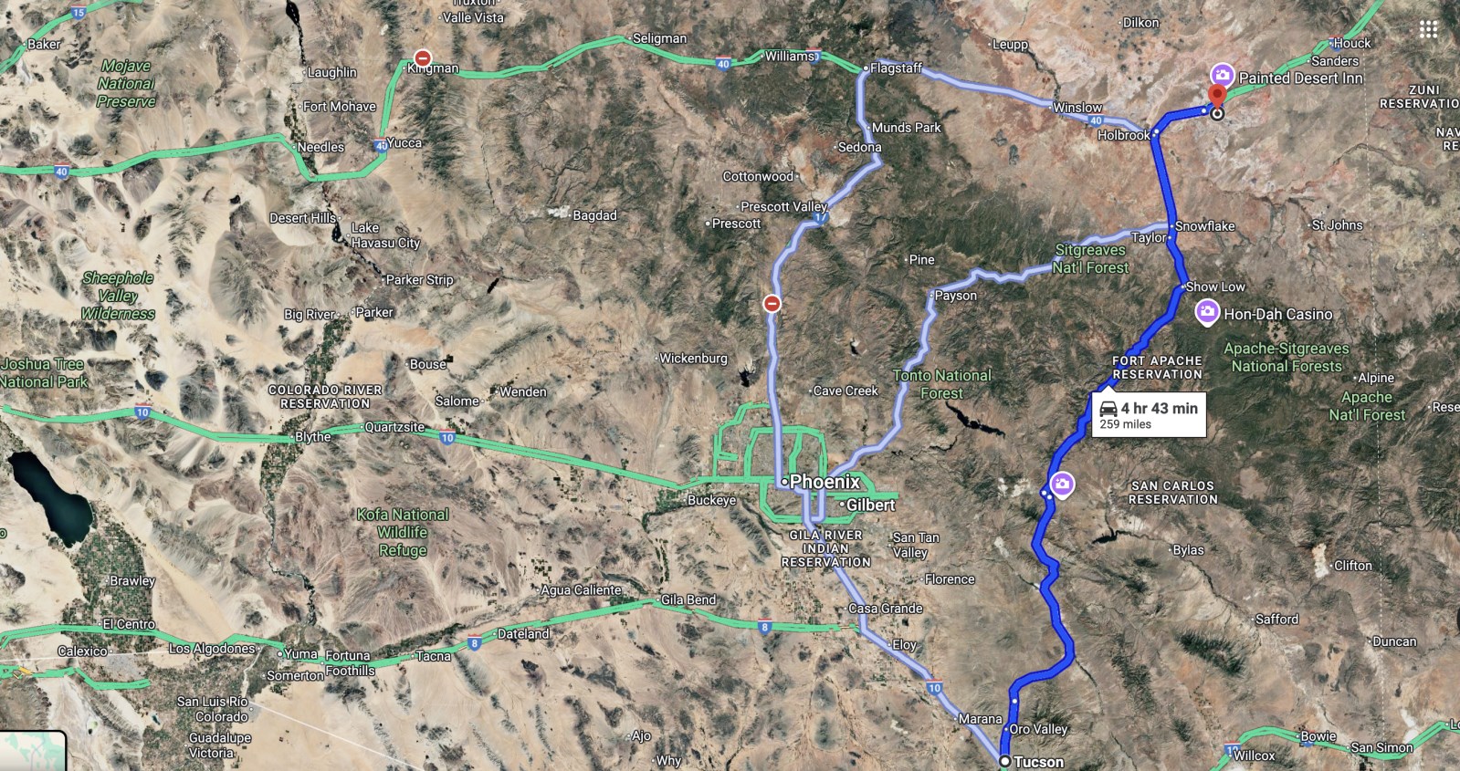
Directions to Land
Tucson
Arizona, USA
Head west on W Jacinto St toward N Balboa Ave
54 sec (0.2 mi)
Drive from AZ-77 N to Navajo County. Take exit 303 from I-40 E
4 hr 29 min (250 mi)
Turn right onto N Oracle Rd
Pass by Wienerschnitzel (on the right in 1.1 mi)
18.8 mi
Continue onto AZ-77 N
78.9 mi
Turn left onto US-70 W
2.0 mi
Turn right onto AZ-77 N/US-60 E (signs for Show Low/Springerville)
Pass by Sonic Drive-In (on the left in 85.5 mi)
86.6 mi
Use the left 2 lanes to turn left onto AZ-77 N/N Penrod Rd
Continue to follow AZ-77 N
Pass by Wells Fargo Bank (on the right in 46.4 mi)
47.1 mi
Turn right onto the ramp to Albuquerque/Keams Canyon
0.4 mi
Merge onto I-40 E
16.1 mi
Take exit 303 toward Adamana Rd
0.2 mi
Follow Old Rte 66 and 7156/Adamana Rd to N7164 in Apache County
12 min (8.4 mi)
Turn right onto Adamana Rd
194 ft
Turn left onto Old Rte 66
5.0 mi
Old Rte 66 turns slightly right and becomes 7156/Adamana Rd
3.1 mi
Turn left onto N7164
Destination will be on the right
0.2 mi
Sanders Unified District
Arizona, USA
More Land Details
More Land from Karen Gesa
 15 AC : $24K
- 0.5 AC : $18.9K
- 2.6 AC : $7K
- New0.3 AC : $9.9K
- 0.3 AC : $4.4K
- 4.9 AC : $9K
- 5 AC : $9K
- 0.3 AC : $3.9K
- 5 AC : $9K
- New0.2 AC : $9.9K
- New0.2 AC : $11K
- 5 AC : $9K


