Invest & Build in Cheap Residential
Sanders Unified District : Arizona City, AZ 86512
Apache County, Arizona
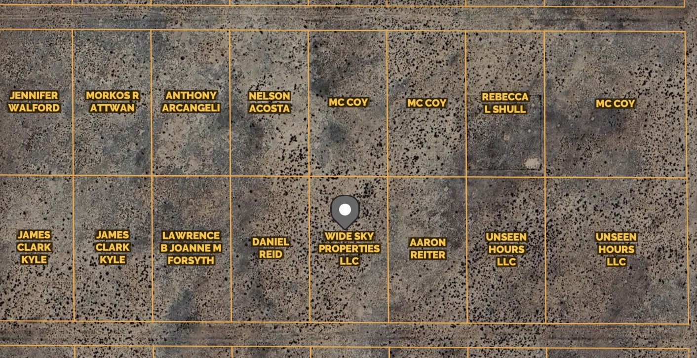
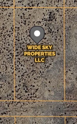
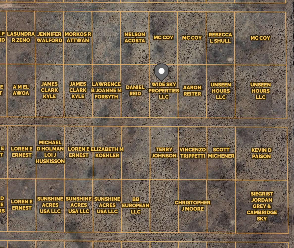
Land Description
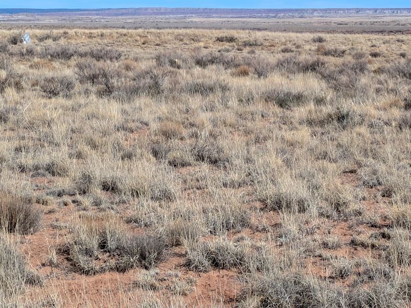
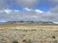
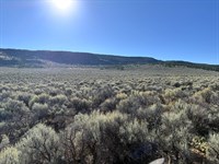
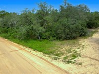
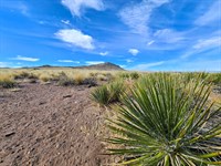
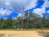
This affordable 1.09-Acre property in Petrified Forest Estates Unit 2 offers incredible investment for building your dream home in a stunning desert landscape with no HOA fees and low annual property taxes of just $3.58. It is easily accessible via a county-maintained dirt road (N7162) with flat, plain, and desert terrain. This lot is zoned for agricultural use, allowing you to build a house.
Camping for up to 14 days is permitted, and long-term RV living is allowed with a septic system. Manufactured homes are allowed, provided they are less than 15 years old. Located near major highways like US Hwy-40 and Rt-77, this lot is within easy reach of Albuquerque, Santa Fe, Tucson, and Phoenix. You'll also be close to must-see attractions like the Petrified Forest National Park and Meteor Crater Natural Landmark.
We will finance it for you. No credit check is required with Low monthly payments. It's way easier than you think.
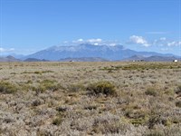
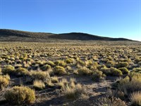
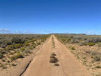
Actual Photos Of The Property
Easy Owner Financing. No credit checks and no banks are required. Contact us NOW for more details.
Property Details:
Property Address: Sanders Unified District, Arizona, 86512
Apn: 211-25-109
Size: 1.09 acres
Subdivision: Petrified Forest Estates Unit 2/N/A/109
Zoning: Agricultural General
Annual Property Taxes: $3.58
Hoa/Fees: None
Camping/Notes: Camping is allowed with an RV for up to 14 days, if longer than 30 days, a septic system must be installed.
RVs/Notes: You can have an RV but if you live in it longer than 30 days, it needs to be hooked to a septic system.
Mobile Homes: Mobile homes are not allowed but manufactured homes are. Age is restricted to 15 years or newer without an approved conditional use permit. A building permit is required.
Conveyance: Warranty Deed
Water: Well or cistern. Contact the Health Department.
Sewer/Septic: Need to install septic. Contact the Health Department.
Electric/ Power: Solar or Contact Navopache Electric.
Gas: Use Propane tanks.
Waste: Contact Waste Management.
Access Road: N7162
Road Surface: Dirt
Terrain Type: Flat, Plain, Desert.
GPS Coordinates (4 corners): 34.993668,-109.810127
Nw: 34.994064,-109.810374
Ne: 34.994062,-109.809839
Se: 34.993248,-109.809833
Sw: 34.99325,-109.810368
Approximate Distance to Nearby Cities & Points of Interest:
Closest Highways: US Hwy-40, Rt-77.
Closest Major Cities: Albuquerque, Santa Fe, Ciudad Juarez, Tucson, and Phoenix.
Nearby Attractions:
Petrified Forest National Park, Agate House, Rainbow Forest Museum, Painted Desert Inn, Meteor Crater Natural Landmark.
- Guaranteed Financing
- No Credit Check
- No Bank or Broker fee
- 30-day money back guarantee
- Warranty Deed
- Guaranteed free and clear title
We offer owner financing with multiple options that fit any budget. Contact us a call today and don't forget to ask about our 30-day money back guarantee.
Purchase Options:
Owner Financing: $149 down payment + $149/Month x 34 months
Cash Price: $4,500.00
Closing Fee: $249 (due with a down payment and non-refundable)
Additional monthly fees: $10 monthly note maintenance fee and pro-rated property taxes
Get in touch today to secure this incredible property in Arizona.
Land Maps & Attachments
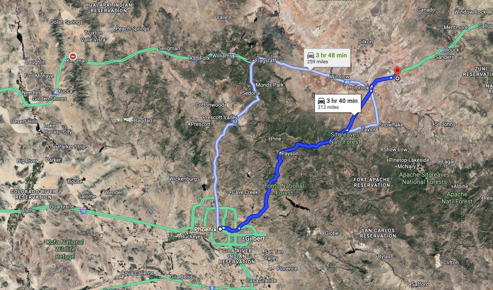
Directions to Land
Phoenix
Arizona, USA
Get on I-10 E from N 7th Ave
4 min (1.5 mi)
Head west on W Washington St toward S 4th Ave
0.3 mi
Use the right 2 lanes to turn right toward N 7th Ave
387 ft
Continue onto N 7th Ave
Pass by McDonald's (on the right)
0.8 mi
Turn right to merge onto I-10 E toward Tucson
0.3 mi
Take AZ-87 N and AZ-260 E to AZ-277 N in Heber-Overgaard
2 hr 30 min (142 mi)
Merge onto I-10 E
1.9 mi
Use the right 2 lanes to take exit 147A-147B for AZ-202 Loop E
0.8 mi
Continue onto AZ-202
12.1 mi
Take exit 13 toward AZ-87 N
0.4 mi
Use any lane to turn left onto AZ-87 N
Pass by Dairy Queen (Treat) (on the right in 73.1 mi)
73.5 mi
Turn right onto AZ-260 E
52.9 mi
Take AZ-377 N to AZ-77 N in Holbrook
39 min (40.7 mi)
Turn left onto AZ-277 N
6.8 mi
Turn left onto AZ-377 N
Parts of this road may be closed at certain times or days
33.9 mi
Drive along I-40 E. Take exit 303 from I-40 E
20 min (19.8 mi)
Turn left onto AZ-77 N
Pass by Wells Fargo Bank (on the right in 2.4 mi)
3.1 mi
Turn right onto the ramp to Albuquerque/Keams Canyon
0.4 mi
Merge onto I-40 E
16.1 mi
Take exit 303 toward Adamana Rd
0.2 mi
Take Old Rte 66 and 7156/Adamana Rd to 19th St/N7162 in Apache County
13 min (8.8 mi)
Turn right onto Adamana Rd
194 ft
Turn left onto Old Rte 66
5.0 mi
Old Rte 66 turns slightly right and becomes 7156/Adamana Rd
2.9 mi
Turn left onto 19th St/N7162
Destination will be on the left
0.8 mi
Sanders Unified District
Arizona, USA
More Land Details
More Land from Karen Gesa
 15 AC : $24K
- 0.5 AC : $18.9K
- 2.6 AC : $7K
- New0.3 AC : $9.9K
- 0.3 AC : $4.4K
- 4.9 AC : $9K
- 5 AC : $9K
- 5 AC : $9K
- 0.3 AC : $3.9K
- New0.2 AC : $9.9K
- 5 AC : $9K
- 0.3 AC : $15.9K


