Your Land in Az, $610.24/Mo
N Orchid Dr : Dolan Springs, AZ 86441
Mohave County, Arizona
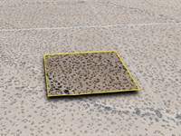
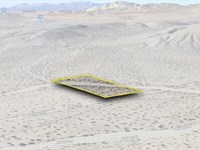
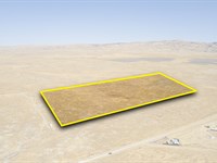
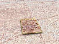
Land Description
$610.24 Down $610.24/Mo for 24 Months 0% Int
No Credit Checks. All Major Credit Cards Are Accepted.
Call or Text Us Now To Reserve.
30-Day Money Back Guaranteed.
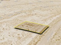
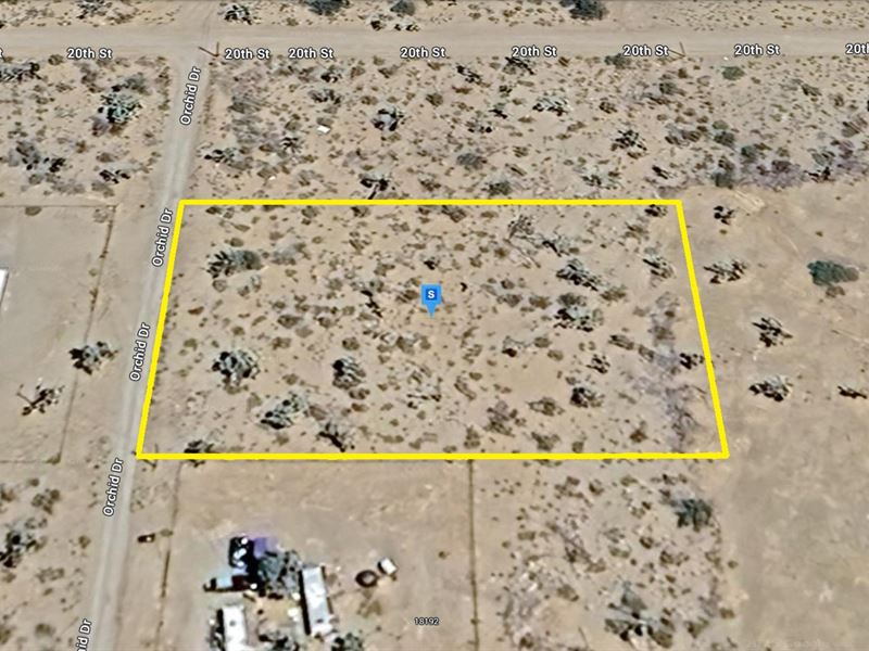
This 1.07-Acre lot in Dolan Springs, Mohave County, AZ offers a quiet setting with access via a dirt road and power available nearby. Located just minutes from Dolan Springs and close to Pierce Ferry Road, this property offers convenient access to local services. Outdoor destinations like Mt. Tipton Wilderness and Joshua Tree Ostrich Ranch are nearby, with Highway 93 providing a direct route to Kingman or Las Vegas. A practical option if you are seeking land in northwest Arizona.
Property Location: Dolan Springs, AZ 86441
Lot Size: 1.07 Acres
Zoning: Residential and Agricultural Use
Electricity: YES - Power Lines are There
Primary Road: Dirt Road Access
Water: Would be from Alternative Sources
Time Is Ticking, Reserve It Now For Only $610.24. Invest In This Prime Property While it's Hot on the Market. Get Easy 24 Months Financing at 0% Interest, No Credit Checks, All Major Credit Cards Are Accepted.
$610.24 Down $610.24/Mo for 24 Months 0% Int
Call or Text Us Now To Reserve.
Cheap and Affordable Vacant Land For Sale in Dolan Springs
Flexible Financing Options are Available
Owner Financed Land in Arizona
Undeveloped Property For Sale With Direct Road Access
For Agricultural and Residential Development in Mohave County
Buildable Land With Power Access
Land With Mountain Views
Finance Land Near Entertainment Hubs
Private greenhouses and horticultural collections, flower and vegetable gardens, fruit trees, orchards, dogs and cats as domestic pets, poultry for domestic use. Horses and cows may be maintained for private use.
Perfect for Hiking Enthusiasts, Being Close to Recreational Areas
Quiet and Friendly Neighborhood
Located Near School, Parks, Shops, and Restaurants
Not in Flood Zone and Wetlands
Property Within Secured Subdivision
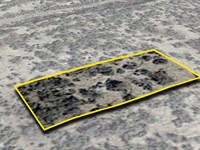
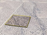
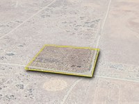
Land Maps & Attachments
Directions to Land
Center of Lot, GPS Coordinates: 35.654384, -114.216819
GPS Coordinates for Corners of the Property:
Nw: 35.654623, -114.217256
Ne: 35.654623, -114.216376
Se: 35.654142, -114.216376
Sw: 35.654141, -114.217260
More Land Details
Land Price History
More Land from Patrick Elder
 2.4 AC : $5K
- 2 AC : $7K
- 20 AC : $25K
- 1.3 AC : $7K
- 0.2 AC : $6K
- 2.4 AC : $5K
- 1.4 AC : $8K
- 14.9 AC : $275K
- 0.2 AC : $4K
- 3.8 AC : $70K
- 2.5 AC : $35K
- 0.2 AC : $50K