No Back Taxes for Homes and Rentals
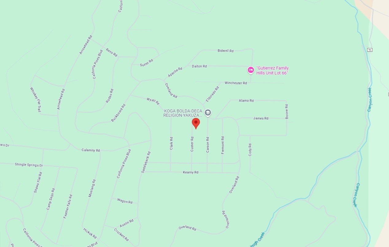
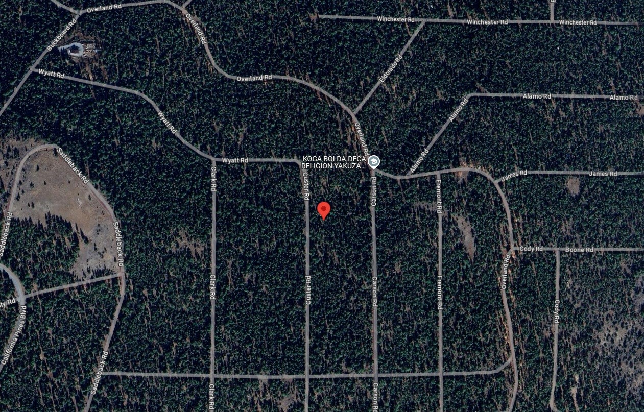
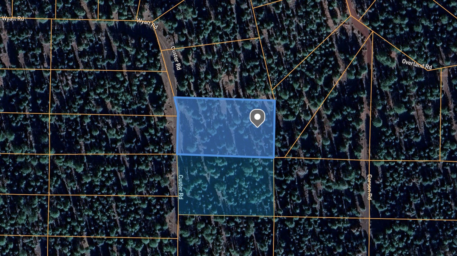
Custer Rd : Alturas, CA 96101
Modoc County, California
Land Description
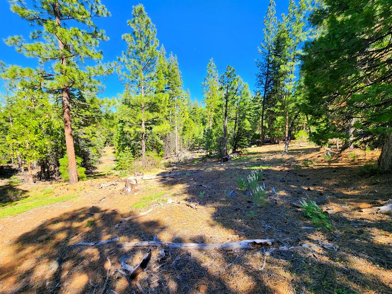
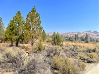
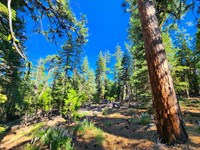
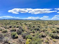
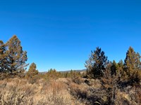
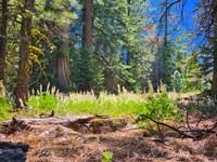
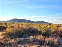
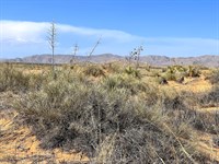
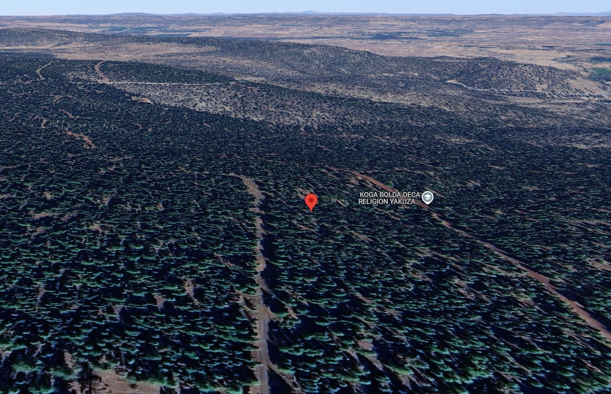
This 0.95-Acre wooded parcel in California Pines, 28 minutes from Alturas, California, offers freedom, tranquility, and opportunity. Zoned for high-density residential use for your dream single-family home, 600+ sq ft tiny house, mobile home, or RV for a limited time. Short-term vacation rentals are allowed with no restrictions for extra income.
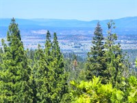
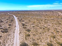
Accessible year-round via Custer Road, the property is near existing power poles, allowing for off-grid options (solar/generators), well, and septic systems (buyer to verify). Camping is permitted up to 30 days annually. Adventure awaits with Modoc National Forest, Lava Beds National Monument, the "Stand By Me" bridge nearby, and convenient access to gas, groceries, and Redding.
Don't let financing slow you down - we will finance it for you. Everyone is approved - Contact us immediately for details.
Financing available - no credit check or banks needed. Everyone approved. Contact us and we will show you how easy it is.
Property Details:
Property Address: Custer Rd, Alturas, CA, 96101
Apn: -000
Size: 0.95 acre
Subdivision: California Pines Unit 1
Zoning: Residential-High Density Zone (Rh)
Taxes: $283
Hoa & Covenants: Yes, California Pines Poa
Camping Allowed: Yes, 30 days per year.
Mobile Home Allowed: Yes, 3Yes, Must fulfill all requirements. Should not be older than 10 years.
RVs Allowed: Yes, 30 days per year.
Conveyance: Warranty Deed
Power: Would have to contact Surprise Valley Electric or use alternative power.
Water: Would require private well.
Septic: Would require septic system.
Road Access: Custer Rd
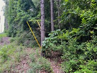
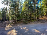
Terrain & Vegetation: Wooded, Slope
GPS Coordinates (4 corners): 41.3242, -120.7492
41.3244, -120.7487 Ne
41.3239, -120.7487 Se
41.3240, -120.7497 Sw
41.3244, -120.7497 Nw
Approximate Distance to Nearby Cities & Points of Interest:
Closest Highways: Us-395
Closest Major City: Redding, California, 2 hr 25 min (122 miles)
Closest Small Town: Alturas, California, 28 min (19.7 miles)
Closest Gas Station: Gils Gas And Grocery, 402 N Main St, Alturas, CA 96101, 29 min (19.3 miles)
Closest Recreation Site:
Modoc National Wildlife Refuge, Co Rd 115, Alturas, CA 96101, 29 min (19.7 miles)
Modoc National Forest, 225 West 8th Street, Alturas, CA 96101, 30 min (17.3 miles)
Lava Beds National Monument, 1 Indian Well, Tulelake, CA 96134, 1 hr 11 min (53.6 miles)
Bridge From "Stand By Me", 111 Bridge Way, Burney, CA 96013, 1 hr 36 min (71.1 miles)
- Guaranteed Financing
- No Credit Check
- No Bank or Broker fee
- 60-day money-back guarantee
- Warranty Deed
- Guaranteed free and clear title
We offer owner financing with multiple options that fit any budget. Contact us a call today and don't forget to ask about our 60-day money-back guarantee.
Purchase Options:
Owner Financing: $199 Down/$125 x 72 Months
Cash Price: $7,650.00
Doc Fee: $300 (due with a down payment)
Call us today for additional pricing options.
Mo-Ja03
Land Maps & Attachments
Directions to Land
Redding
California, USA
Get on I-5 N
4 min (1.6 mi)
Head southeast on W Cypress Ave
1.3 mi
Turn left to merge onto I-5 N toward Portland
0.3 mi
Follow CA-299 E to Co Rd 198 in Modoc County
1 hr 58 min (111 mi)
Merge onto I-5 N
2.4 mi
Take exit 680 for CA-299/Lake Blvd
0.3 mi
Merge onto CA-299 E/Lake Blvd E
Continue to follow CA-299 E
Pass by McDonald's (on the right in 50.6 mi)
108 mi
Take Rush Creek Dr and Fiddletown Dr to Custer Rd
27 min (9.7 mi)
Turn right onto Co Rd 198
0.1 mi
Turn left onto Lower Rush Creek Rd/Rush Creek Dr
5.0 mi
Sharp left
1.0 mi
Sharp right onto Toms Creek
0.9 mi
Continue onto Mt Bullion Rd
0.4 mi
Turn right onto Fiddletown Dr
1.0 mi
Turn right onto Calamity Rd
0.6 mi
Turn right onto Saddleback Rd
0.2 mi
Turn left
0.3 mi
Turn left at the 2nd cross street onto Custer Rd
Destination will be on the right
0.3 mi
Modoc Joint Unified School District
California, USA
More Land Details
More Land from Landon Harris
 2.6 AC : $15.6K
- 0.9 AC : $7.7K
- 0.9 AC : $10.7K
- 5 AC : $19K
- 0.2 AC : $6.3K
- 2.4 AC : $15.6K
- 1 AC : $7.7K
- 1 AC : $15.4K
- 0.9 AC : $7.7K
- 1 AC : $15.4K
- 1 AC : $15.4K


