Arizona Gold for $149 Down
Sanders Unified District : Sanders, AZ 86512
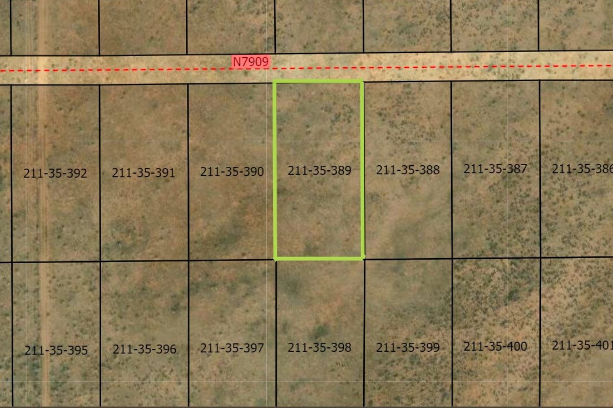
Apache County, Arizona
Land Description
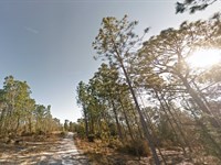
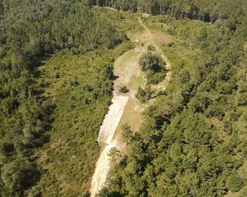
Chase Your Dreams at Bell Brand Ranches.
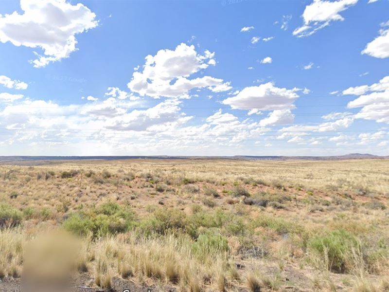
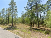
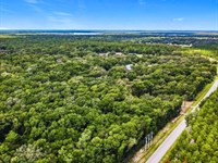
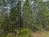
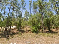
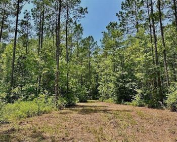
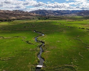
Get ready to saddle up and chase those dreams because Bell Brand Ranches is calling your name. This rugged one-acre lot is the perfect canvas for your next big adventure, tucked away in the heart of Arizona's wild desert beauty. The land's bursting with desert wonders, offering the perfect mix of wide-open space and tranquility. But if one acre isn't enough to satisfy your spirit, you're in luck-the neighboring acre is up for grabs, too. It's time to make your mark in this incredible corner of the desert.
Bell Brand Ranches isn't just a place; it's a lifestyle. With friendly nearby towns that'll greet you like an old friend and that fresh desert air that fills your lungs with inspiration, this land is where memories are made. Whether you're thinking of building a home, creating a getaway cabin, or just soaking up the endless skies, this spot has everything you need to live in the Arizona dream. And the best part? It's all yours to shape.
So, what are you waiting for? The desert is calling, and Bell Brand Ranches won't stay on the market forever. Don't let this opportunity slip through your fingers like sand in the wind. Grab your slice of desert gold, cowboy up, and let the adventure begin. The Arizona sun is waiting, and the sky's the limit.
Status: Available
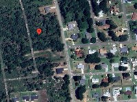
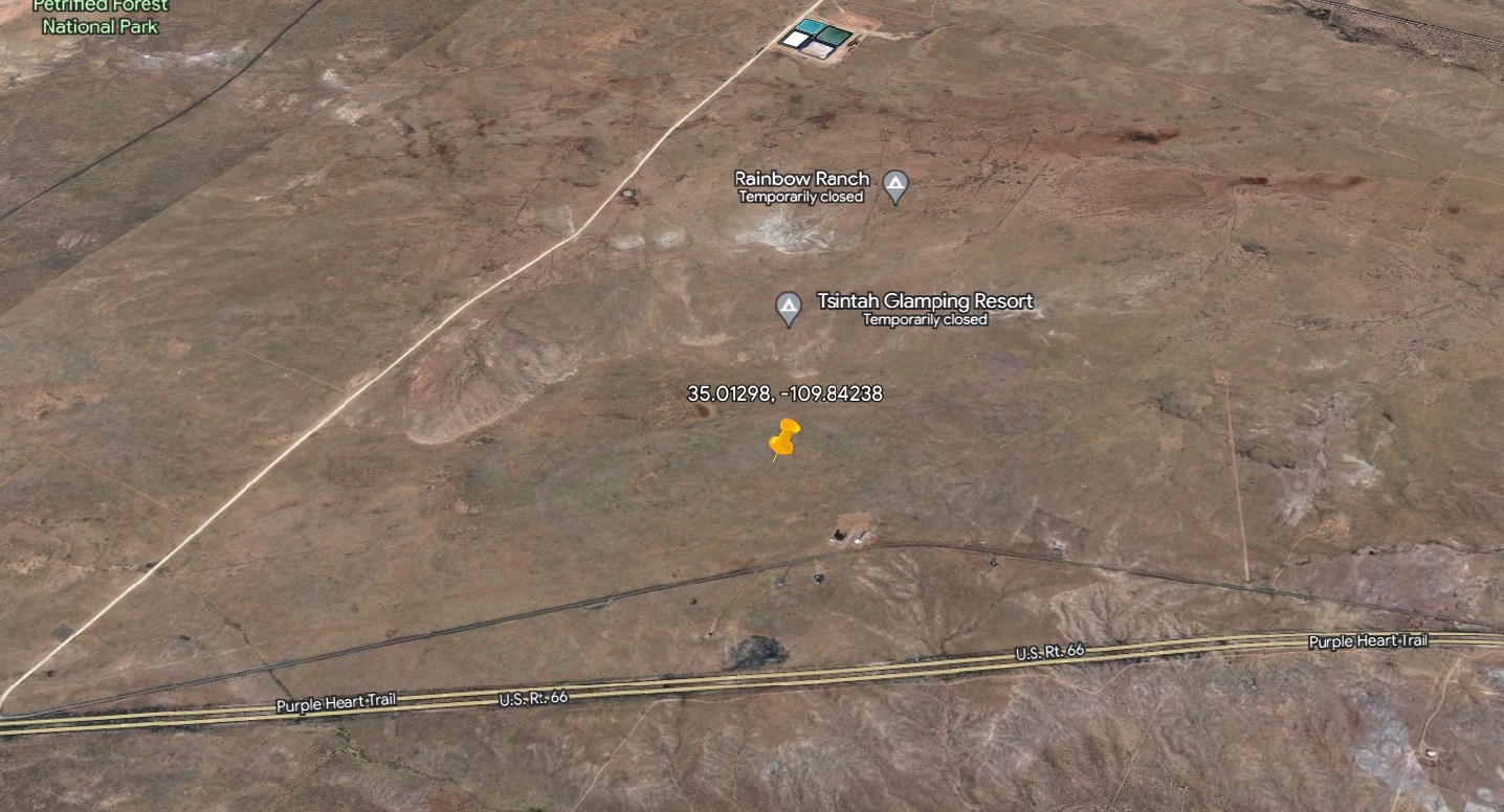
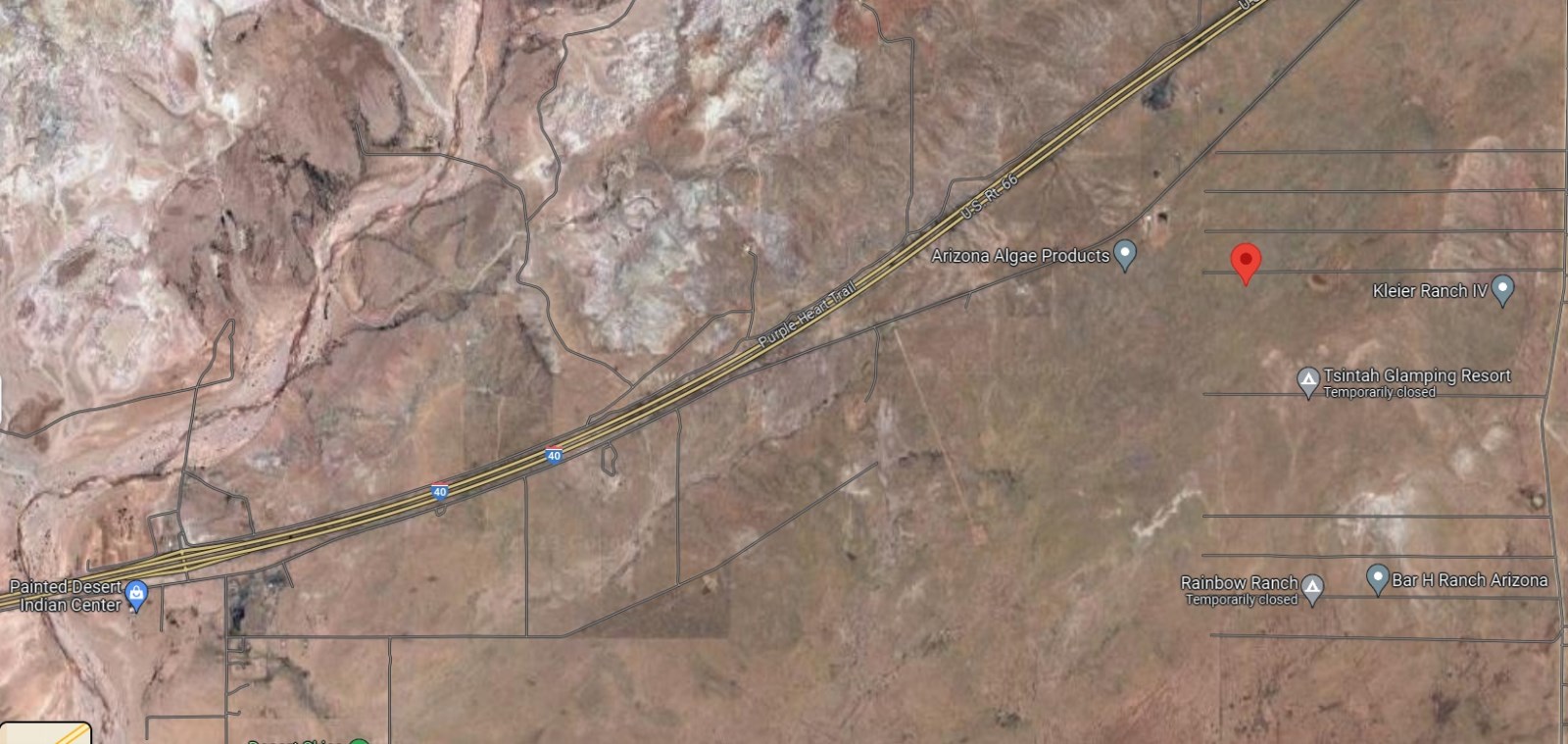
Location: Sanders, Az
Size (Acres): 1.04
Zoning: Ag-Agricultural: 0013 - Res Rural Subdivided
Terrain: Desert
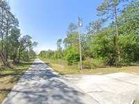
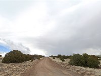
Access: Gravel Road
Nearby Cities: Flagstaff, AZ (2 hr 48 min, 115 miles), Winslow, AZ (56 min, 57.1 miles), Show Low, AZ (1 hr 20 min, 72.2 miles), Holbrook, AZ (29 min, 25.1 miles), Joseph City, AZ (38 min, 35.4 miles)
Nearby Attractions: Petrified Forest national Park, Puerco Pueblo, The Tepees, Painted Desert Inn, Dinos of Holbrook
Nearest highway: US Highway 191 & 7156 Adamana Rd
Utilities:
Power: Nearby street.
Water Well: You install.
Sewer Septic: You install.
What can be built on the property? The minimum lot/parcel size in Apache County is one (1) acre when the dwelling is connected to a septic system and not less than net 10,000 square feet when connected to a public sewer. Contact Building Safety.
Time Limit to build? Begins when a building permit is issued. Contact Apache County Building Safety.
Is Camping Allowed? Up to 30-consecutive days per quarter. Not allowed in Greer, Az
Camping restrictions if any. Up to 30-consecutive days per quarter. Not allowed in Greer, Az
Are RV's allowed? Yes. Not allowed in Greer, Az
Rv Restrictions if any. Used as a permanent dwelling, connected to septic or public sewer. Not allowed in Greer, Az
Are mobile homes allowed? Mobile Homes (Prior to 1976) are prohibited.
Mobile home restrictions if any. Manufactured homes (after 1976), restricted to 15-years or newer. Not allowed in Greer, Az
Is property part of an HOA or Poa? Contact the Recorder's office.
HOA or POA dues if any: Contact HOA or Poa
Subdivision Cc&R availability: Contact the Recorder's office
Snag Your Desert Dream Today
Don't miss this unbeatable Owner Finance Deal with easy monthly payments and a very low $149 down payment
- Zero % Interest
- No Credit Checks
- Cash Discount Available
- 90-Day Satisfaction Guarantee
This is land ownership made simple-no banks, no stress, just your land, your way.
Interested? Contact us NOW and claim your slice of Arizona before it's gone.
Important Notes:
- All of the information we have about this Property is contained on our Website Property Page.
- We ask that buyers do their own Due Diligence.
- You can visit any of our properties at any Time. GPS Co-ordinates and Driving Directions Given.
- Please call the Applicable County offices for any Specific Questions about the Property.
Land Maps & Attachments
Directions to Land
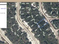
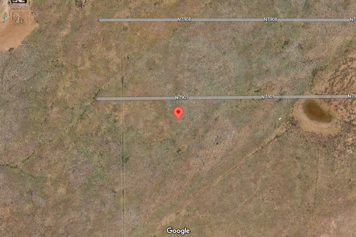
Gps: 35.01298, -109.84238
Gps Nw: 35°00'48.2"N, 109°50'33.5"W
Gps Ne: 35°00'48.2"N, 109°50'31.8"W
Gps Sw: 35°00'45.3"N, 109°50'33.5"W
Gps Se: 35°00'45.2"N, 109°50'31.7"W
Direction from Tucson, AZ
1. Get on I-40 W in Navajo County from 7156/Adamana Rd and Old Rte 66 (13 min, 7.8 mi)
2. Follow AZ-77 S, US-60 W and AZ-77 S to N Oracle Rd in Tucson (4 hr 31 min, 250 mi)
3. Continue on N Oracle Rd. Drive to W Jacinto St (2 min, 0.7 mi)
Directions from Sierra Vista, AZ
1. Get on I-40 W in Navajo County from 7156/Adamana Rd and Old Rte 66 (13 min, 7.8 mi)
2. Take AZ-77 S, US-60 W, US-70 E and I-10 W to N Buffalo Soldier Trail in Cochise County
(5 hr 40 min, 338 mi)
3. Continue on N Buffalo Soldier Trail. Take E Golf Links Rd to E Tiffany Pl in Sierra Vista (8 min, 4.3 mi)
Directions from Phoenix, AZ
1. Get on I-40 W in Navajo County from 7156/Adamana Rd and Old Rte 66 (13 min, 7.8 mi)
2. Continue on I-40 W to Holbrook (20 min, 19.7 mi)
3. Continue on AZ-377 S to Heber-Overgaard (40 min, 40.7 mi)
4. Follow AZ-260 W and AZ-87 to Washington St in Phoenix. Take exit 148 from I-10 E
(2 hr 17 min, 140 mi)
5. Drive to Washington St (6 min, 2.0 mi)
Directions from Mesa, AZ
1. Get on I-40 W in Navajo County from 7156/Adamana Rd and Old Rte 66 (13 min, 7.8 mi)
2. Continue on I-40 W to Holbrook (20 min, 19.7 mi)
3. Continue on AZ-377 S to Heber-Overgaard (40 min, 40.7 mi)
4. Take AZ-87 to W Main St in Mesa (2 hr 11 min, 129 mi)
5. Turn left onto W Main St (1 min, 0.3 mi)
More Land Details
More Land from Kirk Peart
 0.5 AC : $24K
- 1 AC : $25K
- 0.2 AC : $13K
- 0.2 AC : $19K
- New0.5 AC : $29K
- New0.2 AC : $18K
- New0.2 AC : $18K
- 1 AC : $25K
- 1.3 AC : $49K
- 0.2 AC : $19K
- 1.1 AC : $9K
- 0.2 AC : $14K


