1.26 Ac $100/Mo July 4
Winslow-Holbrook, AZ 86025
Navajo County, Arizona
Land Description
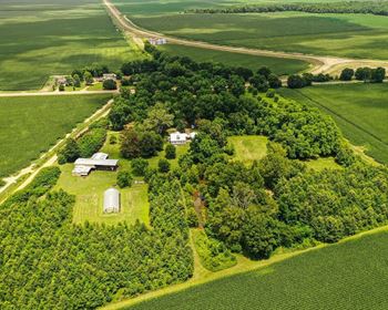
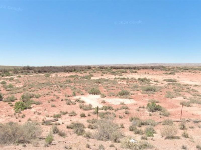
This July 4th, claim your own piece of untouched Arizona desert on this 1.26-Acre parcel in peaceful Navajo County. Flat terrain, wide-open skies, and stunning views make it perfect for your private getaway, homestead, or off-grid adventure.
Accessible year-round via county-maintained dirt easement road, this land offers crisp desert air and star-filled nights with minimal light pollution - ideal for camping, RV living, or simply unplugging.
You're close to natural wonders like Petrified Forest National Park, Agate House, and Meteor Crater, while major routes like US Hwy 40 and Route 77 keep you connected to Phoenix, Las Vegas, Los Angeles, and beyond.
No Hoa, flexible zoning, and easy owner financing at just $100/Month with no credit checks make this the perfect Independence Day deal. Own your desert freedom today.
Payment Info:
Cash Price: $3000 with owner financing $3499
Owner Financing Terms: $100 Monthly For 32 Months
Down Payment: $300
Doc Fee: $125
Property Info:
County: Navajo
State: Arizona
Size: 1.26
Apn: 105-62-137
Coordinate
Center: 35°3'13.63"N,109°59'51.95"W
Nw: 35°3'15.26"N,109°59'52.89"W
Ne: 35°3'15.25"N,109°59'50.92"W
Se: 35°3'11.96"N,109°59'50.93"W
Sw: 35°3'11.96"N,109°59'52.9"W
County Info:
Zoning: Agricultural General
Camping: Allowed for 30 days once per year. You must use all 30 days at once, meaning you cannot leave and return weeks or days after.
RVs: RVs are allowed for camping up to 30 days 1s per year while camping. However, you cannot live in an RV or mobile home. While building, you can receive an RV permit that is valid for up to a year.
Mobile Home: Mobile homes on wheels are not allowed but manufactured homes are allowed.
Water: You can dig a well or contact Arizona of Water Resources.
Sewer/Septic: If none is on the property, you must build one. You'd need a perk test and an Arizona Licensed Contractor to install that septic.
Electric: Use solar or wind towers or contact APS or Navopajo Electric.
Gas: Propane
Land Maps
Directions to Land
1. From Salt Lake City, Utah
Take I-15 S toward Provo
Merge onto US-6 E toward Price
Take US-191 S through Moab into Arizona
In Chambers, AZ, take I-40 E briefly
Exit onto US-191 S, then turn onto local roads toward the coordinates
Approx. 8.5 hours | ~520 miles
2. From Topeka, Kansas
Take I-70 W to Denver
Merge onto I-25 S to Santa Fe, NM
Take US-285 S, then US-60 W into Arizona
At Springerville, AZ, head north on US-191 N
Turn onto local county roads toward the location
Approx. 13 hours | ~800 miles
3. From Boise, Idaho
Take I-84 E to Twin Falls, then US-93 S into Nevada
Merge onto NV-318 S, then US-93 S
Continue to I-40 E in Arizona
Exit at US-191 N, then follow local roads to reach the coordinates
Approx. 14 hours | ~860 miles
4. From Jackson, Mississippi
Take I-20 W through Shreveport and into Dallas, TX
Merge onto US-287 N toward Amarillo
Take I-40 W into New Mexico, then US-191 S in Arizona
Follow local roads to access the parcel
Approx. 17.5 hours | ~1,100 miles
5. From Tampa, Florida
Take I-75 N to Atlanta, then I-20 W to Dallas
Merge onto US-287 N, then connect to I-40 W
Exit onto US-191 S, then head toward the parcel using local access roads
Approx. 26 hours | ~1,650 miles