.31 Acre no Poa, $150/Mo
Apache Drive : Irondale, MO 63648
Washington County, Missouri
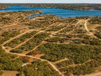
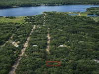
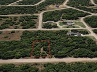
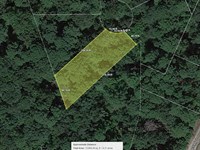
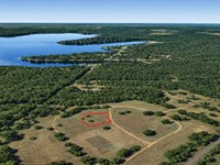
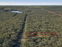
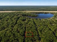
Land Description
Owner Financing Available - This 0.31 acre lot is located in Irondale, Missouri and the address is Apache Drive, Irondale, MO 63648.
Irondale is a town in Missouri with a population of 575. Irondale is in Washington County.
Living in Irondale offers residents a rural feel and most residents own their homes. Many families live in Irondale and residents tend to be conservative. The public schools in Irondale are above average.
Features No Poa, close to Lakes
Only $700 Down and $150/Month for 52 months $8500 or Discounted Cash Price $6997
Property Details
Apn 21-6.0.00000
Address Apache Drive, Irondale, MO 63648
County Washington
State Missouri
Size 0.31 Acre
Dimensions 254' x 170' x 163'
Legal Lot 98 Plat 1 Camp Irondale Estates
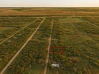
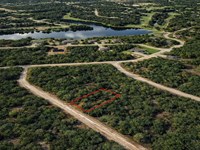
Terrain Flat
Access Paved Road
Power Power in the Area Power Company Independence Power & Light - Blue Valley Power Plant
Water Water in the Area Washington Utility Billing Well Williams Bros Well Drilling Water Haul Bradford Water Hauling
Sewer Sewer or Septic in the Area Septic Poole's Septic System, LLC Taxes per Year $39
Hoa Fees per Year No Hoa/Poa
Gps Coordinates center at the road 37.835701, -90.669878
--- Northwest Corner 37.835853, -90.670077
--- Northeast Corner 37.835851, -90.669486
--- Southwest Corner 37.835411, -90.670076
--- Southeast Corner 37.835851, -90.669487
Elevation 905
Building Information
Zoning Mo-Washington-Irondale-R1-Residential
Time Limit to Build No time limit to build
Site Built Homes Allowed Al lowed 960 min Sqft
Modular Homes Allowed Allowed
Manufactured Homes Allowed Not Allowed
Mobile Homes Allowed Not Allowed
Tiny Homes Friendly Not Allowed
Allowable Uses
Full-Time RV Living Allowed Not Allowed
RV on the Property While I build allowed 3months
Camping in a RV Allowed Not Allowed
Land Maps & Attachments
Directions to Land
From MO-8
Mineral Point, MO 63660, USA
1.Head southeast on MO-8 E toward Old 8 E
2.Turn right onto Benny Meyer Rd
3.Turn right onto State Hwy M
4.Turn left onto Cheyenne
5.Turn left onto W Apache Dr
6.Lot is on the left
More Land Details
Land Price History
More Land from Benjamin Davis
 0.1 AC : $5.5K
- 0.6 AC : $17K
- 0.9 AC : $17K
- 0.3 AC : $5K
- 0.1 AC : $6K
- 0.3 AC : $10K
- 0.3 AC : $8K
- 0.4 AC : $12K
- 0.3 AC : $10K
- 0.3 AC : $11.5K
- 0.2 AC : $7.5K
- 0.3 AC : $11K