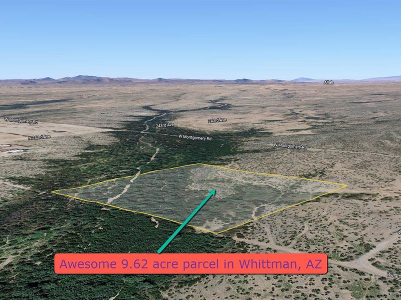
9.62 Acre Parcel in Whittman, AZ
W Laurel : Wittmann, AZ 85361
Maricopa County, Arizona
Land Description
Amazing 9.62 acre parcel in Whittman, AZ. for your dream home, mobile or manufactured.
Located near a wash, you can enjoy thick Mesquite Trees and amazing views.
Property Address: W Laurel, Wittmann, AZ 85361
Latitude/Longitude: 33.757763, -112.580301
County: Maricopa
Subdivision: None
PRICE: Plus closing costs
2023 Maricopa County Assessed Land FCV (Full Cash Value): uses: Single-family dwelling
Property Description
Amazing 9.62 acre parcel in Whittman, AZ. for your dream home, mobile or manufactured (Need to get a building permit and installation permit from the AZ dept. of manufactured housing, 1976 or newer). This very unique property with the southwest half in the floodway, but the northeast half is in a 500 year flood zone which gives you room for your new home and RV (cannot be used as residence) and outbuildings. Lot is buildable with 20'-30' from property line, 100' from flood way otherwise you need to put in a barrier and would require an engineer. Power is available, installation apx 12k with 10k allotment you pay apx 2k, drill well or haul water, septic required. Located near a wash, you can enjoy thick Mesquite Trees and other natural vegetation on your own land with spectacular views.
Property Info
Power: Yes - Available (Aps) - Install cost would be to SE corner
Sewer: None - Septic Required
Water: None - Drill Well or Haul water
Gas: None - Propane Required
Telephone: Unknown
Cable: Unknown
Impact Fees Paid: No
Permits: No
Fence: No
Access: Public Road - Dirt
HOA: No
Violations: No
Survey: No
CCR's: No
Property Details
Parcel Number: 503-30-016K
Property Type: Residential Vacant Land
Lot Size: 419,047 Sq Ft
Acres: 9.62 Ac
Topography: Flat
Dimensions: 660'X635'
Shape: Rectangle
Zoned: Ru-43 (Rural Zoning District - One Acre Per Dwelling Unit)
Horse Property: Yes
FEMA Flood Hazard Zone: Ae
Fema Floodway: Yes - SW Corner
Yearly Tax Amount: Type: Dirt
Road Maintenance: County
School District: Nadaburg Unified School District
Legal: SW4 NE4 SW4 EX S 25' RD 9.62 AC