Close to National Forest
County Road 106340 : Summersville, MO 65571
Shannon County, Missouri
Land Description
Angeline 11.
Approximately 7 acres are located in the western part of Shannon County, just about 4 miles east of Summersville, Mo. The easement road is approximately 1.5 miles down the county road.
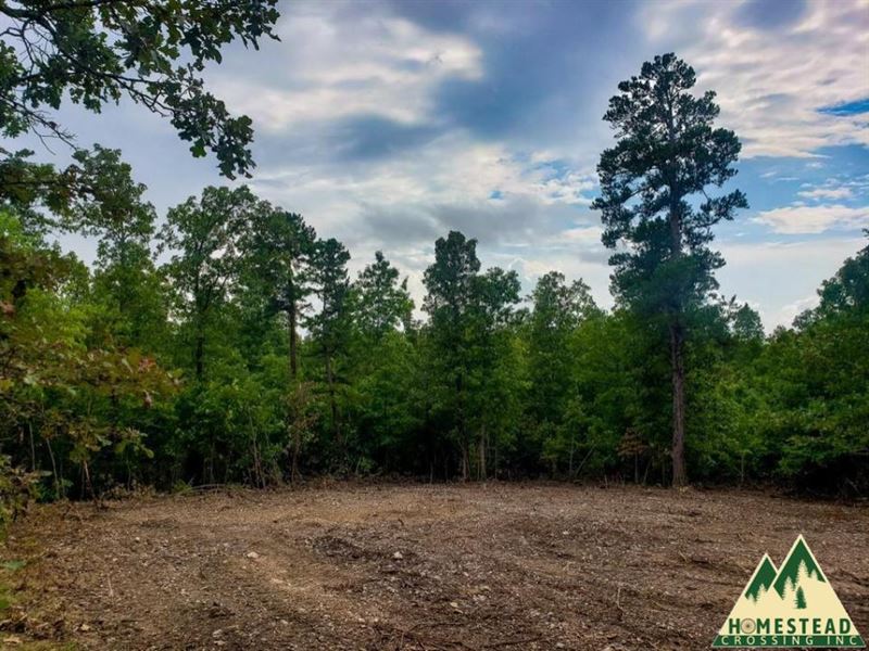
The private driveway will lead you to the clearing as you pull off the easement road. Look ahead, and there will be a trail that will take you through the whole property. The clearing is big and spacious but is still lined with hardwoods to give it that private feeling.
The property slopes to the south and then level back out about the center of the property. The clearing is located on the north side of the property. This parcel is all wooded and relatively flat. The soil is a lovely brown color and not too rocky.
The electricity is available from the county road. If you are looking for a more feasible option for energy, solar would be the one to go with. The clearing provides a nice view of the eastern and southern skies.
There is no water on the property, but there are many ways to obtain water. Drilling a well is one choice, and most wells will run you about 400-500 FT in this area. If you are looking for a cheaper way, water tanks or even a catchment system would be the way to go. There is a rural water filling station just about 23 miles away from the property. Here you can fill up to 25 gallons for just a quarter.
If you plan to live on the land, you will need human waste disposal in place. These days there are all sorts of new ideas that are coming out. You can do a composting system, get an incinerating toilet (they work on propane, gas, diesel, and electricity), install a septic tank, or you can even do a lagoon.
If you would like to make the dream of owning land a reality, join the Homestead Crossing Family today. Give us a call.
Location: CR 106-340 Summersville, MO 65571
Gps Coordinates: 37.174861, -91.592417
Acres: 7 (+/-)
Taxes: Approximately per year.
Zoning: None
Restrictions: No junkyard/dumps, no more than five dogs/no breed of dog that is not covered under your liability insurance policy, no single or double wide mobile homes
Terrain: Fairly Level
Utilities: Electric Available
Access: Easement/Driveway
Remote
Views
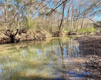
Near The Jack's Fork River
Near National Forest
Owner Financing Terms:
Down Payment: Purchase Price: at Signing: Down Payment
First Month's Payment Is Not Due Until 30 Days After Initial Payment.
Ask us about our veteran's discount.