Unique Riverfront Property
Off Laurel Lake Trail : Newberry, MI 49868
Luce County, Michigan
Land Description
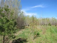
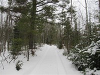
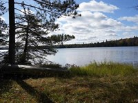
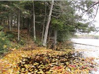
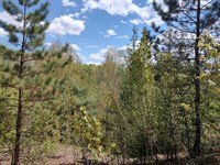
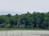
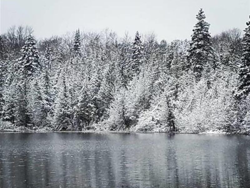
Michigan 45± Acre Parcel with 1,400± Feet of Tahquamenon River Frontage For Sale - This exceptional 45± acre parcel is located in east-central Luce County near the western border of Chippewa County in Michigan's eastern Upper Peninsula. - The property offers approximately 1,400± feet of frontage along the legendary Tahquamenon River, an 89-mile Blue Ribbon waterway best known for the iconic Tahquamenon Falls. The Upper Falls are Michigan's largest waterfall and the second largest east of the Mississippi River. - Beyond the falls, the Tahquamenon River is prized for its remote beauty and outstanding fishing. Anglers have been drawn to these waters for generations to pursue northern pike, muskellunge, walleye, yellow perch, and smallmouth bass. The river's calm stretches and wilderness setting also make it ideal for canoeing, kayaking, tubing, and wildlife viewing. - The property lies on the west bank of the Tahquamenon River just north of the confluence of the East Branch, the Hendrie River, and the Main Branch of the Tahquamenon. It is situated nearly across from the entrance of Hiawatha Creek, placing it in a particularly scenic and ecologically rich section of the river. - There is no recorded legal land access to the parcel, making it accessible by water only and offering a rare level of privacy and seclusion. Access is easily achieved by boat, canoe, or kayak from The Confluence Camping Boat Launch and Rental, locally known as “Kallio's Landing,” located approximately one-half mile south of the property. Kayaks, canoes, tubes, and related gear are available for rent at this location. - The southern boundary of the parcel adjoins Lake Superior State Forest lands, managed by the Michigan Department of Natural Resources. This vast state forest encompasses over one million acres across the eastern Upper Peninsula and supports abundant wildlife and year-round recreation. Hunting opportunities include deer, bear, small game, furbearers, woodcock, ruffed grouse, and waterfowl. - The surrounding region is renowned for outdoor recreation in every season. Activities include boating, fishing, kayaking, canoeing, swimming, hiking, camping, backpacking, hunting, mountain biking, wildlife photography, and exceptional stargazing. Tahquamenon Country (Luce County and parts of Chippewa County) features more than 200 miles of designated ATV and UTV trails, along with hundreds of additional miles of forest and county roads open to off-road vehicles. - Seasonal attractions include fall color tours and hunting, as well as winter snowmobiling, cross-country skiing, and ice fishing. - The area's forests include cedar, spruce, pine, birch, maple, and aspen, with tannins from conifers giving the river its brown color and hardwoods providing striking fall foliage. - This property presents a rare opportunity to own a large, secluded riverfront parcel surrounded by public lands in one of Michigan's most iconic wilderness settings.
Land Maps
Directions to Land
From the Marquette City Intersection of Lincoln Avenue and West Washington Street head east on Washington to Front Street. Take a right and go 3.75 +/- miles to M-28 East. Take a left and follow M-28 East 104 miles to M-123. Turn left and go about 5 miles to Charcoal Grade Road. Turn right onto Charcoal Grade Road and go about 9 miles to Laurel Lake Trail. Turn right onto Laurel Lake Trail and go about 7 miles to a woods road on the left. Turn left onto the woods road and go about a mile to the property. These Directions do not provde recorded legal access to the property. - To get there from the Confluence Camping Boat Launch & Rental follow the above directions. When you get to M-123 continue on M-28 and go 17 miles to South Hulbert Road. Turn left onto South Hulbert Road and go 1 mile to W 6th St. Turn left onto W 6th St to S Maple St. Go right onto S Maple St to W 2nd St. Go left onto W 2nd St to S North Hulbert Road. Go right onto S North Hulbert Road. Take S North Hulbert Road for 9 miles to Bills Drive. Turn left onto Bills Drive to Confluence Camping Boat Launch & Rental.
More Land Details
More Land from Timothy Keohane
 29.8 AC : $328K
- 400 AC : $418K
- 240 AC : $328K
- 51 AC : $748K
- 25.9 AC : $189K
- 9.4 AC : $1.77M
- 160 AC : $250K
- 288 AC : $438K
- 2 AC : $38.8K
- 159.2 AC : $455K
- 417 AC : $1.23M
- 5 AC : $348K