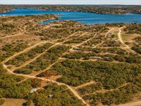
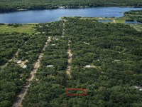
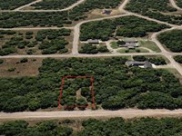
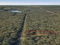
.4 Acre Lakefront on Lake Corpus
County Road 372 : Sandia, TX 78383
Jim Wells County, Texas
Land Description
Owner Financing Available - This 0.4 acre lot is located in Sandia, Texas and the address is County Road 372, Sandia, TX 78383.
Sandia is located in northeastern Jim Wells County. Texas State Highway 359 forms the northwest side of the community, leading northeast 6 miles 10 km to Mathis and southwest 24 miles 39 km to Alice, the Jim Wells county seat.
Sandia is an unincorporated community and census-designated place in Jim Wells County, Texas, United States. The population was 379 at the 2010 census, down from 431 at the 2000 census
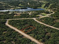
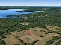
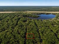
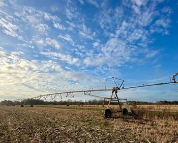
Features Across the street from Lake Corpus Christi, no Poa
Only $2400 Down and $500/Month for 54 months $29400 or Discounted Cash Price $23997
Property Details
Apn 11150-00
Address County Road 372, Sandia, TX 78383
County Jim Wells
State Texas
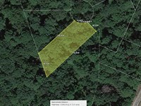
Size 0.4 Acre
Dimensions 100' x 144' x 116' x 177'
Legal Barbon Estates SEC 1 LT 17 BLK B 0000.000
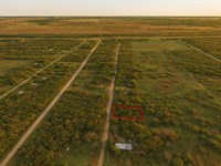
Terrain Flat
Access Paved Road
Power Power in the Area Power Company Save on Energy
Water Water in the Area Jim Well County Fresh Water Well Bee Cave Drilling Inc Water Haul Pawlik & Son Water Well Service
Sewer Sewer or Septic in the Area Septic A & R Septic Services LLC Taxes per Year $58
Hoa Fees per Year No Hoa/Poa
Gps Coordinates center at the road 28.044854, -97.922463
--- Northwest Corner 28.044787, -97.922706
--- Northeast Corner 28.045116, -97.922468
--- Southwest Corner 28.044556, -97.922462
--- Southeast Corner 28.044980, -97.922199
Elevation 120
Building Information
Zoning Tx-Jim-Wells-Barbon-Estates-Residential
Time Limit to Build No time limit to build
Site Built Homes Allowed Allowed
Modular Homes Allowed Not Allowed
Manufactured Homes Allowed Not Allowed
Mobile Homes Allowed Not Allowed
Tiny Homes Friendly Not Allowed
Allowable Uses
Full-Time RV Living Allowed Not Allowed
RV on the Property While I build Not Allowed
Camping in a RV Allowed Not Allowed
Land Maps
Directions to Land
From Orange Grove Independent School District Texas, USA
1.Head northwest on FM 534 N toward Co Rd 302
2.Turn right onto Co Rd 369
3.Turn right onto Co Rd 372
4.Lot is on the right
More Land Details
More Land from Benjamin Davis
 0.1 AC : $5.5K
- 0.6 AC : $17K
- 0.9 AC : $17K
- 0.3 AC : $5K
- 0.1 AC : $6K
- 0.3 AC : $10K
- 0.3 AC : $10K
- 0.3 AC : $11.5K
- 0.3 AC : $11K
- 0.4 AC : $12K
- 0.2 AC : $7.5K
- 0.3 AC : $8K