Rvers & Overlanders Paradise
Somerset Drive : San Luis, CO 81152
Costilla County, Colorado
Land Description
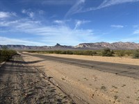
This 2.61-Acre flat, buildable lot in Wild Horse Mesa, Colorado, is ideal for a full-time RVer or vanlifer who craves wide-open spaces, dislikes crowded RV parks, and thrives on true boondocking freedom. It is the perfect off-grid base camp for your next adventure. Tucked less than a mile from the paved highway with solid dirt road access, this secluded property gives you the peace, quiet, and solitude you crave-no neighbors, no noise, no rules, and no Hoa.
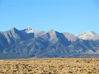
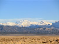
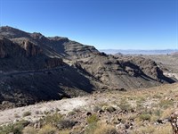
Spend your summer camped on your own land at 7,800 ft, where the air stays cool and mountain-fresh, with millions of acres of nearby public land for hiking, 4x4 exploring, fishing, and hunting. A true rugged individualist's playground, this land gives you the freedom to park, camp, build, or roam on your own terms, all while staying close to Taos, the Sangre de Cristo Mountains, and some of the best overlanding and off-grid living in the Rockies.
We will finance it for you with NO Interest. No credit check is required with Low monthly payments. It's way easier than you think.
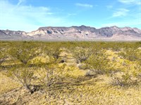
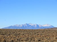
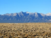
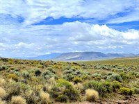
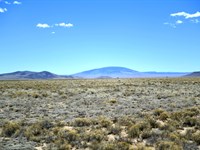
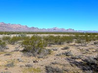
Actual Photos Of The Property
Easy Owner Financing available for all. No credit checks and no banks are required. We can work with your budget with low monthly payments. Contact us NOW for more details.
Property Details:
Property Address: Centennial School District R-1, Colorado, 81152
Apn: 71203860
Size: 2.61 acres
Subdivision: Wild Horse Mesa/14/42
Zoning: Estate Residential
Annual Property Taxes: $54.72
Hoa/Fees: None in the area.
Camping/Notes: Allowed up to 14 days every 3 months.
RVs/Notes: Allowed up to 14 days every 3 months.
Mobile Home/Notes: Allowed but must be manufactured after 1976.
Conveyance: Warranty Deed
Water: Well or cistern. Contact the Division of Water Resources to obtain a well permit.
Sewer/Septic: Septic
Electric/ Power: Power by solar, wind, generator, or contact Xcel Energy.
Waste: Pickup service through GT Trash or visit the transfer station
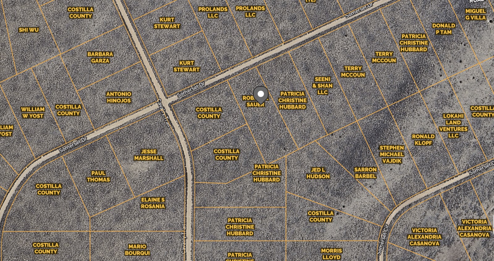
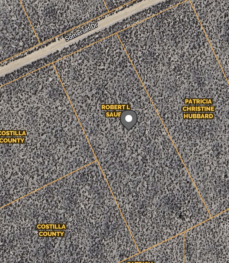
Access Road: Somerset Dr
Road Surface: Dirt
Terrain Type: Flat, Plain, Desert
GPS Coordinates (4 corners): 37.110859,-105.496696
Nw: 37.111645,-105.49691
Ne: 37.111674,-105.496829
Se: 37.110057,-105.496614
Sw: 37.110738,-105.497008
Approximate Distance to Nearby Cities & Points of Interest:
Closest Highways: US HWY 285, RT 159
Closest Major Cities: Alamosa, Colorado City, and Cañon City
Nearby Attractions: Fort Garland Museum & Cultural Center, Bishop Castle, Great Sand Dunes National Park and Preserve, Cole Park, Great Sand
Dunes Visitor Center, and Colorado Gators Reptile Park.
- Guaranteed Financing
- No Credit Check
- No Bank or Broker fee
- 90-day money back guarantee
- Warranty Deed
- Guaranteed free and clear title
Our best properties don't last long. Don't miss your chance to secure this land for you and your family.
Purchase Options:
Owner Financing: $249 Down and $169/Month x 48 months
Cash Price: $5,999
Closing Fee: $249 (due with a down payment and non-refundable)
Additional monthly fees: $10 monthly note maintenance fee and pro-rated property taxes
Reach out today
Land Maps & Attachments
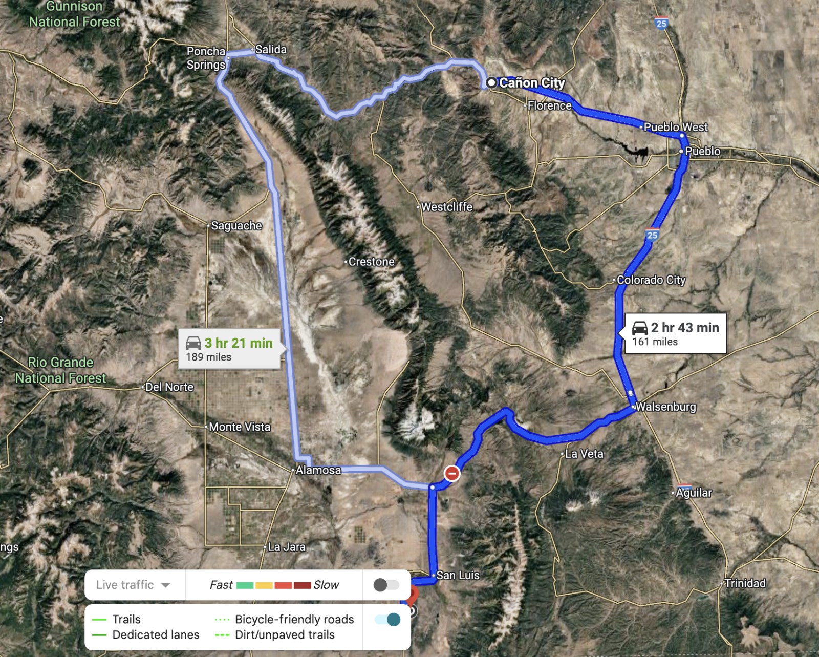
Directions to Land
Cañon City
Colorado 81212, USA
Follow Franklin Ave and N 15th St to US-50 E/Royal Gorge Blvd
2 min (0.4 mi)
Head north toward Franklin Ave
144 ft
Turn left onto Franklin Ave
0.1 mi
Turn left onto N 15th St
0.2 mi
At the traffic circle, continue straight onto 15th St
404 ft
Follow US-50 E, I-25 S and US-160 W to CO-159 S/Miranda Ave in Fort Garland
2 hr 10 min (134 mi)
Turn left onto US-50 E/Royal Gorge Blvd
Continue to follow US-50 E
35.2 mi
Slight right to merge onto I-25 S toward Walsenburg
48.9 mi
Take exit 52 for I-25 S toward US-160 W/Walsenburg/Alamosa
0.3 mi
Merge onto I-25BL S
2.5 mi
Turn right onto US-160 W/W 7th St
Continue to follow US-160 W
42.3 mi
Slight left
0.2 mi
Slight left onto US-160 W
4.5 mi
Follow CO-159 S to Somerset Dr
30 min (27.1 mi)
Turn left onto CO-159 S/Miranda Ave
Continue to follow CO-159 S
25.6 mi
Turn left onto Rd J
1.1 mi
Slight left onto Casa Blanca Dr
0.1 mi
Turn right at the 1st cross street onto Cavalry Trail
0.2 mi
Turn left at the 2nd cross street onto Somerset Dr
Destination will be on the right
495 ft
Centennial School District R-1
Colorado, USA
More Land Details
Land Price History
More Land from Tony Steier
 2.8 AC : $13.2K
- 4.8 AC : $9.9K
- 1.3 AC : $9.5K
- 9.8 AC : $13K
- 2.5 AC : $5K
- 5 AC : $7.5K
- 5 AC : $6.5K
- 4.8 AC : $7K
- 1.5 AC : $6K
- 2.1 AC : $7K
- 2.4 AC : $7.5K


