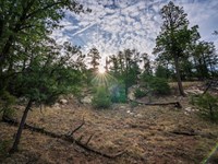
Forested Lot Close To Sprague River
Chiloquin, OR 97624
Klamath County, Oregon
Land Description
Cash Price: $16,000
Terms Offered: 20% Down Payment of $3,200, 9.9% Interest Rate, $350 Monthly Payment, 43 Month Term
Location & Size
County, State: Klamath County, Oregon
Lot Size: 1.2 Acres
Nearest Town: Klamath Falls
Street Address: Not Designated
Zip Code: 97624
Latitude & Longitude:
Center: 42.54090,-121.6130
Nw: 42.54110,-121.61360
Ne: 42.54110,-121.61230
Sw: 42.54070,-121.61360
Se: 42.54070,-121.61230
Legal Information
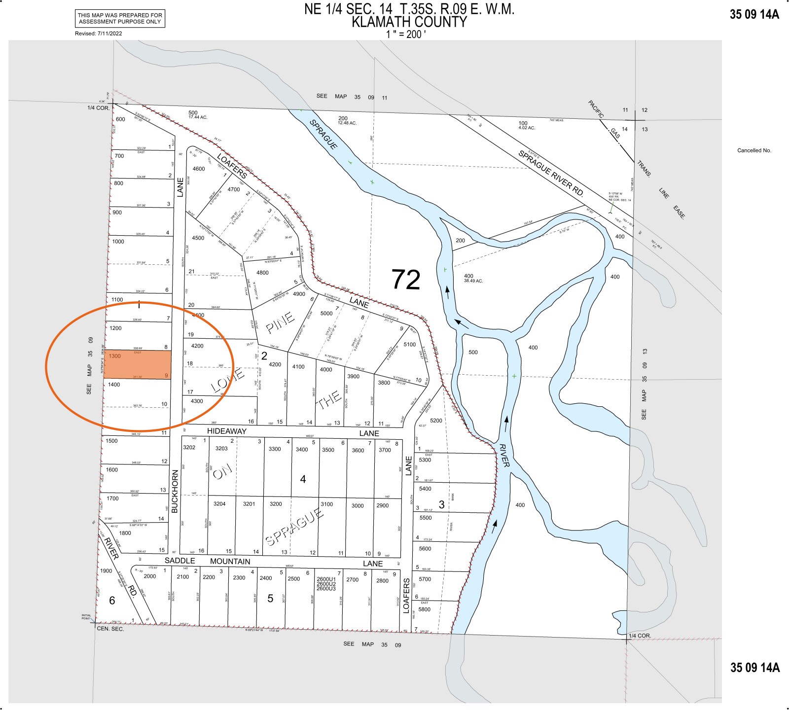
Legal Description: Lone Pine On The Sprague, Block 1, Lot 9
Parcel Number: 3509-014A0-01300
Account Number: R253344
Annual Taxes: $53.00
Access & Utilities
Legal Access: Yes
Access Road: Buckhorn Lane
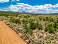
Access Condition: Dirt And Gravel Roads
Access Frontage: 145 Feet (Eastern Boundary)
Power: Solar or Alternative
Phone: Mobile or Satellite
Water: Well or Holding Tank
Sewer: Septic/Alternative
Zoning & Restrictions
Zoning: R-2 Rural Residential
HOA: None
Covenants, Conditions & Restrictions: None
Annual Dues: None
Time Limit On Building: None
Title Info
Title: Free & Clear
Liens and Encumbrances: None
Mineral Rights: None
Recent Survey: None
Title Insurance: Yes - Insured Through AmeriTitle
Conveyance Document: Warranty Deed
Suggested Type Of Closing: Title/Escrow
Doc Prep Fee: Waived
Misc
National Forest: It should be noted that the subject property backs up to 14,600+ acres of government land designated as National Forest. That means this is public land which may be used for hunting, hiking, horseback riding, camping, picnicking, riding dirtbikes and any number of other outdoor activities. Additionally, as it backs up directly to the subject property, it will give whoever buys this 1.2 acre parcel an additional 14,600+ acres of backyard. That also means the land will never be developed and the property's western border will always be flanked by this National Forest retreat.
Sprague River: This subdivision gets its name from the nearby Sprague River. This river and its many tributaries boast superb trout fishing opportunities, making this property especially suited for the fisherman in the family. In addition, there are a number of public fishing spots within walking distance of the subject property, meaning anyone looking to take advantage of the nearby river will not have to worry about trespassing on their neighbor's land.
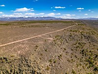
Lone Pine On The Sprague: It's worth noting that the Lone Pine On The Sprague subdivision is one of the smallest we've ever encountered, totaling no more than 56 parcels. Additionally, there appear to be no more than ten developed lots in this area. When combining these facts with the location of the subdivision - two miles from the bridge and on the other side of Federal Land - it makes the subject property perfect for those seeking privacy and seclusion, as you're unlikely to encounter anyone that doesn't already live here.
Property Boundary Markers: Potential buyers will be pleased to learn that property boundary stakes can be found marking each of this parcel's four corners, denoting where the subject property ends and the neighboring lot begins. This should be a benefit to anyone looking to develop the land concerned about encroaching on their neighbor's property who also doesn't want to incur the cost of a survey.
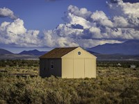
Neighboring Structure: It should be noted that the neighboring property is home to small green structure which appears to be either a tiny home or an outhouse. Again, this structure is on the neighboring property and is not included with the sale of the subject property.
Nearby Towns
Chiloquin: 17 miles (23 min)
Beatty: 25 miles (31 min)
Klamath Falls: 44 miles (52 min)
Lakeview: 81 miles (1 h 29 min)
Nearby Attractions
Discover Klamath
Fremont-Winema National Forest
Klamath Basin National Wildlife Refuge
Sprague River
Crater Lake National Park
Sycan Marsh Preserve
Land Maps & Attachments
Directions to Land
Step 1: From Sprague River Road, turn left onto Saddle Mountain Pit Road.
Step 2: Continuing south on Saddle Mountain Pit Road, you will cross the Sprague River along this bridge.
Step 3: From the bridge, continue driving south another 0.35 miles until you come to this fork in the road.
Step 4: Take the fork to the left along what will now be called Saddle Mountain Lane. NOTE: Some maps identify this road as Loafers Lane.
Step 5: Continue south for approximately 0.7 miles until you come to this intersection.
Step 6: Take the first left onto Buckhorn Lane.
Step 7: Drive north for roughly 0.12 miles. You will see the intersection of Buckhorn Lane and Hideaway Lane...
Step 8: Continue straight driving another 0.05 miles. The subject property will be on your left.
More Land Details
More Land from William Hemingway
 1.3 AC
- 10.7 AC : $35K
- 5.8 AC : $18K
- 2.5 AC : $12K
- 1.1 AC : $30K
- 20 AC : $25K
- 1.7 AC : $14K
- 2 AC : $12K
- 1.4 AC : $15K
- 5.1 AC : $12K
- 0.2 AC : $15K
- 0.3 AC


