Forested Lot, Power & Paved Roads
Ramah, NM 87020
Cibola County, New Mexico
Land Description
Financing Offered: $2,500 Down Payment + $250 Monthly Payment x 46 Months; 180 Days Same As Cash
Location And Size
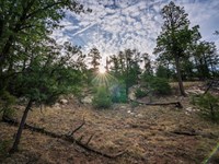
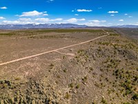
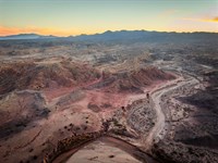
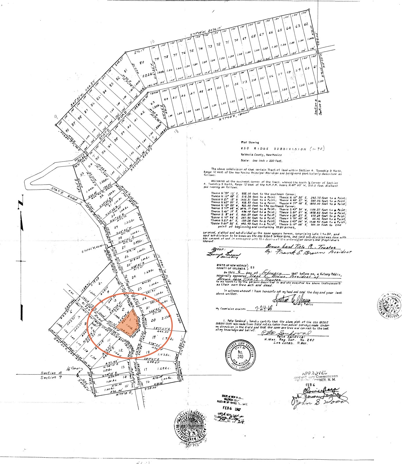
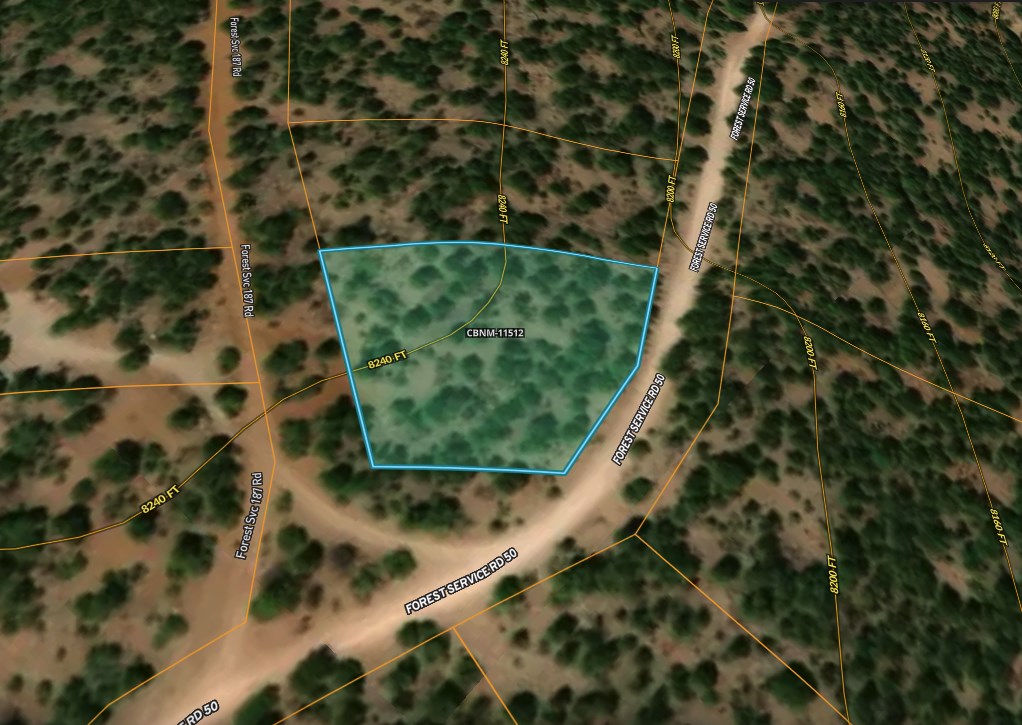
The subject property is a 1 acre lot located just north of Highway 53 in Oso Ridge, a rural subdivision situated on the outskirts of the Cibola National Forest.
County, State: Cibola County, New Mexico
Lot Size: 1 Acre
Nearest Town: Ramah
Street Address: Not Designated
Zip Code: 87020
Latitude & Longitude:
Center: 35.03290,-108.1060
Nw: 35.03290,-108.10650
Ne: 35.03340,-108.10590
Sw: 35.03260,-108.1060
Se: 35.03280,-108.10560
Legal Information
Legal Description: Oso Ridge, Lot 1
Parcel Number:054
Account Number: R07883
Annual Taxes: $7.00
Access & Utilities
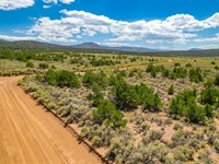
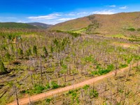
Roads & Access: The subject property is located roughly a mile and a half north of State Road 53 along Zuni Canyon Road. While it sits within a rural and densely forested region backing up to the Cibola National Forest, Zuni Canyon Road is freshly paved and very well maintained, meaning it will be easy to navigate in any vehicle type.
Roads & Access, Cont'd: Zuni Canyon Road is also identified on some maps as Forest Service Road 50. Anyone scouting the property should be aware of this discrepancy.
Power & Utilities: While residential power lines can be found running the length of Zuni Canyon Road as well as servicing a number of developed home sites in this region, the nearest ones stop roughly 1,800 feet south of the subject property. Curiously, however, they start up again roughly another 3,600 feet north of the subject property in a second area with more developed home sites. Because of this, it's reasonable to suggest the local utility company works with property owners in rural parts of their service area to bring power to remote home sites. Anyone looking to investigate the costs associated with connecting to the grid is encouraged to contact Continental Divide Electric Cooperative, the utility company servicing this region.
Power & Utilities, Cont'd: Despite the absence of residential power lines on the property itself, underground telecom box are present here as well as on all the neighboring lots along Zuni Canyon Road, further lending credence to the idea that getting power extended to the subject property may not be as expensive as one might think.
Wells & Water Service: As with most of the rural land we list, city water service does not exist in this region and anyone electing to develop the land will need to either utilize holding tanks or install a well. Applications for well drilling permits and water rights are handled by the Office of the State Engineer. Anyone curious to learn more about this process is encouraged to visit their website here. Anyone looking to investigate the water table depth common to this region is encouraged to contact well drillers local to the area.
Legal Access: Yes
Access Road: Zuni Canyon Road aka Forest Road 50
Access Condition: Paved Road
Access Frontage:
138 Ft Southern Boundary; 238 Ft Eastern Boundary; 195 Ft Western Boundary
Power: Within 1,800 Feet Of Subject Property
Phone: Underground Telecom At The Lot Line
Water: By Well or Holding Tank
Sewer: By Septic
Zoning & Restrictions
Zoning: Cibola County is one of the few New Mexico counties that has no formal county-wide zoning ordinance and defers instead to towns, municipalities and owners' associations within its borders to make and enforce their own rules. Because of this, the only "local" regulations specific to this region would come either from an Association or from the covenants and restrictions on file for the subdivision.
No Hoa: The Oso Ridge subdivision is not part of an HOA and there are no annual dues associated with land ownership here.
Covenants, Conditions & Restrictions: When the subject property was first subdivided, the developer drew up a set of covenants and restrictions to run with the land. While most of these are what we like to refer to as "reasonable, good neighbor restrictions" dealing primarily with the disposal of trash and prohibitions on excess noise, there are a few covenants that deal with acceptable structures or use of the land. Because of this, anyone considering purchasing the property is encouraged to review the Oso Ridge Covenants and Restrictions document found here.
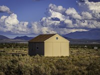
Editor's Note: Given the lack of formal zoning in this region combined with a covenants and restrictions document notably lite on detail, it suggests that land here can be developed in a number of ways. Additionally, surveying the homesites within the subdivision reveals a variety of styles, structures and building materials - from two story homes to one story sheds, log cabins to metal hangars, A-frames, stucco homes, hunting cabins, barns and greenhouses - with every type of dwelling represented, some even of notably small square footage. This suggests that as long as structures are created per state building codes, they should be acceptable here. See photos in the gallery at the bottom of this page for further reference.
Zoning: No Formal Zoning Designation
HOA: None
Covenants, Conditions & Restrictions: Yes
Annual Dues: None
Time Limit On Building: None
Title Info
Title: Free and Clear
Liens and Encumbrances: None
Mineral Rights: None
Recent Survey: None
Title Insurance: None
Conveyance Document: Special Warranty Deed
Suggested Type Of Closing: Title/Escrow
Doc Prep Fee: Waived
Misc
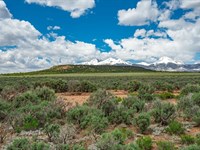
Cibola National Forest: The subject parcel sits in close proximity to thousands of acres of private land in the form of the Cibola National Forest. This makes the property ideal for hunters looking to take advantage of the elk, mule deer, wild turkey and other species that make this area one of the premier hunting destinations in the state.
Property Boundary Markers: While the subject property has a triangular footprint and its boundaries are well defined by the roads that surround it, potential buyers will be pleased to learn that a lone property boundary marker sits along the back or northern end of the lot, denoting where the subject property ends and the neighboring lot begins. This should be a benefit to anyone looking to develop the land and is concerned about encroaching on their neighbor's property but who also doesn't want to incur the cost of a survey.
Oso Ridge Lookout: For those who are interested in such things, Oso Ridge Lookout Road branches off Zuni Canyon Road and leads, via dirt road, along the subject property's western boundary to an outpost roughly two miles north in the forest known as the Oso Ridge Lookout. Located on a bed of red volcanic rock, the Lookout, along with the forest road leading to it, were created in the 1930'S as a part of the New Deal to help monitor forest fires in the region of the Continental Divide. This base was added to the National Historic Lookout Register in 2005 and includes a wooden ground house also built during the 1930'S as well as a restored aircraft beacon. It is both an important historic landmark and notable stop along a scenic hiking trail.
Nearby Towns
While small towns such as Ramah and Fence Lake sit within relatively close proximity of the subject property and will provide easy access to gas, convenience and some supply stores, the larger towns of Grants and Gallup (both roughly an hour away) will be your nearest source for most everyday supplies.
Grocery stores and Walmart Supercenters can be found in both towns, along with fast food chains and sit-down restaurants. While building supply stores can also be found in both, Home Depot only has a presence in Gallup. Each town boasts a Municipal Airport as well as medical facilities such as the Cibola General Hospital in Grants and the Rehoboth McKinley Christian Healthcare Center in Gallup.
It is only Gallup, however, which features recreational gambling such as the Fire Rock Casino.
Ramah: 26 miles (33 min)
Grants: 30 miles (39 min)
Gallup: 68 miles (1 hr 17 min)
Albuquerque: 128 miles (2 hr 4 min)
Los Lunas: 108 miles (1 hr 47 min)
Rio Rancho: 143 miles (2 hr 21 min)
Nearby Attractions
In addition to the Cibola National Forest, there are a number of scenic National and State Parks within easy driving distance of the subject property. Those parks include - but are not limited to - the El Malpais National Monument, El Morro National Monument, Bluewater Lake State Park, Ramah Reservoir, the Ice Caves & Bandera Volcano and Quemado Lake.
El Morro National Monument
El Malpais National Monument
Acoma Pueblo
Wild Spirit Wolf Sanctuary
San Estevan Del Rey Mission Church
Ice Cave & Bandera Volcano
Land Maps & Attachments
More Land Details
More Land from William Hemingway
 1.3 AC
- 10.7 AC : $35K
- 5.8 AC : $18K
- 1.1 AC : $30K
- 2.5 AC : $12K
- 1.4 AC : $15K
- 20 AC : $25K
- 2 AC : $12K
- 1.7 AC : $14K
- 5.1 AC : $12K
- 0.3 AC
- 0.2 AC : $15K


