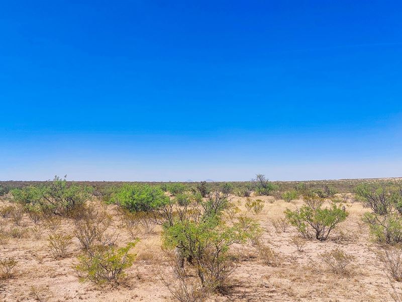
10.4 Acres Near El Paso
Fort Hancock, TX 79839
Hudspeth County, Texas
Land Description
Owner Financing:
$200 down (plus the $250 doc fee)
$200 down $145/Mo for 72 months (plus prorated taxes and a $12/Mo note maintenance fee)
Living in today's crowded, regulated cities is becoming increasingly suffocating. Rising costs, restrictive HOAs, light pollution, and constant noise are stealing our freedom and connection to nature. Many people feel trapped in a system that doesn't align with their desires for independence and self-reliance.
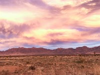
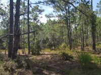
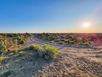
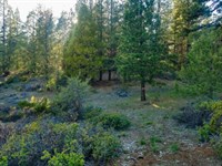
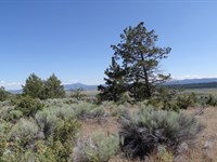
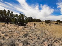
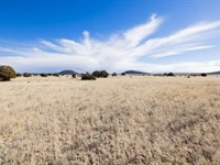
The remote location creates the perfect environment for hunting enthusiasts, with abundant wildlife like deer, elk, javelina, and quail roaming the terrain. With the option to expand to 20.8 acres, you'll have even more territory for hunting, recreation, and complete privacy. The private setting also accommodates target practice without disturbing others. Stay in your RV as long as you wish while enjoying panoramic mountain views and tranquil desert surroundings.
Despite the peaceful seclusion, you're just 39 miles from Hueco Tanks State Park & Historic Site and within reasonable distance to El Paso. The extremely low annual property taxes make this an incredibly affordable long-term investment as you plan your future.
We back this opportunity with a 100% money-back guarantee, giving you complete confidence in your purchase. This is your chance to achieve true independence and self-sufficiency in the vast Texas desert - whether on 10.4 acres or a full 20.8 acres of unrestricted freedom.
Subdivision: Na
STREET Address: N/A, near Fort Hancock, TX 79839
State: Tx
COUNTY: Hudspeth County, Tx
Zip: 79839
Size: 10.40 acres
LOT Dimensions: 922 feet x 523 feet
Apn: 101623
Legal Description: Description for Lot 36:Being a tract of land out of the South Half (S/2) of Section 24, Block 11, Public School Lands (Psl), and being more particularly described as follows: Beginning: At a point 2240.17 feet S 89° 07' 26" W and 1492.28 feet N 00° 00' 00" E of the Southeast corner of Section 24, and also known as the Southeast corner of Lot 35; Thence: S 89° 07' 37" W 882.73 feet to the northwest corner of the lot; Thence: S 11° 35' 40" E 43.80 feet along the center of the road to a point of deflection on the west sideline; Thence: S 06° 04' 58" W 115.42 feet along the center of the road to a point of deflection on the west sideline; Thence: S 00° 48' 42" E 97.22 feet along the center of the road to the southwest corner of the lot; Thence: N 89° 07' 37" E 885.25 feet to the southeast corner of the lot; Thence: N 00° 00' 05" W 256.94 feet to the Point of Beginning at the northeast corner of the above referenced lot and containing 5.20 acres of land, more or less. There shall be a 20 foot easement along the north, south, east, and west sidelines for access purposes. The foregoing description is based upon metes and bounds data provided by the owner, the Texas Railroad Commission, and the Texas General Land Office, and has not been surveyed as of this date. Description for Lot 37:Being a tract of land out of the South Half (S/2) of Section 24, Block 11, Public School Lands (Psl), and being more particularly described as follows: Beginning: At a point 2240.17 feet S 89° 07' 26" W and 1235.34 feet N 00° 00' 00" E of the Southeast corner of Section 24, and also known as the Southeast corner of Lot 36; Thence: S 89° 07' 37" W 885.25 feet to the northwest corner of the lot; Thence: S 11° 57' 44" W 154.53 feet along the center of the road to a point of deflection on the west sideline; Thence: S 00° 48' 42" E 99.03 feet along the center of the road to the southwest corner of the lot;THENCE: N 89° 07' 37" E 915.96 feet to the southeast corner of the lot; Thence: N 00° 00' 05" W 249.70 feet to the Point of Beginning at the northeast corner of the above referenced lot and containing 5.20 acres of land, more or less. There shall be a 20 foot easement along the north, south, east, and west sidelines for access purposes. The foregoing description is based upon metes and bounds data provided by the owner, the Texas Railroad Commission, and the Texas General Land Office, and has not been surveyed as of this date.
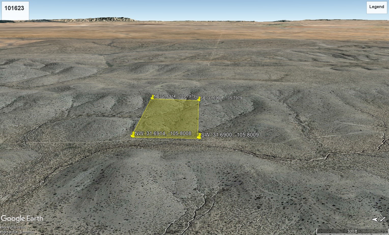
Lat/Long Coordinates:
Nw: 31.6914, -105.8008
Ne: 31.6914, -105.7979
Sw: 31.6900, -105.8009
Se: 31.6901, -105.7979
Elevation: 4,887 feet
ANNUAL Taxes: Approx. $95 per year
ZONING: No Zoning - There is no zoning at this time in Hudspeth County (it is unincorporated), except in the City of Dell City. There are no building restrictions at this time in Hudspeth County. You can camp on your own property. You must have a proper way to dispose of sewage. You can bring your RV on your lot and stay there upon building a home. You just need to dispose of sewage properly and legally. Mobile homes are allowed as there are no building restrictions.
Land Use:
Building Information
Time Limit to Build: no time limit to build
Site Built Homes Allowed: Yes
Modular Homes Allowed: Yes
Manufactured Homes Allowed: Yes
Mobile Homes Allowed: Yes
Tiny Homes Allowed: Yes
Allowable Uses
Full-Time RV Living: No
RV on the property while you build: Yes, with proper way to dispose sewage
Camping in a RV: Yes
Tent Camping: Yes
Notes: This is a general restriction as long as there is no deed restrictions or covenants on the property.
FLOOD Zone: Unsure
HOA/POA: No
IMPROVEMENTS: None
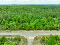
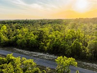
ACCESS: There is a trail to the property and 20 foot easements along the north, south, east, and west sidelines for access purposes.
WATER: Would be a well, water haul and holding tank or other similar option
SEWER: Would be by Septic
UTILITIES: Power by solar, wind or generator, Phone by cellular, satellite Tv/Internet/Phone
Land Maps & Attachments
More Land Details
More Land from Landopia, LLC
 0.8 AC : $16.5K
- 2.8 AC : $23K
- 5 AC : $15.1K
- 0.2 AC : $12.8K
- 5 AC : $14.2K
- 0.6 AC : $19.8K
- 0.5 AC : $19.3K
- 2.5 AC : $23K
- 1.6 AC : $10.9K
- 0.2 AC : $3.8K
- 1.1 AC : $5.5K
- New5.7 AC : $14.6K


