Serenity Haven
Cottonwood Rd : Santa Margarita, CA 93453
San Luis Obispo County, California
Land Description
Attention Investors, Flippers, and Wholesalers:
Gold Rush Club Deal - Way Below Market Value.
Perfect for Quick Flips, Strong Margins, and Long-Term Gains.
Reserve NOW with Just $500 Down-Then Pay the Balance in Full or in 3 Easy Monthly Payments.
Call Or Text Us Now For Availability.
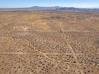
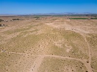
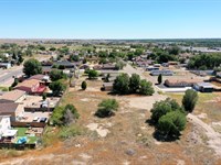
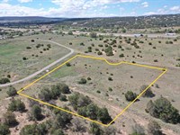
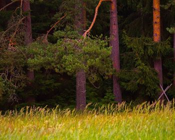
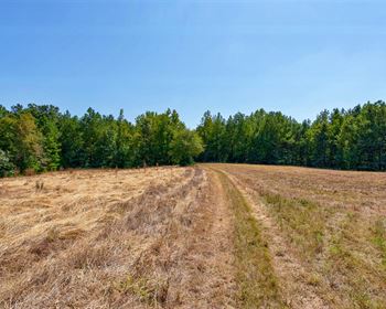
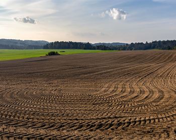
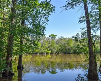
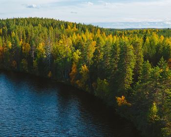
Imagine owning 2.50 acres in the serene landscape of Santa Margarita, San Luis Obispo County, CA - a beautiful retreat offering the perfect mix of nature and convenience. This expansive land is perfect for building your future home. With open skies and breathtaking, you'll have a serene space to relax or connect with nature. Plus, you're just a short drive from the amenities and coastal charm of San Luis Obispo and Paso Robles.
Santa Margarita's desirable location places you within reach of world-renowned wineries, scenic hiking trails, and the stunning Pacific Coast. Whether you're an investor, builder, or looking to create a private sanctuary, this property offers boundless potential. Embrace California's rustic charm and natural beauty.
Call Now Or Text Us For Availability.
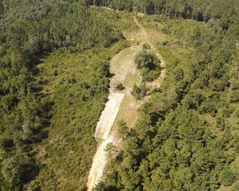
Easy roll-on, roll-off access.
Zoned for Residential Use.
Electricity: Off-Grid, Would need Solar or other types of Alternative Energy.
Primary Road: Dirt Road Access.
Water: Would be from Alternative Sources.
Call Us Now.
Cheap and Affordable Vacant Land For Sale in Santa Margarita
Undeveloped Property For Sale With Direct Road Access
For Residential Development in San Luis Obispo County
Buildable Land Perfect Off-Grid Living
Desert Land With Mountain Views
Land Near California Valley Solar Ranch and Soda Lake
Perfect for Hiking and Hunting Enthusiasts, Being Close to Recreational Areas
Quiet and Friendly Neighborhood
Located Near Golf Course, Schools, Parks, Shops, and Restaurants
Not in Flood Zone and Wetlands
Property Within Secured Subdivision
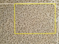
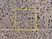
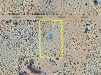
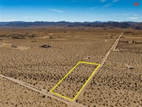
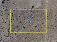
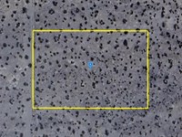
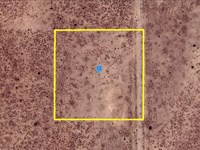
Land Maps & Attachments
Directions to Land
Center of Lot GPS Coordinates: 35.297191, -119.955523
GPS Coordinates for Corners of the Property:
Nw: 35.297636, -119.956061
Ne: 35.297632, -119.954950
Se: 35.296719, -119.954962
Sw: 35.296723, -119.956066
More Land Details
Land Price History
More Land from Patrick Elder
 7.5 AC : $40K
- 10 AC : $19K
- 2.5 AC : $14.5K
- 20.3 AC : $16K
- 8.9 AC : $31K
- 1 AC : $20K
- 2.5 AC : $18K
- 1.1 AC : $5K
- 0.7 AC : $24K
- 2.4 AC : $27K
- 1.1 AC : $7K
- 2.5 AC : $6K