Greer Ferry Lake, Boat, Fish, Rec
Greer Ferry, AR 72088
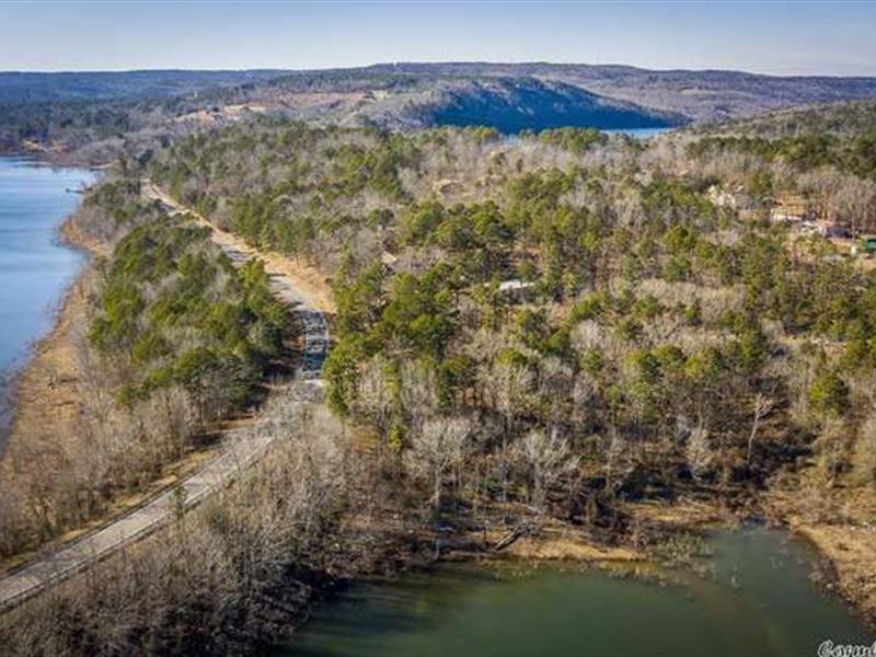
Cleburne County, Arkansas
Land Description
Greers Ferry Lake is the reservoir formed by Greers Ferry Dam, a United States Army Corps of Engineers dam in Northern Arkansas. It is located about 60 miles (100 km) north of Little Rock. Since the formation of Greers Ferry Lake in the early 1960S, tourism has thrived around the lake, and the population has topped 6,000 in Heber Springs. Through the 1970S, many luxurious neighborhoods were built around the lake and continue to be made. Various activities are available to the public: swimming, cliff diving, boating, fishing, scuba diving, camping, and other water recreational activities are popular among locals and tourists alike. Recently famous for rainbow trout, the Little Red River has become a favorite fishing spot year-round in the cool water coming from under the dam. Several campgrounds and boat docks/ramps offer direct access to the river. Also, houses, even small neighborhoods, have been built around the Little Red River.
Greer Ferry - Autumn Ln
Apn: 600-03730-000
Gps: 35.601878, -92.239396
County: Cleburne
Size: 0.22Ac
Lot: Block 9 Lot 307
Zoning: Res
Hoa: Yes, Analysis: There is a decent amount of nearby development; it just hasn't quite hit this little pocket yet-an an excellent recreational area.
Note: Our parcels are priced to sell as-is, where-is, with all potential faults. It would be best if you were willing to find answers to your questions and do research on the property. I am not a Real Estate Agent, Construction Company, Land Analyst, or an individual who will provide guarantees not backed by the regulations put forth by the County or state where you're buying the land. The State and the County decide what is possible, not the investor. You're seeing these low prices because it requires work on your end to confirm your preferred use of the land, and that's called meeting us halfway.
Google: “Minimum Lot Size”, “Building Codes", “Municipal Codes”, “County Tax Assessor Search”, etc.
Disclaimers:
Total market value is determined by time of sale, pricing in the vicinity, etc. We've researched (sale/sold) to find the regional prices on the same street or within a reasonable distance at the time of the auction. We can't guarantee that if you sold all of this right now, it would yield this much, but if you monitor these areas for development and buy land next to it and nearby, you could potentially go much higher.
Proper Analysis is often done without ever setting foot on this land. We look at market numbers and scan around for the current situation in that area. Investments may not sell today for double, but with economic changes around that area, they're almost certain to continue appreciating higher values. We pick land near lakes, rivers, golf courses, and other types of recreation.
Assessments can go up or down when a piece of land is purchased. There can also be discrepancies between sources and the Assessor if they provide the number at all. The assessments posted are believed to be accurate at the auction being posted.
All taxes are estimates; they can go up or down at any time. Any back taxes are paid as we know of them and current. The buyer is responsible for all taxes beyond the date of deed recording.
Due diligence means you may have to pay somebody to go to this place. It's paper land, good value, and lined up for a quick sale to the correct entity. The land is being sold As-Is. The buyer is responsible for all inspection of the land, its capabilities, and other activities surrounding the investigation of whether it's viable for that person's specific use.