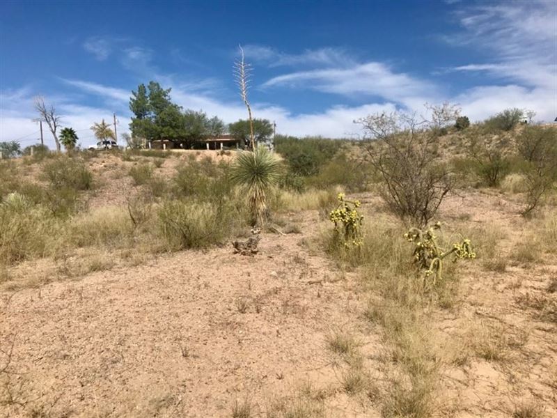
.63 Acres in Rio Rico, AZ
282 Donna Ct : Sonora, AZ 85648
Santa Cruz County, Arizona
Land Description
.63 Acres in Santa Cruz county, AZ for sale. Owner Financing Available - No credit check. Price: down and per month at 7% interest. OR - you can buy with an All cash discount of We accept credit cards.
You'll love these.63 acres in the Rio Rico Ranchettes subdivision. It's SO easy to build your dream home - this property already has paved road access Plus electricity and water available.
Rio Rico is known for its resort-style living, serene landscapes and brisk weather. Opportunities for hiking, horseback riding and golfing can be found near the property - outdoor lovers will enjoy exploring Sonoita Creek State Natural Area and Patagonia Lake State Park and Las Lagunas de Anza Wetlands, all less than 20 miles away. And Esplendor Resort, just 8 miles away, offers an 18-hole course and lovely restaurant.
Don't miss the chance to live like you're always on vacation. Contact us today to take advantage of this amazing lot.
All Property Details
County: Santa Cruz, Az
Street: 282 Donna CT RIO Rico, 85648
Size: 0.63 acres
Apn: 116-14-324
Legal Description: SUB RIO Rico Ranchettes Unit No.11 Lot 26 OF BLK 229
Terrain: Quite level
Access: Paved
Property Zoning: R2 (Single-Family Residential District)
Is the property buildable? Yes, Single-family residence only build on site
HOA: n/a
Electric: Yes, provided by UniSource Energy Services
Sewer: Would need to install septic
Water: Yes, available provided by Liberty Utilities (Arizona)
Taxes: 3,600 ft
Flood Zone: No
Is the lot splittable? If yes, what is the minimum build size? Not splittable.
Any setbacks to be followed? Front: 25 ft. Side: 15 ft. Rear: 25 ft.
Nearby Schools:
San Cayetano Elementary School
Little Red Schoolhouse
Desert Shadows Middle School
Center GPS Coordinates: 31.444671, -110.931305
Gps Coordinates:
31.444982, -110.931326- Sw
31.444863, -110.930932- Se
31.444339, -110.931329- Ne
31.444531, -110.931605- Nw
Area Attractions:
Sonoita Creek State Natural Area- 16.3 miles
Patagonia Lake State Park- 16 miles
Calabasas Park- 1.9 miles
Mission Los Santos Ángeles de Guevavi- 3.8 miles
Tumacácori National Historical Park- 14.3 miles
Las Lagunas de Anza Wetlands- 5.9 miles
Cave of the Bells- 18.5 miles
San Rafael State Natural Area- 37.6 miles
Santa Cruz County Parks & Rec- 6.8 miles
The Patagonia Museum- 20.1 miles
“Refer someone who buys land from us and we will pay a referral fee..”
Disclaimer: No warranties are stated or implied. Land is being sold as is. Buyer is responsible for doing all due diligence and verifying accessibility, utilities, build-ability and all other information contained herein prior to purchase.