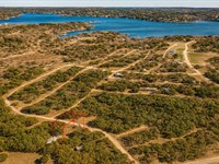
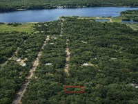
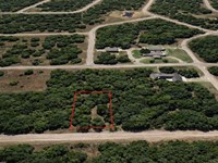
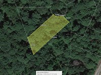
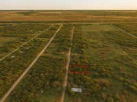
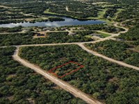
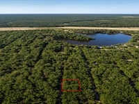
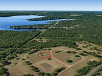
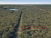
2.36 Acre Colorado Retreat
6th Trail : Cotopaxi, CO 81223
Fremont County, Colorado
Land Description
Owner Financing Available - This 2.36 acre lot is located in Cotopaxi, Colorado and the address is 6th Trail, Cotopaxi, CO 81223.
Cotopaxi is a tiny, unincorporated community in Fremont County, Colorado, located in the heart of the state's rugged high country. It's not a town or city with a formal government but rather a census-designated place CDP centered around a post office, a few businesses, and scattered homes. It sits along the scenic Arkansas River, making it a popular stop for outdoor enthusiasts.
Features Treed lot, mountain backdrop, road access
Only $2750 Down and $550/Month for 56 months $33550 or Discounted Cash Price $27497
Property Details
Apn 98704090
Address 6th Trail, Cotopaxi, CO 81223
County Fremont
State Colorado
Size 2.36 Acres
Dimensions 332' x 310'
Legal Subd Florida Colo Acres Sw4 Ne4 Sw4 Nw4 Sec 27 20 73 Fla Colo Acres Tr 78
Terrain Gently Rolling
Access Dirt Road
Power Power in the Area Power Company Black Hills Energy 1-
Water Water in the Area Water On The Spot Well American Drilling Service Water Haul Wood & Water
Sewer Sewer or Septic in the Area Septic KW & Sons Excavating Taxes per Year $290
Hoa Fees per Year No Hoa/Poa
Gps Coordinates center at the road 38.287556, -105.533665
--- Northwest Corner 38.288012, -105.534208
--- Northeast Corner 38.287991, -105.533120
--- Southwest Corner 38.287103, -105.534194
--- Southeast Corner 38.287086, -105.533116
Elevation 7888
Building Information
Zoning Co-Fremont-R-1-Residential
Time Limit to Build No time limit to build
Site Built Homes Allowed Allowed 400 min sqft
Modular Homes Allowed Allowed 400 min sqft
Manufactured Homes Allowed Allowed 400 min sqft
Mobile Homes Allowed Allowed 400 min sqft
Tiny Homes Friendly Allowed 400 min sqft
Allowable Uses
Full-Time RV Living Allowed Not Allowed
RV on the Property While I build Not Allowed
Camping in a RV Allowed Allowed Max 14 days
Land Maps
Directions to Land
From Westcliffe, CO 81252, USA
1.Head north on CO-69 N/3rd St toward North Ave
2.Turn right onto Copper Gulch Rd
3.Turn left onto Reed Rd
4.Turn right onto S Path
5.S Path turns right and becomes 8th Trail
6.Turn left
7.Lot is on the left
More Land Details
More Land from Benjamin Davis
 0.1 AC : $5.5K
- 0.9 AC : $17K
- 0.6 AC : $17K
- 0.3 AC : $5K
- 0.1 AC : $6K
- 0.3 AC : $10K
- 0.3 AC : $8K
- 0.3 AC : $11.5K
- 0.3 AC : $11K
- 0.2 AC : $7.5K
- 0.4 AC : $12K
- 0.3 AC : $10K