Pleasant Hill Ranch
Mathers Rd : Sunset, TX 76270
Montague County, Texas
Land Description
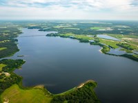
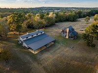
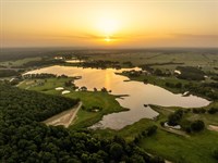
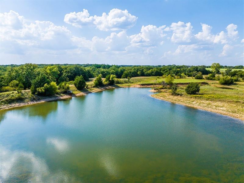
Overview Pleasant Hill Ranch, a 224.47 acre combination cattle and hunting property, is located just north of Alvord in southern Montague County near the Wise County line. Featuring rolling terrain, a mix of treed and open areas, and numerous stock tanks, the ranch offers both excellent grazing and abundant wildlife habitat. With no structural improvements, it serves as a blank canvas for the new owner to create their vision. Accessible by county road in a quiet, scenic setting, Pleasant Hill Ranch is ideal for ranching, recreation, or a private retreat.
If additional acreage is desired, an adjacent 398 acres is available across the county road, Circle B Ranch.
Location and Access Pleasant Hill Ranch is located on Mathers Road and Jim Harry Loop in southern Montague County, about one hour northwest of Fort Worth and 1.5 hours north-northwest of Dallas. Nearby towns include Sunset, Alvord, Decatur, and Denton. The ranch offers approximately 2,521 feet of all-weather caliche road frontage for convenient access.
Historical Point of Interest Located adjacent to the property, the Pleasant Hill Cemetery and Outdoor Church is registered by the Texas Historical Commission as a historic Texas Cemetery. Established around 1850, the cemetery is central to the history of the Pleasant Hill community in Sunset, Texas-a region shaped by its pioneering spirit and the families who built it. The site also marks the heart of the community, once home to the church, school, and lodge, and remains the final resting place for many of the area's early settlers.
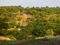
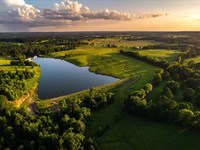
Terrain The landscape of Pleasant Hill Ranch features a well-balanced mix of wooded areas 60 and open pastures 40. Four fenced pastures, located on the northern portion of the ranch, are set up for rotational grazing and consist of native and improved Bermuda grasses, providing high-quality forage for cattle. The ranch currently supports a carrying capacity of 25-35 animal units.
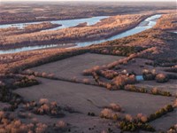
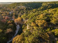
The southern half of the property is native terrain with a mix of woods, creek bottom, food plots and pastureland. Primary tree cover includes a variety of oak species, pecan, and cottonwood trees in the creek bottoms, as well as hickory, elm, cedar, and other native species. The mature timber provides excellent wildlife habitat, shade for livestock, and an ideal setting for future ranch improvements.
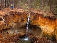
Topography The land is characterized by rolling terrain with elevation changes of approximately 120 feet. The highest point of the ranch is located along the far north corner at approximately 1,060 feet, offering scenic views. From there, the land slopes down to 940 feet toward the western boundary and along Panther Creek.
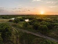
Water Features Water resources on Pleasant Hill Ranch include seven stock tanks and the seasonal Panther Creek running along the western boundary and through the southern portion of the property. The ranch sits above the Trinity Aquifer, with groundwater depths ranging from 160 to 280 feet based on nearby wells. These abundant water features provide reliable sources for livestock while also creating excellent opportunities for fishing. Additionally, there is a potential lake site where the dam washed out years ago. With some repairs, it could be a nice little lake. The property currently has no water wells.
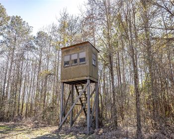
Wildlife Wildlife populations on the ranch are healthy, and hunting is excellent due to light hunting pressure. Pleasant Hill Ranch supports a thriving native wildlife, including whitetail deer, Rio Grande turkey, hogs, and dove. Select areas could be cultivated as wildlife food plots to further enhance habitat and support the deer herd.
Fences and Trails The property is fully fenced with internal cross-fencing, all in fair to good condition and suitable for cattle. New gates have been added at key intersections for better access. A graveled entry road and recently cleared trails wind through the property, connecting key areas of interest.
Improvements Other than fencing, there are no structural improvements.
Leases A grazing lease is currently in place but can be terminated upon a sale if desired.
Easements A pipeline easement runs along Jim Harry Loop near the northwest fence line. A feeder line follows a cross fence through the center of the property, doubling as a good north-south trail.
Minerals No active oil or gas production and owner will convey any minerals owned with no warranties regarding mineral ownership.
Utilities Electricity is available through Wise Electric Coop.
School District Bowie Independent School District
Taxes 2024 Property taxes were approximately $223.74 with an ag exemption in place.
Price $2,188,583 $9750/ acre Broker & Commission Disclosure Buyer's Agent/ Broker must be identified upon first contact with Listing Broker/ Listing Agent and Buyer's Agent/ Broker must be present at the initial property tour in order to participate in the real estate commission. Commission splits will be at the sole discretion of Listing Broker.
Contact Cash McWhorter- Broker/ Partner
Blake Hortenstine- Broker/ Partner
mobile
Land Maps
More Land Details
More Land from Cash McWhorter
 5,700 AC : $131.1M
- 235 AC : $3.53M
- 3,173 AC : $23.5M
- 2,700 AC : $14.85M
- 720 AC : $6.98M
- 2,511 AC : $10.67M
- 2,511 AC : $10.67M
- 10 AC : $2M
- 2,025 AC : $10.11M
- 5,195 AC : $1.75M
- 476.4 AC : $3.64M
- 593.7 AC : $9.45M