Roger Springs 367
1230 West Rd : Saulsbury, TN 38067
Hardeman County, Tennessee
Land Description
Roger Springs 367
County: Hardeman County
Acreage: 367+/-
Improvements:
Multiple gated access points from West Rd
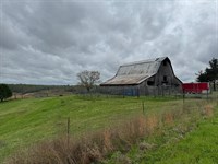
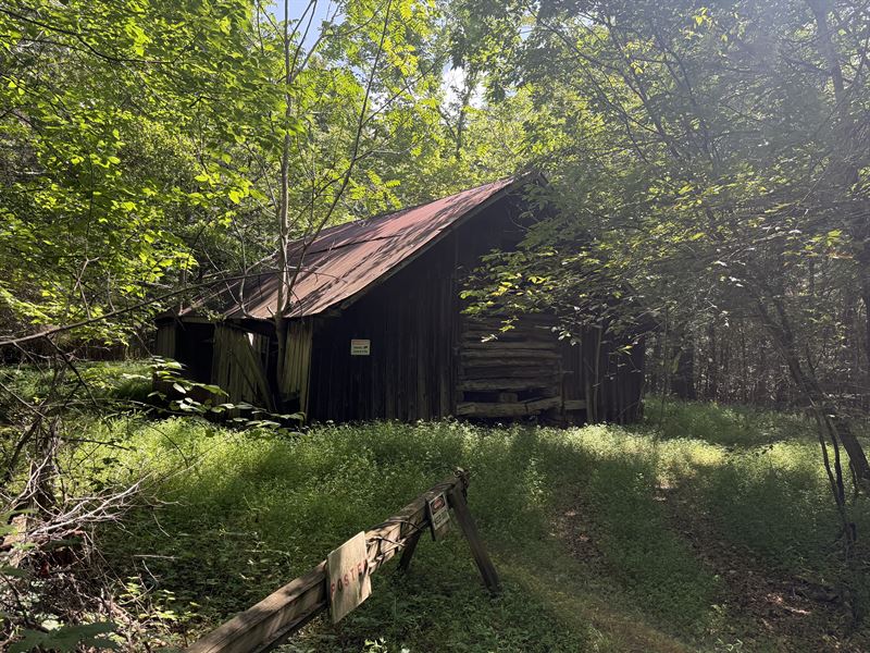
Barn for storage and small Hunting Camp house
An extensive interior road and trail system for easy navigation throughout the property
Established food plots, bordered by mature hardwood timber and abundant native browse
Multiple deer stands and hunting blinds in place (some may need repair)
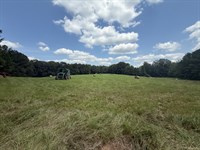
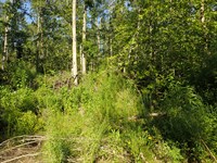
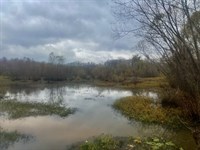
TERRAIN: A blend of Upland hills and fertile bottomland, this tract features mature hardwood timber, thick bedding cover, and the East Fork Spring Creek, which meanders through the landscape-creating an ideal habitat for whitetail deer and wild turkey. The property's diversity supports exceptional year-round hunting and outdoor recreation.
Parcel: 0
Rights:
• All seller-owned gas, oil, and mineral rights convey
• Exclusive hunting rights included
PRICE: $935,850.00 ($2550/Acre) - includes all timber, mineral, and hunting rights
INSPECTION: Shown by Appointment
Remarks:
Welcome to Roger Springs 367, a remarkable 367± acre recreational and hunting retreat located in the heart of West Tennessee. Situated in Hardeman County at 1230 West Rd, Saulsbury, TN 38067, this expansive property offers a rare blend of seclusion, accessibility, and natural beauty. Highlights include mature hardwood timber, an established internal trail system, excellent road frontage with power access, and strategically placed deer stands and hunting blinds throughout the tract. Surrounded by large neighboring farms, this property is ideally suited for hunting, recreation, or building your private getaway.
Land Maps & Attachments
Directions to Land
1230 West Rd. Saulsbury, TN 38067
45 miles to Collierville, TN
44 miles to Jackson, TN
173 miles to Nashville, TN
Coordinates: 35.085212°N, 89.034830°W