Hidden Gem, Rainbow Lake, $499 Down
Dunnellon, FL 34432
Marion County, Florida
Land Description
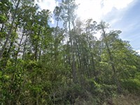
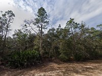
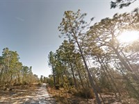
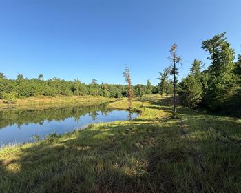
Discover Secluded Paradise in Rainbow Lake Estates
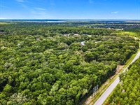
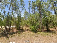
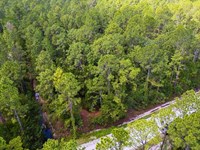
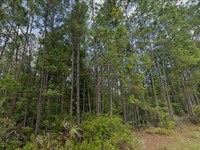
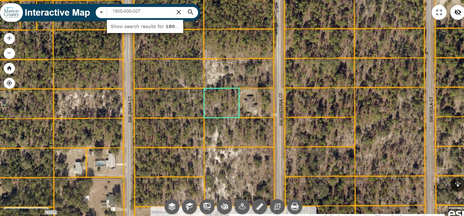
Tired of noisy neighbors, honking cars, and glaring headlights? Say hello to your own half-acre hideaway tucked in the peaceful woods just west of Ocala. This isn't your average lot-it's perfectly set off the street behind another half-acre, making it feel like your own private forest retreat. You'll enjoy unmatched seclusion, serenity, and silence-without being off the grid. Yes, it's that magical.
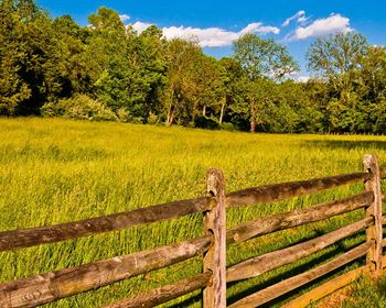
Easy Access, Total Privacy-The Dream Combo
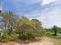
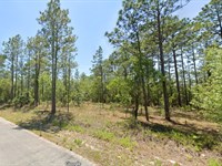
This rare gem comes with deeded access, meaning you get total privacy and legal ingress/egress-no weird easement issues here. Zoned R1 Residential, this lot is ready for a beautiful site-built home. Picture it: your dream house surrounded by trees, songbirds, and space to breathe. The neighborhood features large lots and stunning homes, giving you the perfect blend of remote living with a touch of luxury.
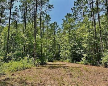
Build Your Dream. Live the Life.
With power at the street and space for your own well and septic, this lot is ready when you are. Whether you want to work remotely in peace, retire surrounded by nature, or invest in Florida land, Rainbow Lake Estates offers a lifestyle that's hard to match. Close enough to Ocala for fun and essentials, far enough away to truly unplug.
Status: Available
Location: Dunellon, Fl
Size (Acres): 0.50
Zoning: Residential Zones (e.g. R-1, R-2)
Terrain: Flat with Trees
Access: Paved Road
Nearby Cities: Citrus Springs, FL (24 min, 14.9 miles), Williston, FL (27 min, 21.8 mile), Inglis, FL (25 min, 21.6 miles), Crystal River, FL (35 min, 25.6 miles), Yankeetown, FL (30 min, 24.4 miles)
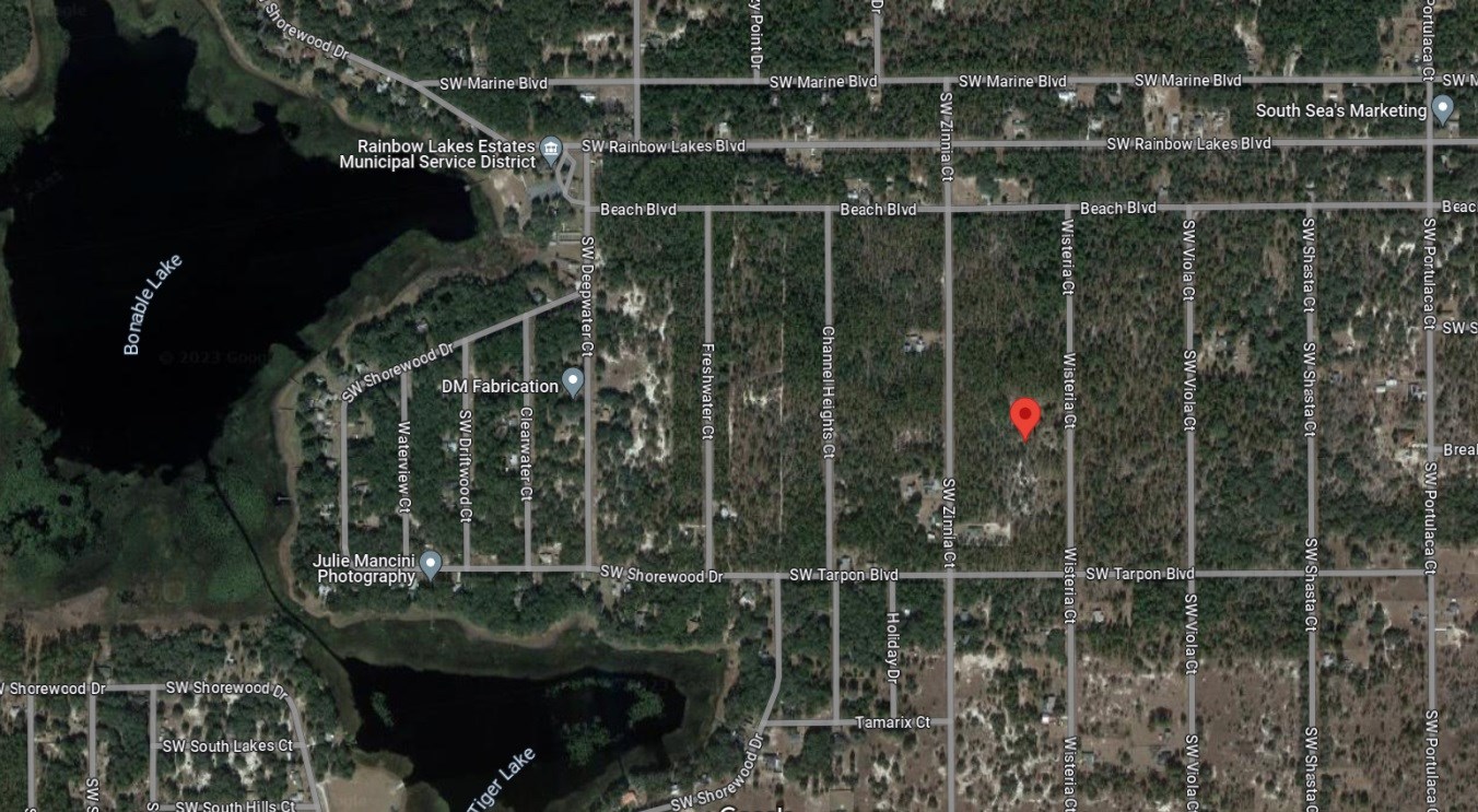
Nearby Attractions: Rainbow Springs State Pork, Crystal River Preserve State Park, Sholom Park, Blue Run Dunnellon Park, KP Hole Park
Nearest highway: US Hwy 41 Dunnellon FL and US Hwy 98, Inglis, Fl
Utilities:
Power: Power on street
Water Well: You install.
Sewer Septic: You install.
What can be built? Generally, residential structures, possibly with restrictions on type and density.
Time limit to build? Specific to local ordinances and development plans.
Is camping allowed? Usually not.
Are RV's allowed? Often not, or possibly only temporarily.
Are mobile homes allowed? Depends on zoning sub-classification and specific regulations.
Hot Owner Finance Deal.
No banks. No credit checks. Just easy monthly payments, a super low-down payment, and Zero% interest. Want even more savings? Ask about our cash discount price. And with our 90-day satisfaction guarantee, you've got nothing to lose and land to gain.
Ready to make your move? Contact us NOW and claim your piece of paradise.
Important Notes:
- All of the information we have about this Property is contained on our Website Property Page.
- We ask that buyers do their own Due Diligence.
- You can visit any of our properties at any Time. GPS Co-ordinates and Driving Directions Given.
- Please call the Applicable County offices for any Specific Questions about the Property.
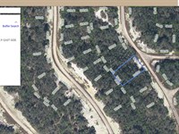
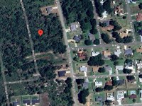
Land Maps & Attachments
Directions to Land
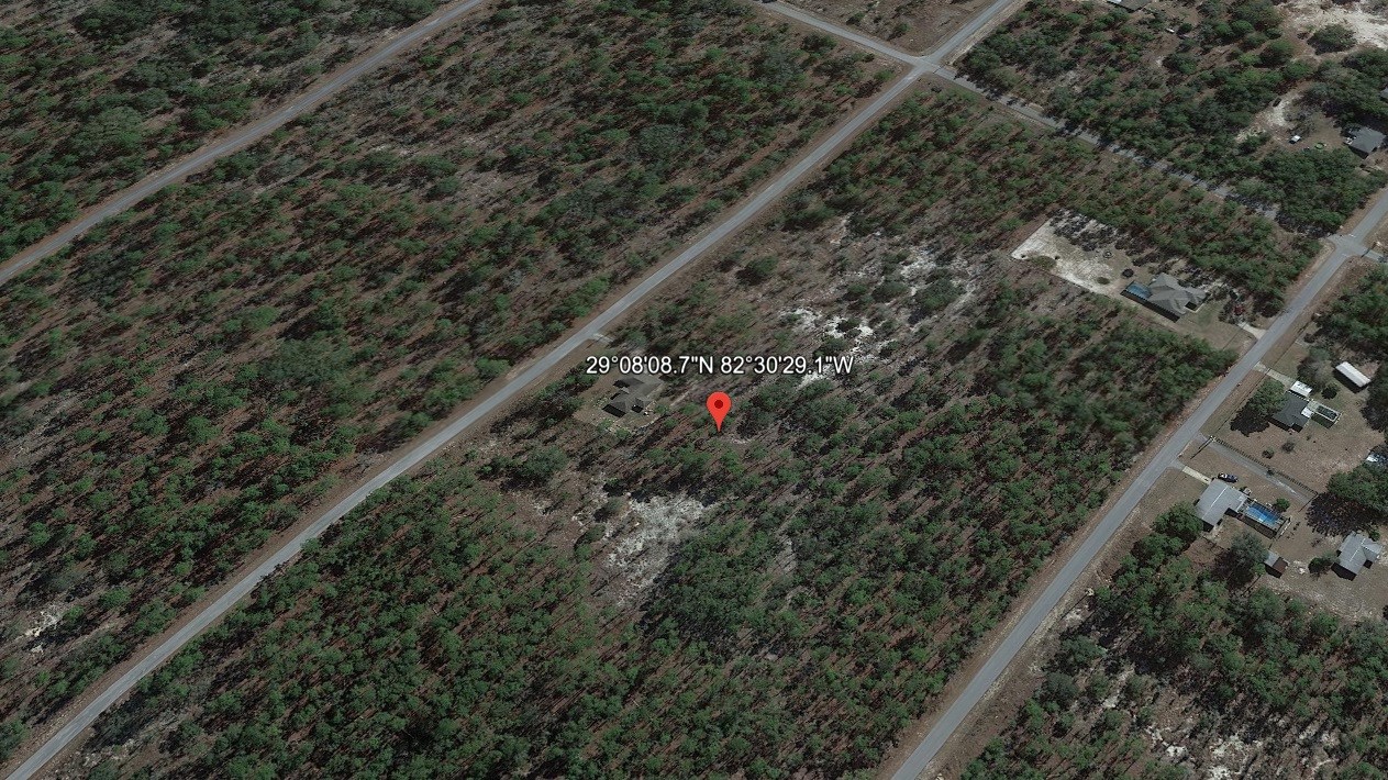
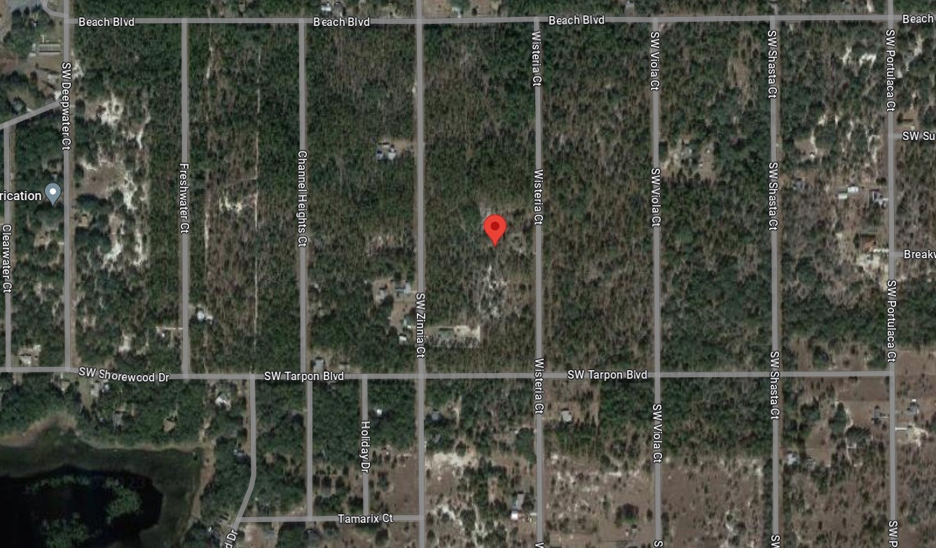
Gps: 29.13575, -82.50809
Gps Nw: 29°08'09.4"N, 82°30'30.0"W
Gps Ne: 29°08'09.4"N, 82°30'28.3"W
Gps Sw: 29°08'08.1"N, 82°30'30.0"W
Gps Se: 29°08'08.1"N, 82°30'28.2"W
Direction from Gainesville, FL
1.) Take Beach Blvd to US Hwy 41 N (7 min, 4.2 mi)
2.) Follow US Hwy 41 N and FL-121 N to FL-331 N/SW Williston Rd in Alachua County (38 min, 34.2 mi)
3.) Follow FL-331 N/SW Williston Rd to S Main St in Gainesville (10 min, 5.0 mi)
Directions from Ocala, FL
1.) Take Beach Blvd to US Hwy 41 S (7 min, 4.5 mi)
2.) Follow FL-40 E to W Silver Springs Blvd in Ocala (32 min, 21.8 mi)
Directions from Orlando, FL
1.) Get on I-75 S in Ocala from FL-40 E (31 min, 23.5 mi)
2.) Continue on I-75 S. Take Florida's Tpke to S Lucerne Cir E in Orlando. Take exit 10B from FL-408 E
(1 hr 6 min, 76.2 mi)
3.) Take FL-527 N to E South St (3 min, 0.7 mi)
Directions from Tampa, FL
1.) Take Beach Blvd, US Hwy 41 S and Co Rd 491 to FL-589 in Lecanto (41 min, 27.3 mi)
2.) Follow FL-589 to N Tampa St in Tampa. Take exit 44 from I-275 N (1 hr 4 min, 73.6 mi)
3.) Drive to E Cass St (1 min, 0.2 mi)
More Land Details
More Land from Kirk Peart
 0.5 AC : $24K
- 1 AC : $25K
- 0.2 AC : $13K
- 0.2 AC : $19K
- New0.2 AC : $18K
- New0.2 AC : $18K
- 1 AC : $25K
- 0.2 AC : $19K
- 0.2 AC : $14K
- 1.3 AC : $26K
- 1.1 AC : $9K
- New1.3 AC : $49K


