Cheap Land for Sale
Roosevelt, UT 84066
Duchesne County, Utah
Land Description
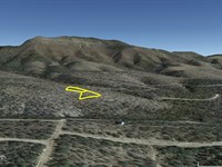
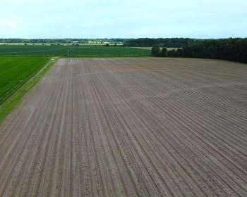
The undeveloped Cove Acres subdivision is centrally located in the beautiful Uinta Basin in Duchesne County, Utah. To the north and northwest is the Uinta Wasatch National Forest, to the south and northeast is the Ashley National Forest. Close by to the southeast is the town of Roosevelt.
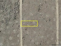
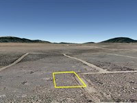
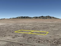
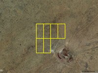
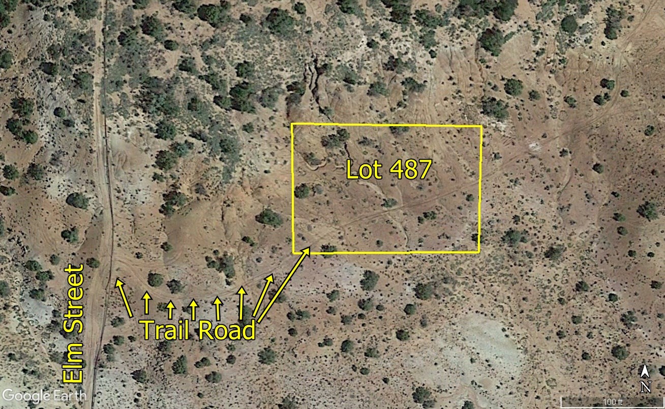
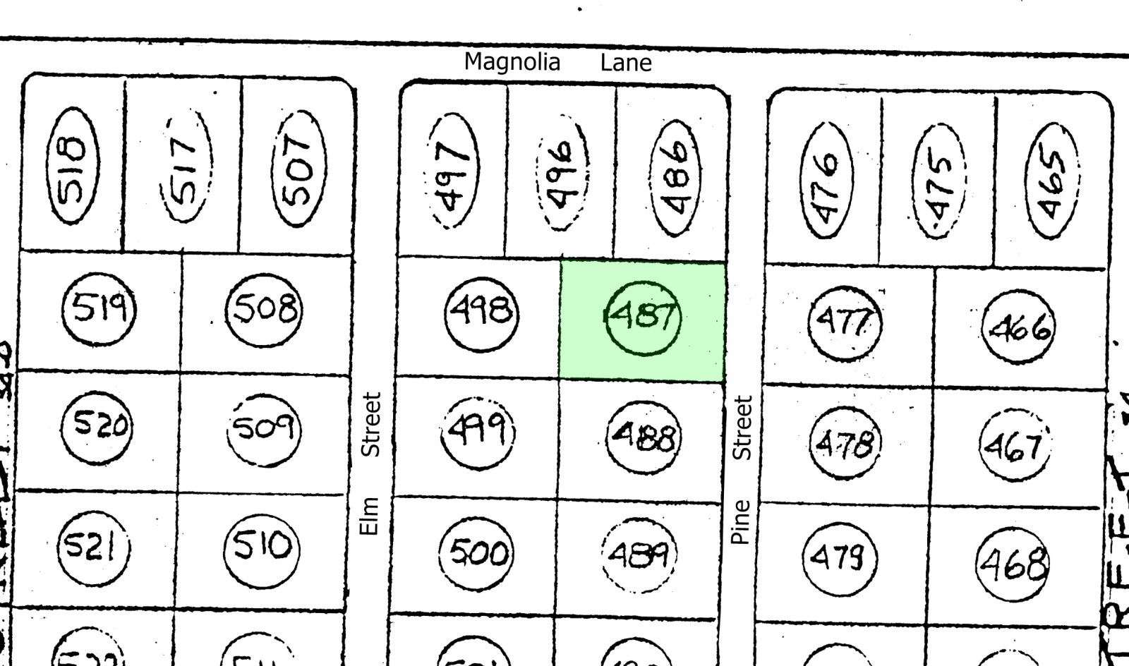
This property is Lot 487 in Cove Acres.
This is a secluded area with great mountain views.
It is in a remote area of Cove Acres, about 1 mile north of Bluebell Road.
There is scattered vegetation. Electric lines are a couple of lots away. The northwest corner goes up in elevation about 15 feet, where it tucks into a hill.
This can be a great property for camping, RVing, and storage while you hold it for investment. It is not big enough to qualify for a building permit. Utilities have not been run into this area, but electricity is only a few lots away.
Everyone qualifies for the same financing, we do not run credit checks.
With a $294 initial payment ($99 down payment + $195 document fee) we will finance the balance for as little as $71.57 per month over 4 years. This works out to less than $3 per day over 3 years and you will own this property. You can pay your loan off early at any time and save all of the interest you otherwise would have paid after that date. Or you can buy it outright instead of financing, and receive a 10% cash discount.
For more information or to purchase, please click on the green Land Website button below.
Land Maps & Attachments
Directions to Land
Starting at the intersection of State Highway 121 and N 200 E Street in downtown Roosevelt.
Head west on State Highway 121 for 1.5 miles.
Turn left onto Upper Hancock Cove Road and drive 2 miles.
Turn right onto 3000 W and drive north for 0.48 mile.
Turn left onto 4075 N and drive west for 2 miles.
Turn right at 40.327650 -110.085911 and drive north for 0.69 mile.
Turn left at 40.337706 -110.085908 and drive west for about 0.37 mile.
Turn right at 40.337795 -110.092682.
0.19 mile turn right at 40.340331 -110.092311 and take the trail to the property.
More Land Details
Land Price History
More Land from Samantha Stephens
 0.3 AC : $4K
-
1.2 AC : $6K
- 1.2 AC : $9K
- 0.3 AC : $3K
- 1 AC : $4K
- 7.5 AC : $12K
- 5 AC : $30K
- 0.3 AC : $7K
- 7.5 AC : $12K
- 10 AC : $20K
- 1.8 AC : $7K
- 26.3 AC : $18K


