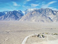
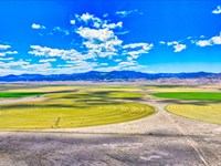
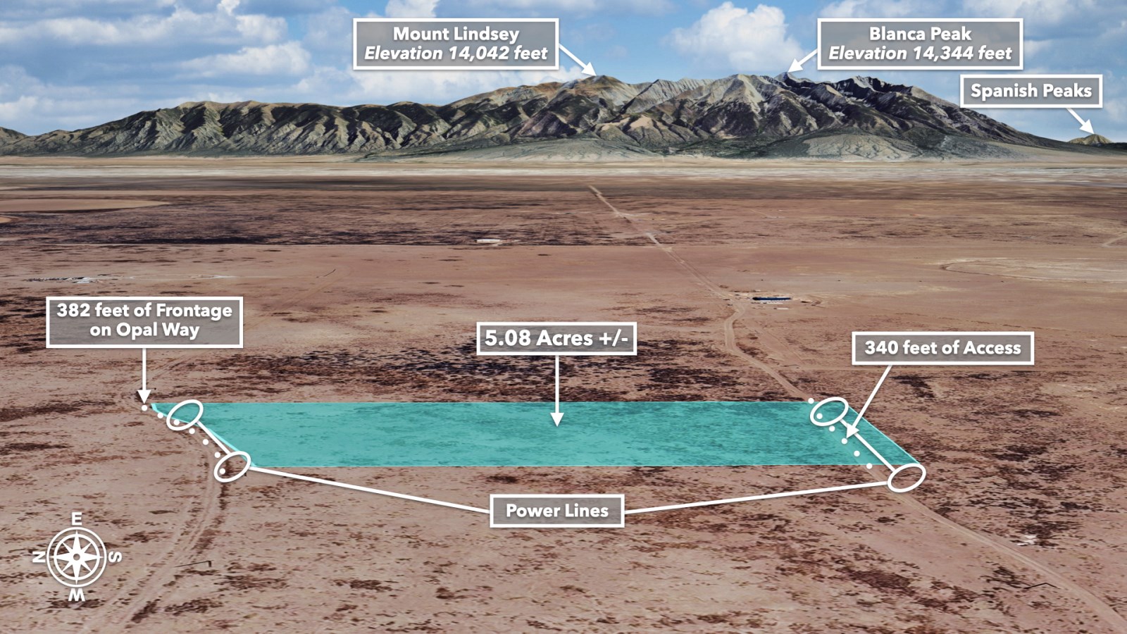
Power, Roads & Rocky Mountain Views
Opal Way : Alamosa, CO 81102
Alamosa County, Colorado
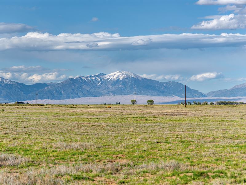
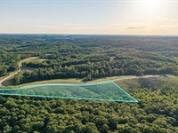
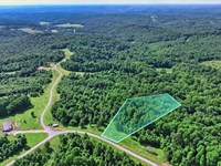
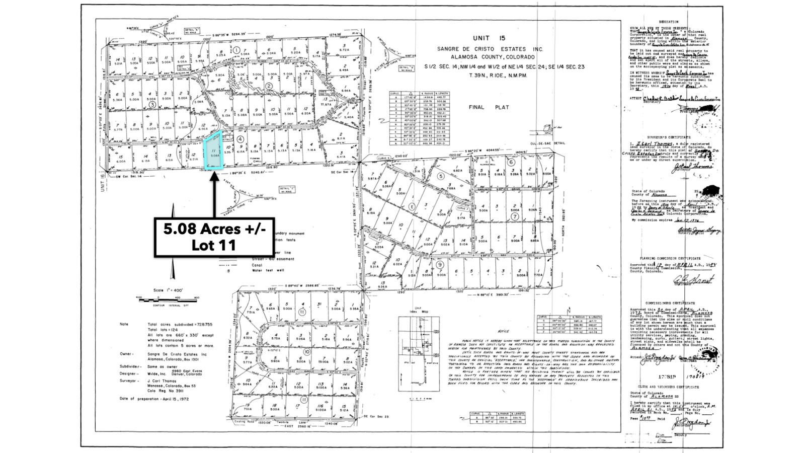
Land Description
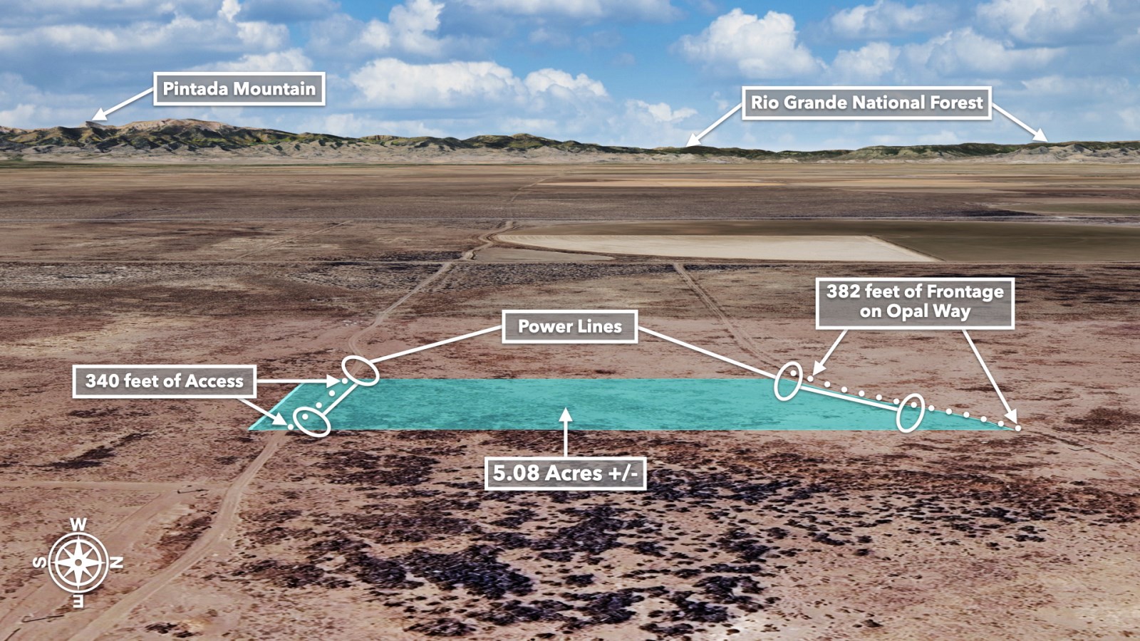
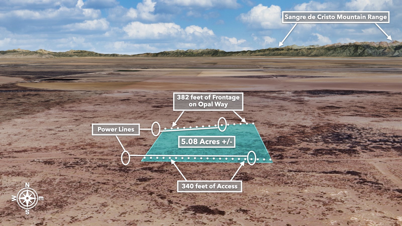
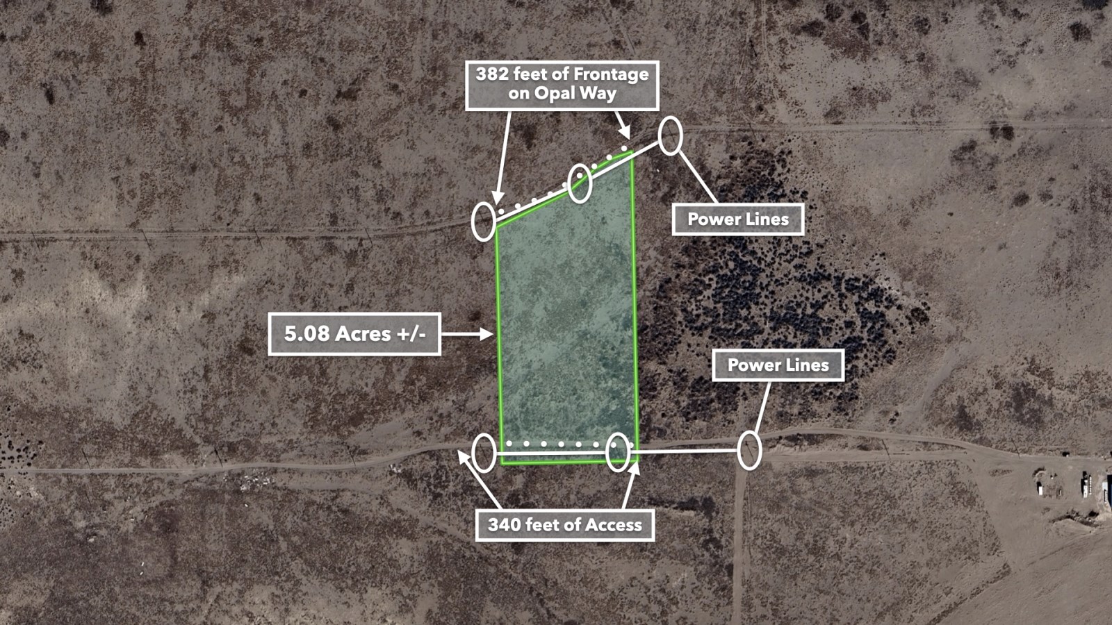
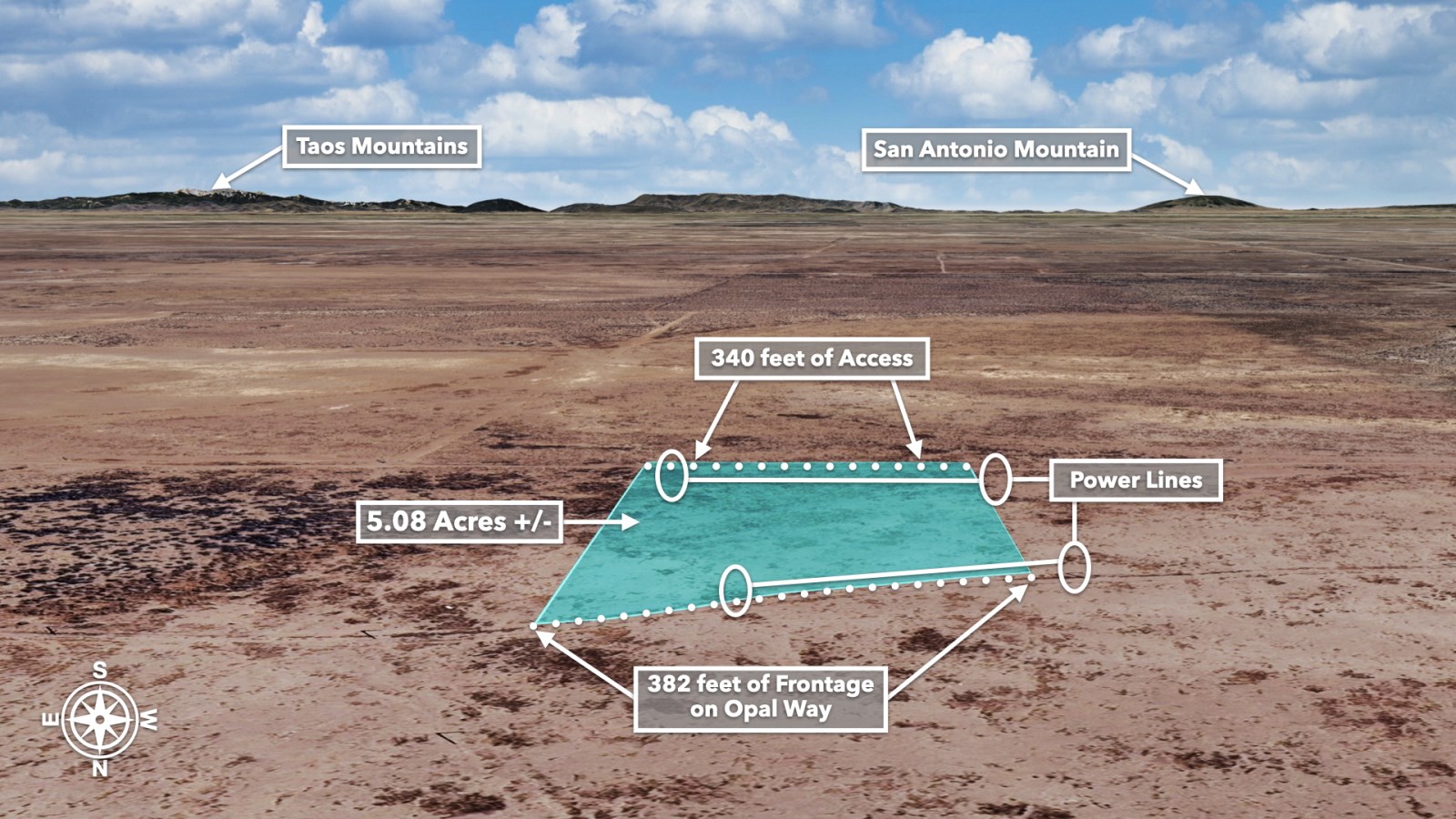
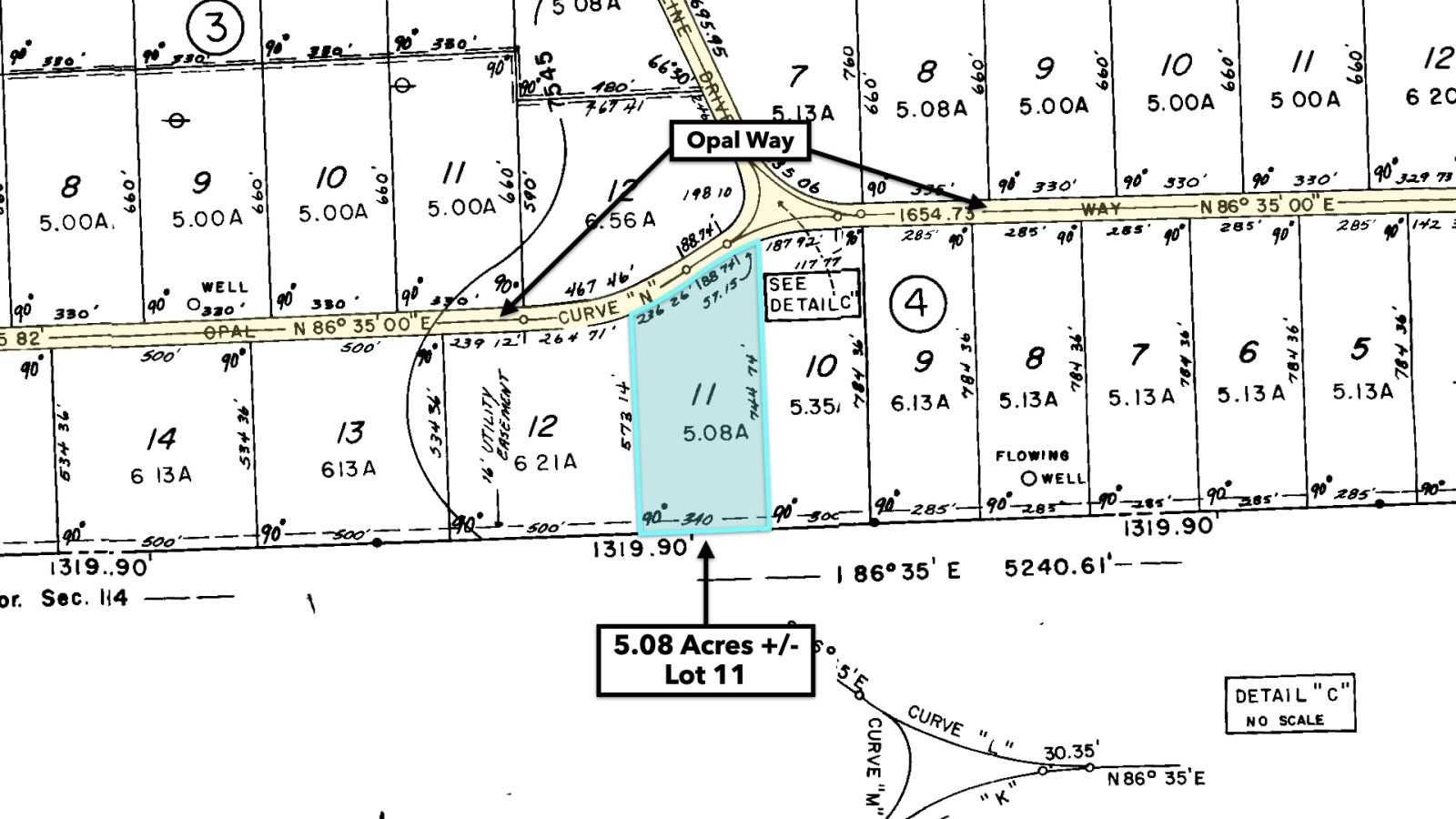
5.08 Acre Homesite with Electricity Lines & Poles already in place at the road on the Northern & Southern Boundaries.
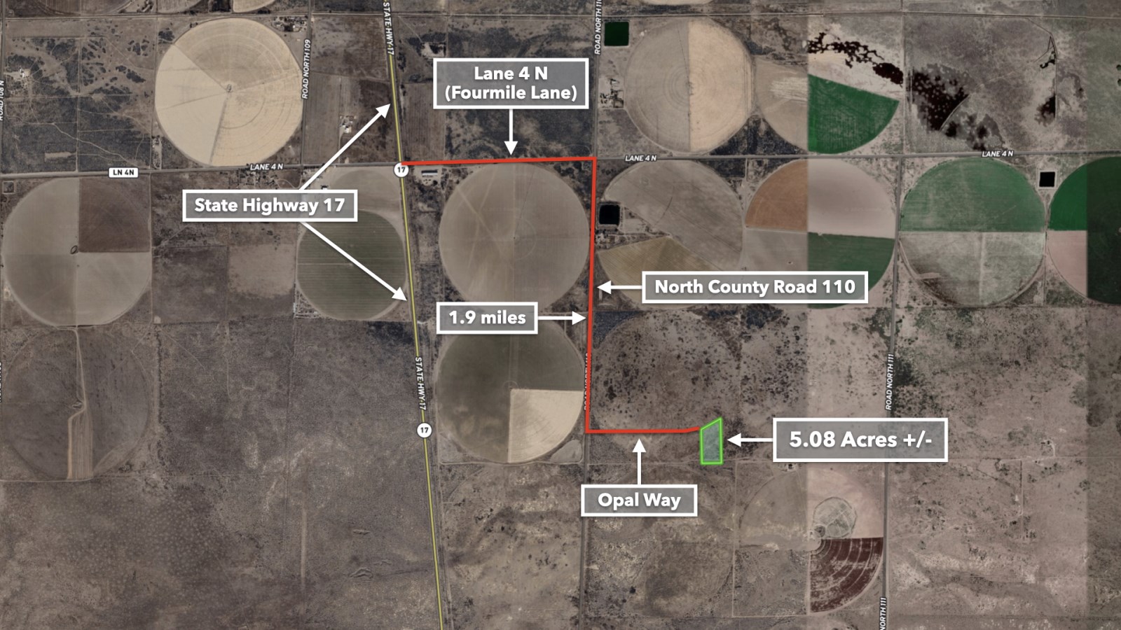
This property has great drive-up access with 382 feet of Road Frontage on Opal Way along the entire Northern boundary.
In addition to the great drive-up access, it is only a 3 minute drive to the paved State Highway 17, which will take you directly to Alamosa, Colorado to the South.
One of the many great attributes of this property is that it is located just a short 16 minute drive to Alamosa, where you'll be able to find a variety of Grocery Stores, Restaurants, Professional services, Public Schools, a University, many local parks, Churches, and much more.
No Hoa, HOA Fees, or Time Limit to Build
Camping is permitted on the property with a Temporary Use Permit from the county that allows you to camp for a total of 180 days throughout the calendar year.
During construction of a new residence, you may use an RV on the property for up to two years.
Horses & Animals are permitted on the property.
The minimum dwelling size per the Alamosa County Land Use Code is 500 square feet - For Manufactured Homes it is 600 square feet.
Single & Double Wide Mobile / Manufactured homes are also allowed on the property within certain guidelines that can be seen in the Residential Use Standards portion of the Land Use Code.
Electricity Lines & Poles are located at the road along the Northern & Southern boundary.
Power Company: Xcel Energy
Telephone, Internet & Cable provided by Jade Communications
There is Curbside Trash Service by Waste Management in the area, with a setup cost of $80, and a 96 or 64 gallon container serviced every week at $18/Month.
The area has a shallow water table and well depths on nearby properties range between 50 feet - 100 feet. Estimates from local water well contractors are around $6k - $7k for a water well.
Property Specifications
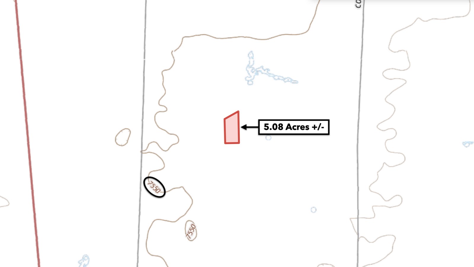
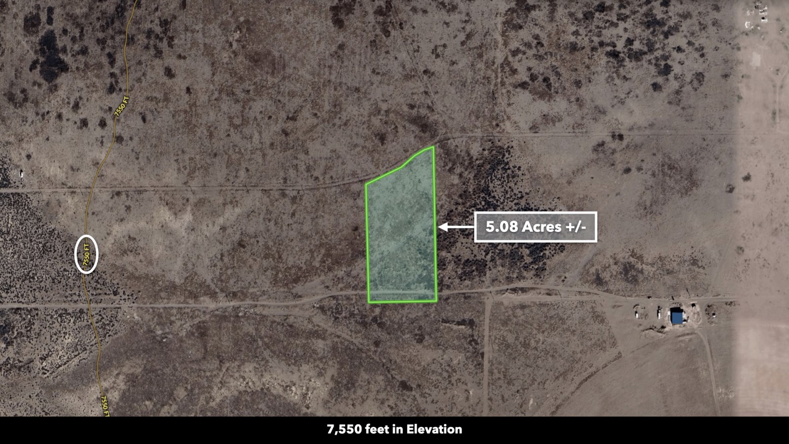
Parcel Size: 5.08 Acres +/-
Landio Property ID : Co_Alamosa_00019
Legal Description: Sangre de Cristo Estates Unit 15 Block 4 Lot 11
Apn: 11
Property Taxes: $167 per year
Title: Free & Clear
Conveyance: Warranty Deed
Approximate Distance to Nearby Cities & Points of Interest
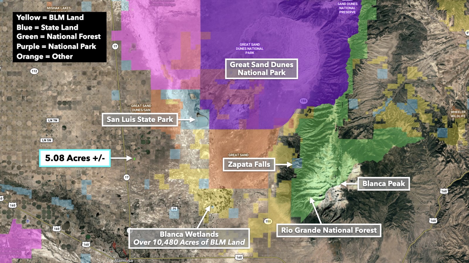
10.4 miles to San Luis State Wildlife Area
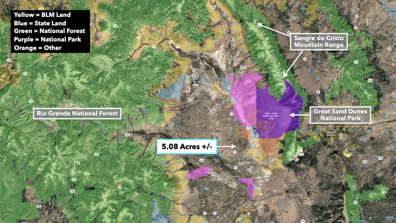
11.1 miles to Great Sand Dunes National Park
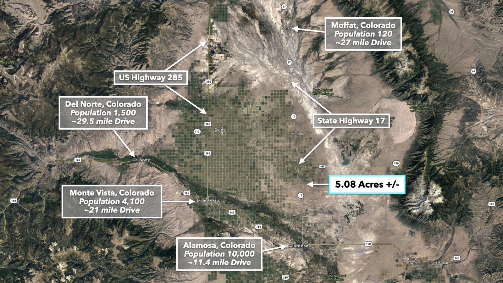
11.4 miles to Alamosa, CO : Population 10,000
14.3 miles to Blanca Wetlands
21 miles to Monte Vista, CO : Population 4,100
24.8 miles to Zapata Falls
25.7 miles to Monte Vista National Wildlife Refuge
27 miles to Moffat, CO : Population 120
29.5 miles to Del Norte, CO : Population 1,500
32.9 miles to Blanca Peak
40.5 miles to Hot Creek State Wildlife Area
41.3 miles to Terrace Reservoir
45.4 miles to South Fork, CO : Population 370
58 miles to Rio Grande National Forest
63.6 miles to Wolf Creek Ski Area
132 miles to Pueblo, CO : Population 112,000
175 miles to Colorado Springs, CO : Population around 480,000
208 miles to Denver, CO : Population 3,000,000
Visiting the Property
You are welcome to visit the property while it is available. Please contact Landio for instructions.
Gps Coordinates
Northwest Corner: 37.04305, -105.84987458614899
Northeast Corner: 37.26276, -105.84871647865384
Southeast Corner: 37.4889, -105.84866604397729
Southwest Corner: 37.3108, -105.8498258627975
Center Point: 37.619781, -105.849267
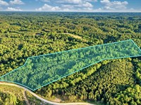
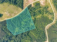
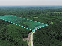
Land Maps & Attachments
More Land Details
More Land from LANDiO
 New15.7 AC : $133K
- New9.5 AC : $81.3K
- 11.6 AC : $99K
- 7.7 AC : $65.7K
- New30.8 AC : $30K
- 137 AC : $1.9M
- 40 AC : $160K
- 1 AC : $20K
- 8.3 AC : $70.6K
- New15.9 AC : $136K
- 3 AC : $70K
- 800 AC : $1.3M


