10 Acres Private Serenity, $200/Mo
Montello, NV 89835
Elko County, Nevada
Land Description
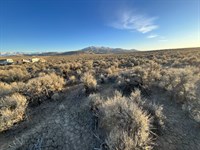
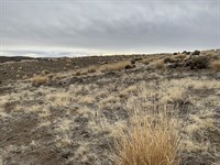
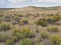
Here's your chance to own 10 full acres of wide-open Nevada land in peaceful Elko County-where the skies stretch endlessly and the quiet goes on for miles. Just 20 miles from the small town of Montello, you'll still have access to gas, groceries, a post office, and a local bar & grill when you need it.
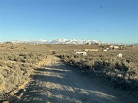
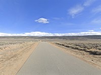
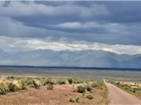
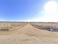
But out here, you're surrounded by nature, fresh air, and nothing but open space. The property sits just off 9th Street near Pilot Road-easy to locate with a high-clearance vehicle-and far enough away from neighbors to give you the kind of privacy city living just can't offer.
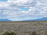
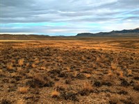
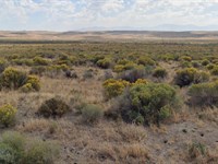
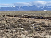
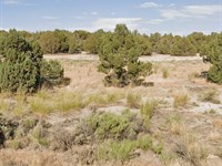
Imagine watching the sunrise over Pilot Peak with a cup of coffee in hand, or falling asleep under a blanket of stars you can actually see. You'll spot wildflowers blooming in the spring, find deer tracks winding through the brush, and maybe catch a rabbit hopping through the sage.
The land is zoned open space with mixed use, so your options are wide open-whether you want to build a cabin, set up an off-grid escape, or simply pitch a tent and camp on weekends.
This isn't just land-it's your chance to slow down, spread out, and build something that's truly yours. With no heavy restrictions and room to grow, dream, and explore, it's a smart choice for outdoor lovers, future builders, and investors alike.
Opportunities like this don't last forever. Reach out today and let's talk about how easy it can be to make this beautiful 10-acre property yours-with flexible owner financing that fits your budget. This could be the one-let's turn that interest into ownership.
Details:
Parcel ID:
Address: Montello, NV 89835
County: Elko County. Nevada
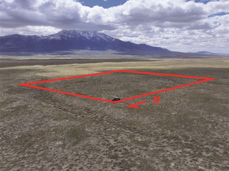
Size: 10 Acres
Zoning: Open Space, Mixed Use
GPS Coordinates (approximate):
Nw 41.093889, -114.196389
Ne 41.093611, -114.193889
Se 41.091944, -114.194167
Sw 41.091944, -114.196667
Pricing:
Cash Price: $11,895
Term Pricing: $200 Down, $200 Month x 60 Months
$250 Doc Fee (one-time payment)
No Background/Credit Checks
The chance to own land with no rules, no rush, and endless potential doesn't come often-so why wait? Make it yours before it disappears.
Click “Contact Seller” Button Now To Secure This Lot Today.
Directions to Land
GPS Coordinates (approximate):
Nw 41.093889, -114.196389
Ne 41.093611, -114.193889
Se 41.091944, -114.194167
Sw 41.091944, -114.196667
More Land Details
More Land from Chris Black
 1.1 AC : $5.9K
- 1.1 AC : $6K
- 2.1 AC : $5.5K
- 1.1 AC : $5.9K
- 5 AC : $5.9K
- 5 AC : $5.9K
- 1.1 AC : $5.9K
- 10 AC : $14.6K
- 5 AC : $5.9K
- 2.3 AC : $5.5K
- 5 AC : $5.9K
- 1.1 AC : $5.3K