City Convenience for $381.43/Mo
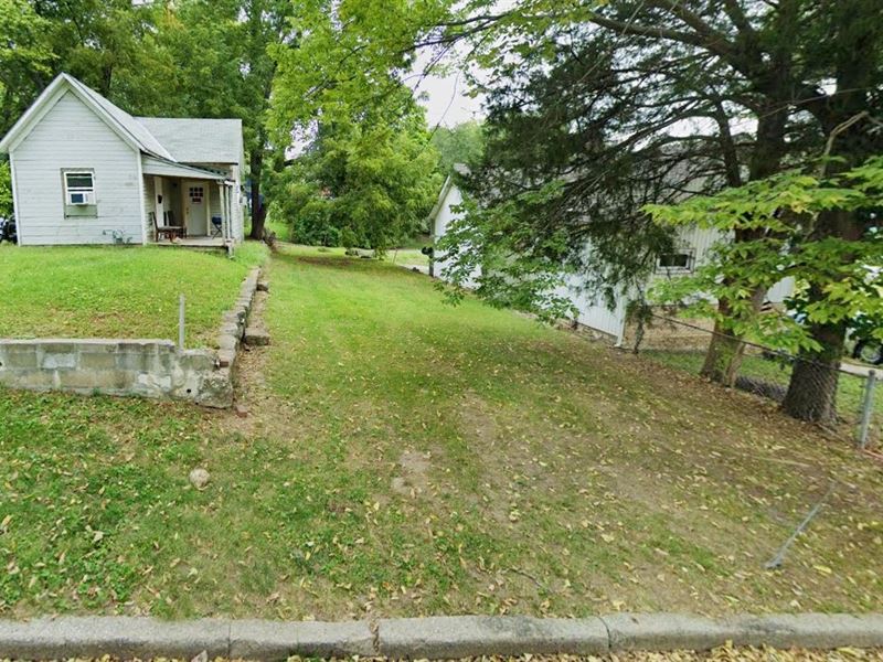
714 Stewart Ave : Kansas City, KS 66101
Wyandotte County, Kansas
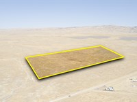
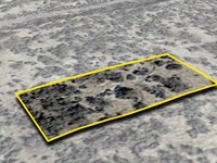
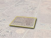
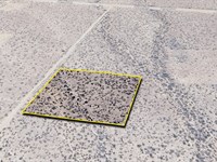
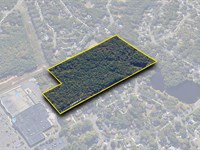
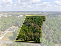
Land Description
$381.43 Down $381.43/Mo for 12 Months 0% Int
No Credit Checks. All Major Credit Cards Are Accepted.
Call or Text Us Now To Reserve.
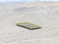
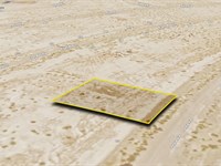
The serenity that you deserve on this 0.07-Acre vacant land in Kansas City, KS. This location offers much to residents in terms of entertainment, food, and leisurely activities. Additionally, it provides ample opportunities for those who want to explore nearby cities such as Downtown Kansas City and Overland Park.
Property Address: 714 Stewart Ave, Kansas City, KS 66101
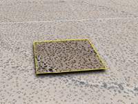
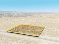
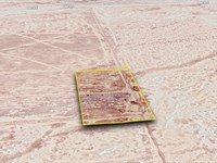
Lot Size: 0.07 Acre
Zoning: Residential and Recreational Use
Electricity: YES - Power Lines are There
Primary Road: Paved Road Access
Water: YES - Water Service is Available in the Area
Take This Opportunity, Reserve It Now For Only $381.43. Secure This Stunning Piece of Land While it's Available. Get Easy 12 Months Financing at 0% Interest, No Credit Checks, All Major Credit Cards Are Accepted.
$381.43 Down $381.43/Mo for 12 Months 0% Int
Call or Text Us Now To Reserve.
Cheap and Affordable Vacant Land For Sale in Kansas City
Flexible Financing Options are Available
Owner Financed Rural Land in Kansas
Undeveloped Property For Sale With Direct Road Access
For Residential Development in Wyandotte County
Buildable Land With Water And Power Access
Homesite Potential With Scenic Views
Single-Family Homes, Municipal Facilities, and Community Centers are Permitted
Permitted Uses include Agricultural Uses That Do Not Involve Animals or Livestock
Finance Land Near Entertainment Hubs
Perfect for Hunting and Fishing Enthusiasts, Being Close to Recreational Centers
Quiet and Friendly Neighborhood
Located Near Golf Course, Schools, Parks, Shops, and Restaurants
Not in Flood Zone and Wetlands
Property Within Secured Subdivision
Land Maps & Attachments
Directions to Land
Center of Lot GPS Coordinates: 39.129543, -94.627644
GPS Coordinates for Corners of the Property:
Nw: 39.129705, -94.627688
Ne: 39.129705, -94.627599
Se: 39.129375, -94.627600
Sw: 39.129373, -94.627689
More Land Details
Land Price History
More Land from Patrick Elder
 2.4 AC : $5K
- 2 AC : $7K
- 2 AC : $45K
- 1.3 AC : $7K
- 20 AC : $25K
- 0.2 AC : $6K
- 1.4 AC : $8K
- 2.4 AC : $5K
- 14.9 AC : $275K
- 0.2 AC : $4K
- 3.8 AC : $70K
- 0.2 AC : $50K