2 Acres Only $1 Down, $399/Mo
Rio, WV 26755
Hampshire County, West Virginia
Land Description
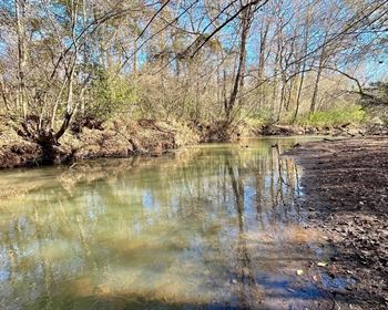
This is a beautiful forested property close to wildlife refuges and state forests. Situated in Hampshire County, this lot is surrounded by mountains and forests. The area offers natural beauty and a quality of life “that will make visitors want to stay forever“.
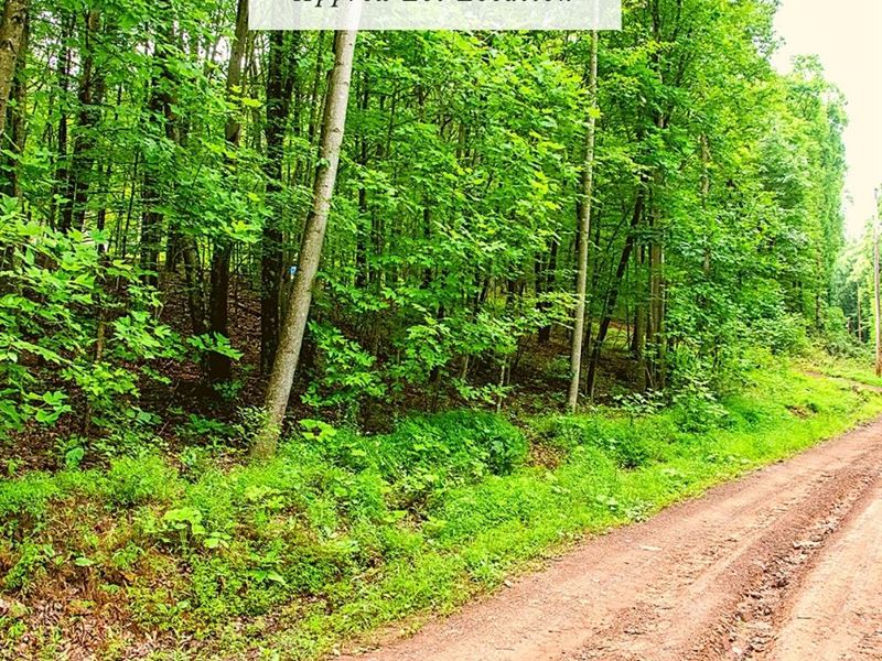
The lot has direct access via a dirt road. The property is about 5 minutes to Short Mountain Wildlife Management Area, 40 minutes to Green Ridge State Forest, 2 hours and 15 minutes to Washington DC, and 2 hours and 30 minutes to Baltimore and Harrisburg. There are many recreational opportunities in the area, including fishing and hunting, hiking and camping.
According to our research, there is no zoning in Hampshire County. There are deed restrictions that were recorded when the subdivision was first created that restrict the lot to residential uses.
Cash Discount Price: + Doc Fee
We accept cash payment via ACH Transfer, Wire Transfer or Zelle.
Don't forget to check out our 30 Day Money Back Guarantee.
Seller Financing down + doc fee and for 64months.
0% Apr. No prepayment penalty. No credit check.
Hold Price: we can hold the property for you for 2 days while you decide whether you want to purchase. If you buy the property, this will count toward the purchase price. You can also hold the property up to 8 days.
Location
According to website, “Less than a 2 hour's drive from three state capitols (Va, PA & MD) as well as our nation's capital (Washington, Dc), Hampshire County is uniquely situated as a gateway to Wild Wonderful West Virginia. A visit here provides you with an experience rooted in our country's biggest historical events including the American Revolution and the Civil War.
Our museums, cemeteries, farms and markets, festivals, scenic marked trails, train rides, and old fashioned resorts will take you back in time to a bygone era. Family-owned and operated hotels, restaurants and art/music centers bring our rich heritage to life and everyone is better for it.”
Lot Details
Assessor's Parcel Number: 14-09- 21-0061.0000
Legal Description: Please email us for a copy of the full metes and bounds legal description.
Elevation: 1620 ft
GPS Center Coordinates (Approx.): 39.1959, -78.6913
Gps Boundary Coordinates (Approx.): 39.1961, -78.6906; 39.1952, -78.6914; 39.1953, -78.6915; 39.1954, -78.6916; 39.1955, -78.6917; 39.1958, -78.6919; 39.1965, -78.6913; 39.1961, -78.6906
Annual zoning
Time Limit To Build: None as far as we are aware
Access: Dirt Road
Power: There appear to be powerlines on the road, but power would need to be connected to the property.
Water: A well would need to be installed.
Sewer: A septic system would need to be installed. Please note that a perc test has not been done.
RVs Allowed? We recommend that you contact Hampshire County to confirm, but, according to our research, RVs are allowed.
Buildable? Because we do not know the specifics of what you may want to build on the property, we recommend that you contact the building and/or zoning department(s) for more information on the relevant zoning and building regulations and how to obtain a building permit.
Survey Available? No, we have not had a survey commissioned, but if you would like to pay for a survey we would be happy to work with your chosen surveyor.
In Hoa? No Hoa
Hoa 0