A Haven Near The St Johns River
Satsuma, FL 32189
Putnam County, Florida
Land Description
Owner Financing:
- down (plus the doc fee)
- down and for 60 months (plus prorated taxes and note maintenance fee)
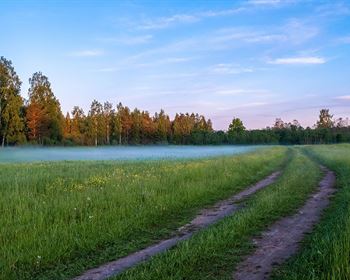
St. Johns Riverside Estates in Satsuma is an ideal location for whatever your Florida life is designed around. You've got 0.23 acres with no time limit to build. Close to Little Lake George, Lake George, Crescent Lake, as well as the Murphy Creek Conservation area and Dunn Creek State Park. Head west for the coast at Cedar Key or east for the Atlantic oceanside at St. Augustine or Flagler Beach. A visit to Orlando for your theme park fix is just an hour or so away, and if you have a need for speed you've got multiple speedways in the area, including one right in Satsuma.
With the proximity to St. Johns River, you'll be catching largemouth bass, crappie, bluegills, catfish and more on a regular basis. Not into fishing? No problem, take a scenic riverboat tour of the area instead or day trip to DeLeon Springs to visit Volusia Speedway Park or make your own pancakes at the SugarMill restaurant (housed in a historic replica mill building).
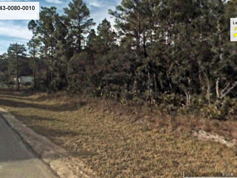
Enjoy this convenient corner lot situated at the intersection of Hickory Nut Trail and Pond Rd. While you're deciding what to build, you can bring your RV for temporary visits (see zoning details for length of time) without needing a temporary use permit as long as the RV is self-contained and it's being used by the owners or friends and family of the owners (with permission). Plus, if you plan to build on the property, the RV temporary use permit is good for 6 months.
Subdivision: St Johns Riverside Estates, Hoot Owl Ridge 3rd Addition
STREET Address: 100 Pond Rd, Satsuma, FL 32189
State: Fl
COUNTY: Putnam County
Zip: 32189
Size: 0.23 acres
LOT Dimensions: 76 feet x 136 feet
Apn: 11-11-26-8243-0080-0010
Legal Description: Lot 1, Block 8, HOT OWL Ridge Section OF ST. Johns Riverside Estates, Third Addition, a subdivision according to the plat thereof, recorded in Plat Book 5, Page 35, Public Records of Putnam County, Florida.
Lat/Long Coordinates:
Nw: 29.560186, -81.642207
Ne: 29.560195, -81.641973
Sw: 29.559816, -81.642194
Se: 29.559822, -81.641956
Elevation: 45 ft
ANNUAL Taxes: Approx. per year
ZONING: R-2 - Residential, Mixed - Site built, manufactured and mobile homes are allowed. No time limit to build. Minimum size is 700sqft. Mobile homes require permanent installation and must comply with H.U.D. standards. Tiny Homes are not allowed; however small homes that comply fully with the current Florida Building Code can be constructed in R-2 Zoning Districts. RVs may be used for temporary shelter in the residential zoning districts without need of a temporary use permit under the following conditions: 1. The use is for temporary visits on a non-fee basis by the property owner or by friends and family members of the owner or occupant of the property, with permission of the property owner. 2. The RV is self-contained. 3. The extent of the stay in the RV does not exceed 14 consecutive days or 120 non-consecutive days in a given calendar year. If planning to build on the property, the RV temporary use permit is available and shall have a duration limited to 6 months (once approved), subject to an extension of time up to 6 months if the construction of the principal residence is diligently proceeding. Maximum time allowed is 12 months. The recreational vehicle shall be self-contained or shall be lawfully connected to an outside source of electrical power, potable water, and sewage disposal. Contact Putnam County, FL Planning and Zoning Department for any additional details.
HOA/POA: No
IMPROVEMENTS: None
ACCESS: Property can be accessed via Hickory Nut Trail and Pond Rd.
WATER: Would be a well, water haul and holding tank or other similar option
SEWER: Would be by Septic
UTILITIES: There are power lines along Hickory Nut Trail. Phone by cellular, satellite Tv/Internet/Phone