Salina Kansas Commercial
W Magnolia Rd : Salina, KS 67401
Saline County, Kansas
Land Description
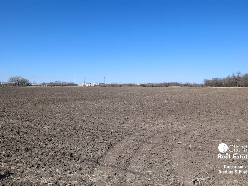
, Terry Zimmer, Michael Hansen & Brian Rose of United Country - Crossroads Auction & Realty of Salina, Kansas are offering are offering for sale 36.69 Acres of Cropland / future Development Land located in Salina, Kansas. This land features 26.82 FSA Cropland Acres with the remaining 9.87 Acres of Timber, Cover & Pasture Land for a total of 36.69 Acres of Land. This land is NOT within the City Limits of Salina however, with its proximity between Interstate I-135 and the K-State Polytechnic Campus, this land would be prime for commercial development. Minerals are believed to be 100 intact and will be sold with the land.
Please go to the following DropBox Folder to download additional property information Property Information DropBox Folder
SELLERS Tom and Linda Rickstrew Trust
LEGAL Address A tract of land located in the Southwest Quarter Sw/4 of Section Twenty-six 26, Township Fourteen 14 South, Range Three 3 West of the 6th P.M. in Saline County, Kansas, being more particularly described as follows Commencing at the Southwest corner of said Southwest Quarter Sw/4 thence on an assumed bearing of South 89 Degrees 54'41 E along the South line of said Southwest Quarter Sw/4 a distance of 130.72 feet to the intersection of said South line, and the Easterly right-of-way line of the Union Pacific Railroad, said point being the point of beginning thence North 00 Degrees 19'47 W along said Easterly right-of-way line, a distance of 599.82 feet thence on a curve to the right having a radius of 5,679.65 feet, a chord bearing of North 07 Degrees 19'07 E, a chord distance of 1,512.35 feet, and an arc length of 1,516.85 feet to the centerline of Dry Creek thence South 52 Degrees 35'23 E along said centerline, a distance of 559.48 feet thence South 46 Degrees 45'04 E continuing along said centerline, a distance of 268.56 feet thence South 32 Degrees 18'34 E continuing along said centerline, a distance of 81.07 feet thence South 20 Degrees 53'59 W continuing along said centerline, a distance of 415.59 feet thence South 27 Degrees 55'22 E continuing along said centerline, a distance of 436.81 feet thence South 20 Degrees 07'55 E continuing along said centerline, a distance of283.94 feet thence South 21 Degrees 58'56 W continuing along said centerline, a distance of 192.69 feet thence South 14 Degrees 59'07 E continuing along said centerline, a distance of 299. 74 feet to a point on said South line of said Southwest Quarter Sw/4 thence North 89 Degrees 54'41 W along said South line a distance of 1,031.96 feet to the point of beginning. except that part taken for roads, highways and right-of-ways Taxes 2020 Taxes were From the intersection of W. Magnolia Rd. and Centennial Rd. in Western Salina, drive a -mile east until you see the Subject Property on the North Side of the road, just past the railroad tracks.