Fabulous 20 Acres
Talihina, OK 74571
Pushmataha County, Oklahoma
Land Description
This 20 Acres is one of the coolest 20s that I've had the opportunity to offer for sale in quite awhile. Everything about it, from the terrain, elevation and setting to the beautiful drive to this property shouts Adventure.
It is located approximately 10 miles south of Talihina, OK behind a locked security gate that protects the area from those unwanted guests.
Being a little over a mile west of the sleepy little mountain highway, Indian Highway, that cuts over the Kiamichi Mountains to Honobia, OK, it is very secluded and private. This fabulous 20 Acres lies at the very end of the access road so you'll not have any traffic passing through.
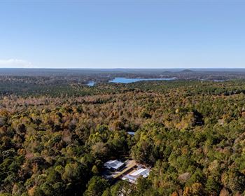
As mentioned above, it is located between Talihina, OK, the gateway to the Ouachita National Forest and Honobia, OK, the Bigfoot Capital of Oklahoma, right in the middle of the Kiamichi Mountains. It is some of the most scenically beautiful country in Oklahoma. And Pushmataha County is one of the four in Oklahoma that has a Black Bear hunting season.
You'll be pleased to find black bear, huge whitetail deer, turkey, squirrel and every other type of wildlife in abundance on this 20 Acres.
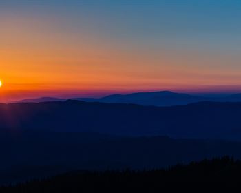
Views from the property are breathtaking, what I like to call "Million Dollar Views".
The road to the 20 Acres is an engineering wonder itself and is an absolutely beautiful drive from Indian Highway back to the property.
This access road can be traveled in about any 4-wheel drive vehicle. It enters onto the property at the northeast corner at about 1440' above mean sea level (amsl).
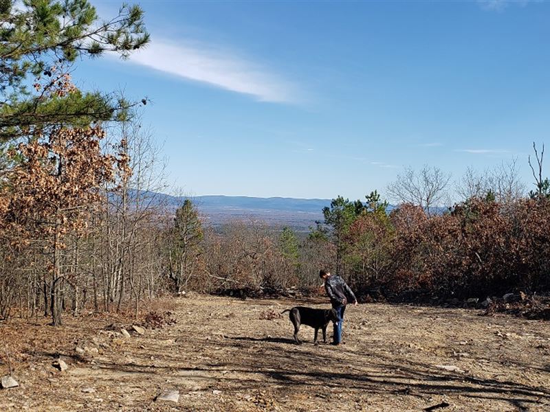
The photos that have my grandson and my killer guard dog, Einstein, in them are from this area at the NE corner of the property. This area would be my choice for an OFF Grid cabin (no electric or rural water lines).
The property rises to about 1500' amsl on the northwest corner providing even greater views.
The elevation change on the property is from about 1240' amsl in the notch at the mid
eastern side up to approximately 1540' amsl on the south end. That is about 300' of elevation change, perfect for hiking, hunting and recreation in general.
One really cool thing about this little place is that the famous K Trail is only about 1/4 mile from the south border.
Property has legal access with formal deeded easement.
If you want a very secluded, private and secure place to hunt or build that getaway cabin, just give a call for your tour, you'll be glad you did.