Lot Road Access Near Blm Land
County Road 124 : Walsenburg, CO 81089
Huerfano County, Colorado
Land Description
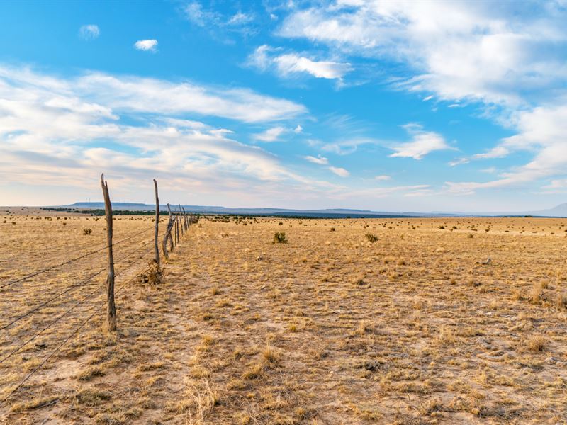
39.17 Acres with Electricity & Dirt Road Access near BLM Land
Call or Text anytime for questions or to purchase this property. Please reference the Property ID: Co_Huerfano_00083
39.17 Acre Ranch with 1,302 feet of road frontage along the entire Northern boundary. There are electricity lines & poles already in place along the Southern boundary of the property.
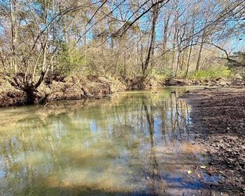
Just 2.7 miles to the West you will find 6,000 Acres of BLM Land that contains the Cucharas River and Cucharas Canyon. Activities include Hunting, Backpacking, Hiking, Wildlife Viewing, Bird Watching, Photography & More. Native Wildlife includes Bighorn Sheep, Black Bear, Elk, Mule Deer, White-Tailed Deer, Pronghorn & Mountain Lions.
The land is located in Game Management Unit 128. The area is rich in native wildlife including Mule Deer, White Tail Deer, Pronghorn Antelope, Bear and Moose.
The property is surrounded by breathtaking Mountain Views including Greenhorn Mountain and Spanish Peaks.
You are also only about 44 miles from the Badito Cone, Greenhorn Mountain and the San Isabel National Forest. The area is rich in native wildlife including Elk, Deer, Antelope and Wild Turkeys.
NO Hoa, Covenants or Restrictions. There is no time limit to build.
The minimum dwelling size per the County is only 600 square feet.
Electricity is provided by San Isabel Electric
CenturyLink provides telephone & DSL Internet service
High-Speed Internet is available through HughesNet
Cable is available through DirecTV
There are RVs, Cabins, Log Homes, Tiny Homes, Site-Built Homes, Mobile Homes and Ranches on nearby parcels
About 8 miles to paved State Highway 10 which takes you directly down to the town of Walsenburg about 21 miles from the property, where you will find groceries, fuel, supplies, restaurants, medical care, schools and professional services.
The Spanish Peaks Regional Health Center in Walsenburg has a Level IV Trauma Center, specialty clinics and the 5 Star Rated Spanish Peaks Veterans Community Living Center.
Spanish Peaks Regional Health Center
Spanish Peaks Veterans Community Living Center
Lathrop State Park is Southwest of the property with about a 25 mile drive from this 39.17 acre property. Lathrop State Park is Colorado's first State Park and consists of 1,594 Acres. Nestled in the shadow of the Spanish Peaks, Lathrop State Park has two lakes; Martin Lake and Horseshoe Lake. Activities at Lathrop State Park include Boating, Swimming, Jet Skiing, Water Skiing, Camping, Fishing, Golfing, Archery, Hunting for Waterfowl and Small Game. For more information visit the park's Website.
Nearby land owners either install water wells, have it delivered or haul it themselves.
Parcel Size: 39.17 Acres M/L
Property ID Number: Co_Huerfano_00083
General Elevation: 5,945 feet
Legal Description: Tyrone Hills Lot 162
Apn: 4734319
Property Taxes: Free & Clear
Conveyance: Warranty Deed
Approximate Distance to Nearby Cities & Points of Interest
22 minutes to Interstate 25
24 minutes to Walsenburg, CO : Population 3,200
33 minutes to the Lathrop State Park
45 minutes to Colorado City, CO : Population 2,100
49 minutes to Greenhorn Mountain, Badito Cone and the San Isabel National Forest
54 minutes to Trinidad, CO : Population 10,000
57 minutes to the Trinidad Lake State Park
1 hour 2 minutes to Pueblo, CO : Population 110,000
1 hour 22 minutes to Lake Pueblo State Park
1 hour 27 minutes to Spanish Peaks State Wildlife Area
1 hour 34 minutes to the Great Sand Dunes National Park
1 hour 40 minutes to Colorado Springs, CO : Population 500,000
2 hours 1 minute to Blanca Peak
2 hours 52 minutes to Denver, CO : Population over 1 Million
Visiting the Property
You are welcome to visit the property at your convenience while it is available.
GPS Coordinates
Northwest Corner: 37.722, -104.522558630667
Northeast Corner: 37.53, -104.518093366614
Southeast Corner: 37.367, -104.518039284445
Southwest Corner: 37.748, -104.522549939438
Center Point: 37.789211, -104.520213
Call or Text anytime for questions or to purchase this property. Please reference the Property ID: Co_Huerfano_00083