Drive-Up Access and Hunting
Porum, OK 74455
Muskogee County, Oklahoma
Land Description
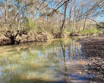
Don't miss out on the oppurtunity to own this wonderful 40 +/- acre property with drive-up access. It sits just 4 miles away from the beautiful Canadian River.
This is a great hunting and recreational property, and won't last long at this price. This is your chance to own your own private getaway retreat. It provides seclusion with the convenience of nearby small towns. It is also 6 miles from Porum, 70 miles from Fort Smith, 90 miles from Tulsa, and 140 miles from Oklahoma City.
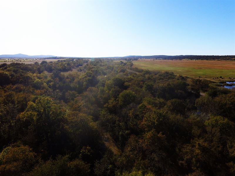
There are no hunting or camping restrictions - you can do what you want. It is beautifully wooded with mature hardwoods, oaks, hickory, pine and other deciduous trees.
Wildlife is abundant in the area, with the Oklahoma Department of Wildlife Conservation, Gaines Creek Eufaula Wildlife Management Area, and more all nearby. Bobwhite quail, white-tailed deer, eastern turkeys, cottontail rabbits, grey and fox squirrels, raccoons, gray fox, and more are all present in the area.
There are abundant hunting, fishing, boating, and camping opportunities nearby. This property is also great for hunting and recreation, as these are great assets to draw game from while on your own private property. You won't have to compete for a hunting area or come out to your hunting blind to find a stranger occupying it. Muskogee county is only one of a few in Oklahoma with a bear hunting season.
If you're looking for a good place to hunt and live - look no further. This place has several level areas to build on and is a great place to get that trophy deer.
This is a special LandFlip discount price, regular price is The listed price is a cash only price. If bought on owner-financing, price is higher.
Property Stats
Size: 40 Acres +/-
Apn: 21487
Legal Description: T10n R19e S29 NE SW NW & W1/2 SE NW & SE SE Nw
State: Oklahoma
County: Muskogee
General Location: 6 miles from Porum, 70 miles from Fort Smith, 90 miles from Tulsa, and 140 miles from Oklahoma City
Gps: 35.313, -95.320
Driving Directions: See maps.
Conveyance Document: Warranty Deed
Recording: to record. We will create deed, send to the county on your behalf, and cover all recording fees. We will send you scanned copies of everything sent in for your tracking. The recorded deed will be mailed to you from the county after it is recorded.
Doc Prep Fee: Elevation: 700 feet
Zoning: Rural vacant land zoning. There are no hunting or camping restrictions.
Power: At or near the lot or alternative system. All around the property.
Water: At or near the lot or alternative system.
Sewer: At or near the lot or alternative system.
Roads: Paved to Dirt
Property Tax: Approximately All property taxes are current.
HOA Fees: None
Time Limit to Build: N/A
Type of Terrain: Flat to hilly with spectacular views.
Property Plat Map: Yes, see attached.
Topographical Map: Yes, see attached.
Area Photos: Yes, photos are of general area, not actual property.
Exact GPS coordinates
35.124,-95.509; 35.393,-95.781; 35.824,-95.298; 35.571,-95.392; 35.582,-95.225; 35.159,-95.338; 35.367,-95.99; 35.924,-95.442; 35.066,-95.592; 35.124,-95.509
Owner financing is available for this property.
We don't do any credit or background checks - you're automatically approved. Please contact us for terms.