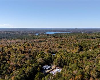
20 Acre at Sacramento Mountains
49 Chapparral Loop : Alamogordo, NM 88310
Otero County, New Mexico
Land Description
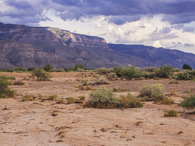
20 Acre Homestead at the Base of the Sacramento Mountains with Magnificent Views.
This large 20 Acre parcel is located at the base of the Sacramento Mountains just South East of Alamogordo NM. The parcel has magnificent views of the Sacramento Mountains and is in close proximity to the Lincoln National Forest and several State Parks.
The parcel is flat, wide open and lush with desert dwelling plants indicating a strong water table in the area great for a personal agriculture operation.
Up to 8 personal farm animals are allowed on the property including Cows and Horses. Personal fowl are also permitted in addition to the larger farm animals.
This 20-acre parcel will allow for two separate home sites giving you a two in one investment. Install a modular home for yourself and another for family, friends or for tenants giving you passive income for years to come.
Mobile and modular homes are welcome as well as traditional stick-built homes. Covenants allow mobiles that meet the following criteria: Minimum of 1000Sqft of heated living area, shingled roof with a pitch of 3 12 or greater. The mobile home must sit on a permeant foundation with complete coordinated skirting. Towing tongues, axels and wheels must be removed.
Nearby Towns and Cities.
-Alamogordo 14.4 Miles to the North along Highway 54. (21 Minute Drive)
- Tularosa 26.6 Miles to the North along Highway 54. (34 Minute Drive)
- Las Cruses 74 Miles South West along Highway 70. (1 Hour 12 Minute Drive)
- El Paso Texas 79.8 Miles to the South West along Highway 54. (1 Hour 15 Minute Drive)
-Cloudcroft NM 32.9 Miles to the North East North along Highway 54 and East along Highway 82. (42 Minute Drive)
-Roswell NM 130 Miles to the North East North Along Highway 54 North East along Highway 70 and East along Highway 380. (2 Hour 24 Minute Drive)
Nearby State Parks
-5.1 Miles (12 Minute Drive) to Oliver Lee State Park where Hiking and Camping can be enjoyed. Starting from Oliver Lee State Park Dog Canyon Trail will take you 5.2 Miles East into the Lincoln National Forest where miles and miles of back packing trails can be explored throughout the Lincoln National Forest.
-Lincoln National Forest Entrance 41 Miles (50 Minute Drive) to the North East.
-Hike in on Dog Canyon Trail beginning at Oliver Lee State Park just 15 minutes from the property.
-White Sands National Monument is located 25.8 Miles to the West (30 Minute Drive) North along Highway 54 and South West along Highway 70.
Pricing Details:
Cash Price: Details:
Parcel : R028411 / R028412
County: Otero County
Parcel Size: 20 Acres
Legal Description: Subd: Desert Aire Lot: 5 & 6 Block: 11
Gps Center Coordinates Lot 5: 32.7728, -105.9634. /
Gps Center Coordinates Lot 6: 32.7736, -105.9652
Gps Coordinates (4 Corners): Lot 5
-32.7744, -105.9641
-32.7744, -105.963
-32.7711, -105.9641
-32.7711, -105.963
Gps Coordinates (4 Corners): Lot 6
-32.7744, -105.9664
-32.7744, -105.9641
-32.7727, -105.9664
-32.7727, -105.9641
Elevation: 4101 ft.
Access to Property (Dirt or Paved): Dirt Road
Zoning: No Zoning
Terrain: Level
Time limit:12 Months.
Tax Amount: 202.88/Yr per tax lot. 405.76/Yr Together.
HOA: None
Water: Well needs drilling.
Sewer: Septic would be installed
Power: At lot line.