River Front Lot By National Forest
Prairie Wind Lane : Capulin, CO 81124
Conejos County, Colorado
Land Description
Call or Text anytime for questions or to purchase this property. Please reference the Property ID: Co_Conejos_00007
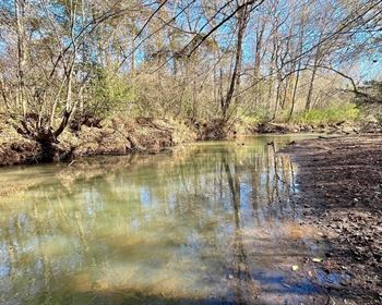
Riverfront Lot along the Alamosa River with Road Frontage near Electricity in Southern Colorado.
This property has great access via County Roads with over 50 feet of road frontage along Prairie Wind Lane.
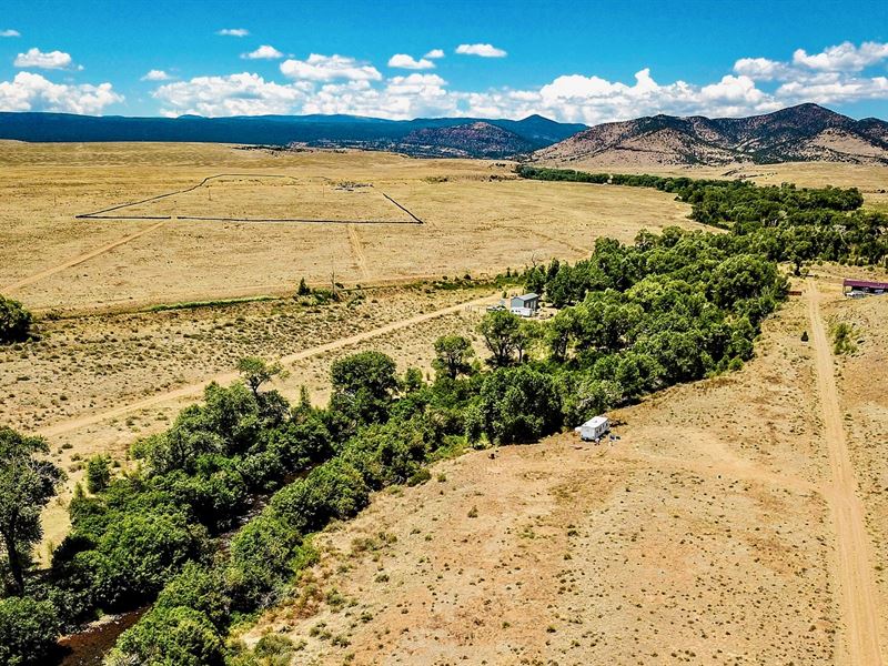
The property is located at the base of the San Juan Mountain Range and offers beautiful views of Chiquito Peak, Rio Grande National Forest, and Green Ridge Mountain.
Within a mile of the property there is more than 4,600 Acres of BLM located in GMU 81 that is desirable for hiking, outdoor recreation and hunting of elk and deer.
This parcel also puts you in close proximity to an abundance of recreation offered by the nearby mountain ranges that include:
2.8 miles to the Hot Creek State Wildlife Area
9 miles to the Rio Grande National Forest
13 miles to the Terrance Reservoir Wildlife Area
20 miles to the La Jara Reservoir Wildlife Area
There is NO Time Limit to Build. There are NO Covenants, Restrictions or Assessments.
You can use the property recreationally or for camping.
You can put a mobile home, tiny home, shipping container home or alternative type of dwelling on the property.
The property is gently sloped towards the Alamosa River with mature trees as you near the river.
There are RVs, Cabins, Mobile Homes, Site-Built Homes and Ranches on nearby parcels (see photos).
Parcel Size: 0.22 Acres M/L
Property ID: Co_Conejos_00007
Legal Description: Alamosa River Estates Block A Lot 99
Property Taxes: / year
Title: Free & Clear
Conveyance: Warranty Deed
Elevation: 8,100 feet
Approximate Distance to Nearby Cities & Points of Interest
2 minutes to County Road Z
6 minutes to the paved Highway 15
11 minutes to Capulin, Co
18 minutes to Monte Vista Nationa Wildlife Refuge
25 minutes to Monte Vista, CO : Population 4,200
34 minutes to Alamosa, CO : Population 10,000
40 minutes to Del Norte, CO : Population 1,600
56 minutes to South Fork, Co
1 hour 10 minutes to the Great Sand Dunes National Park
1 hour 18 minutes to the Wolf Creek Ski Area
GPS Coordinates
Northwest Corner: 37.3929, -106.18261537582686
Northeast Corner: 37.2486, -106.182457266419
Southeast Corner: 37.9778, -106.1827910166326
Southwest Corner: 37.3206, -106.1829874464193
Center Point: 37.326194, -106.182710
Call or Text anytime for questions or to purchase this property. Please reference the Property ID: Co_Conejos_00007