Off Fr 5252 Watersmeet Mls 1111507
Fr 5252 : Watersmeet, MI 49969
Baraga County, Michigan
Land Description
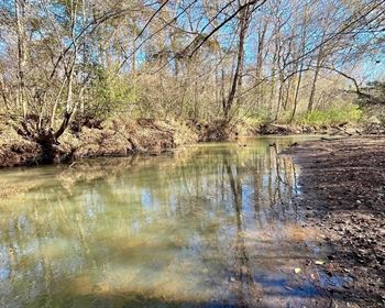
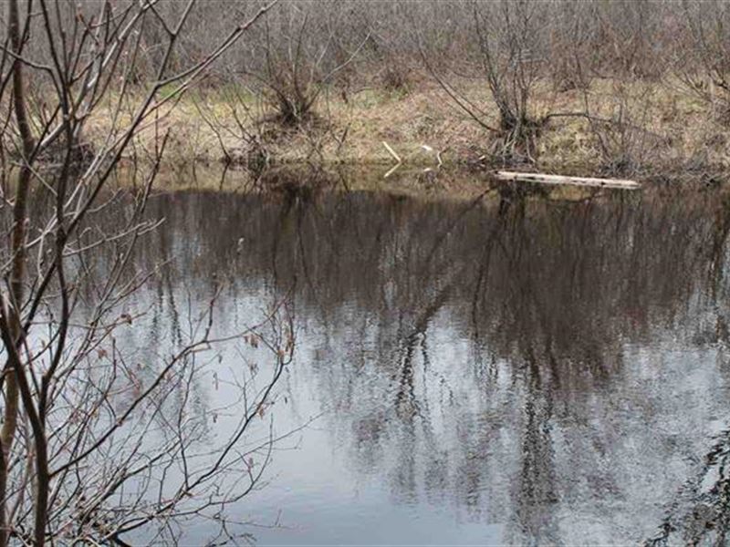
Private 30+/- Acre Wooded Recreational Parcel - Surrounded BY Ottawa National Forest Lands. Located in Interior Township in south-eastern Ontonagon County, this is one of only a few large private tracts available in the area, which also includes over 1,100 feet of river frontage. The Ottawa National Forest covers 993,010 acres in the Upper Peninsula of Michigan. It extends from the south shore of Lake Superior down to Wisconsin and the Nicolet National Forest and includes land in six U.P. counties. These lands offer a variety of hunting opportunities ranging from small game to large animals. Black Bear, Canada Goose, Duck and Mergansers, Ruffed Grouse, Whitetail deer, and Woodcock hunting opportunities exist here. There are more than 196 miles of hiking and backpacking trails, and a wide variety of equestrian opportunities. Over 90 miles of cross country ski trails are located throughout the National Forest. Downhill skiers will find hills only an hour away at Iron River, Ironwood, or the Porkies. The Upper Peninsula has an extensive groomed snowmobile trail network, exciting terrain, and an abundance of snow (Annual snow fall is generally between 100 and 250 inches). About 230 miles of trail are located in the Ottawa National Forest, and access to Trail No. 107 and Trail No. 3 are less than a mile away. The property has over 1,100 feet of frontage on the Middle Branch Ontonagon River. This river is 70+ miles long. Less than a quarter mile north of the property is the Little Falls which empties into a reservoir called the Bond Falls Flowage. This sprawling water body has a surface area of approximately 2,100 acres, and is about 40 feet deep. This water body has 20 miles of shoreline with many coves and more than 20 islands. The Flowage has two public access boat launches. Coolwater fishes present include, but are not limited to, walleyes, northern pike, minnows, suckers, sunfishes, yellow perch, bullheads, and muskellunge. There have been eight State of Michigan Master Angler awards taken from Bond Falls Flowage from 1993-2006, including four rock bass, one northern pike, one muskellunge, one brook trout, and one black crappie. Water leaving reservoir become the Bond Falls, a scenic 50-Foot waterfall which tumbles over a thick belt of fractured rock, dividing it into numerous small cascades. Roadside parking and picnic tables are available near the top of the falls. And there are 600 feet of accessible boardwalk with six viewing locations. The river waters continue northward to the shore of Lake Superior. If you follow the river southward from the property you will find about 11 miles of designated Canoe/Kayak Waters. Many paddlers Put-in at the Burned Dam Campground below Mex-i-min-e Falls and use a take-out at the Interior Road. Others paddle the final miles of the pleasant moving water with intermittent rockbed rapids. After passing a cabin the river bends left and trips across a minor ledge/hole. A brief pool Remarks Continued: and a right-turn leads to more river-wide scattering of ledge/waves (likely class Ii+). A slightly longer gap leads to a final ledge/wave before the river enters the backwater of Bond Flowage. When the water is high this small ledge of the falls is sometimes buried beneath the waters of the flowage as there is only a short class II drop there. An egress paddle over the waters of the flowage will take you to a public access point off Bond Falls Road. Other Summer recreation includes photography, bird and wildlife watching, and visits to see the mysterious Paulding Light. In less than an hour you can be on the Shores of Lake Superior, visit the majestic Porcupine Mountains and Lake in the Clouds. The towns Bruce Crossing and Watersmeet are nearby for shopping and golfing, and casino entertainment. The property is in "Scenic River" designated lands, where building is allowed. Call us for a tour of this private riverfront property today.