Lot 6 W Brule Lake Rd, Mls 1095205
Lot 6 W. Brule Lake Rd : Iron River, MI 49935
Iron County, Michigan
Land Description
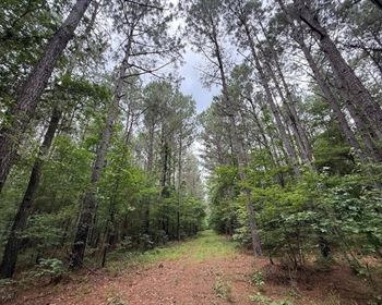
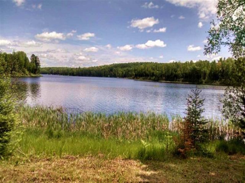
Upper Michigan Brule Lake Waterfront parcel for Sale! Parcel 6 is a.54 Acre lot that has 100+ Feet of frontage on Brule Lake. This lake is located in Stambaugh Township, in south-eastern Iron County in Michigan's Upper Peninsula. This beautiful lake has a water surface area of 250-Acres, and a depth of approximately 20-Feet deep. This lake provides excellent fishing for Northern pike, Walleyes, Muskies, perch, walleye,and Panfish. There is a U.S. Forest Service Owned public access site on the west shore. There is a parking area for 8 vehicles, and a Hard-surfaced ramp for launching boats. The lake is surrounded by the Ottawa National Forest, providing limitless wilderness recreational opportunities. Almost a million acres of the Ottawa National Forest are located in the western Upper Peninsula of Michigan, and extend from the south shore of Lake Superior to the Wisconsin border. 178,000 acres of it occupies the western half of Iron County, and Brule Lake is within its borders. The name Brule originated from early French explorers and means “burned woodlands” in reference to the practice of using fires to stimulate wildlife use by the Native Americans. The lake has two boat ramps. One is located on the north end. The other ramp on the south end of the lake, is located just south of the property being offered for sale. Also located just a short distance from the property is Stateline Picnic Area and the Mile Post Zero National Recreation Trail. The one-half mile trail is easy, with relatively flat surfaces. A 10 to 15 minute hike through hardwood forests will bring you to the historical Treaty Tree and the Wisconsin/Michigan overland border. Captain Thomas Cram made a treaty for passage with Chief Ca-Sha-O-Sha and the band of Ojibwa (Chippewa) near a large tamarack tree at the headwaters of the Brule River. He placed the first marker at this survey point in 1840 - establishing the Wisconsin-Michigan state boundary. Brule Lake forms part of the border between the States of Michigan and Wisconsin and is the headwater of the Brule River. The Brule River is a 52-mile-long river that forms a portion of the boundary between the states of Michigan and Wisconsin. It winds east and southeast until joining with the Michigamme River to form the Menominee River and then flows on into Lake Michigan. The Brule River is stocked with Rainbow, Brook and Brown trout, and there are Smallmouth bass and Northern pike to be caught in the lower sections. The Brule River is famous for canoeing, and has been canoed by four different U.S. presidents. If you love Winter sports, there are the nearby Ge-Che Cross country ski trail and Ski Brule to enjoy. The wooded lot being offered for sale has a gradual sloping terrain to the waterfront. The parcel has year-round access, with power available at the roadside. Call us today to set up your private tour of this lovely property! (If you would like a larger building site, an additional adjacent lot, MLS# 1095204 is also available.)