5 Acres Only $1 Down, $199/Mo
Conchas, NM 88439
San Miguel County, New Mexico
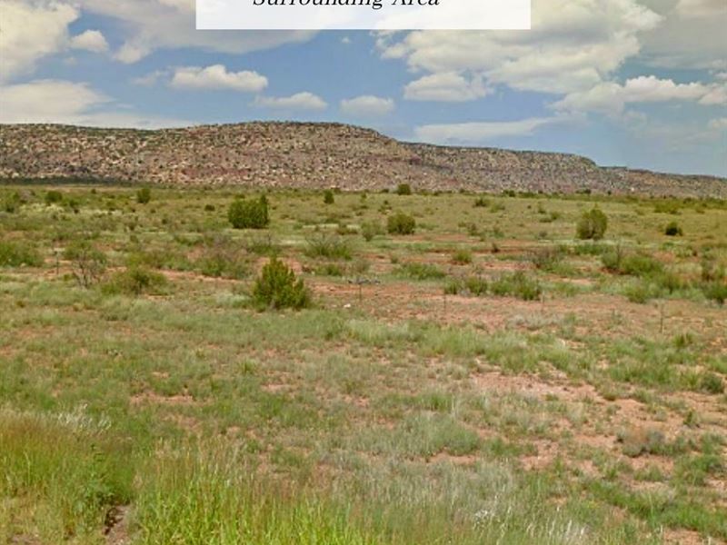
Land Description
This plot is part of the existing Rancho Lake Conchas subdivision, near Conchas Lake. The subdivision is accessible from County Route 129 and 104, and the property itself is accessible via a dirt road.
The lot is about 30 minutes to Conchas Lake, 2 hours to Santa Fe and 2 hours and 40 minutes to Albuquerque.
The area is zoned A1 (agricultural residential), which allows for agricultural uses and single-family homes, including mobile homes. According to our research, the county does not have restrictions on RV use, but please give the county a call to confirm this.
Cash Discount Purchase Price: + Document Fee
We accept payment via PayPal, wire transfer, ACH transfer, and Zelle.
Seller Financing down with a document fee and per month for 26 months at 0% Apr. No prepayment penalty. No credit checks.
Hold Price: we can hold the property for you for 72 hours while you decide whether you want to purchase. If you buy the property, this will count toward the purchase price.
Title And Use
What you can or cannot legally do on the land is controlled by the local government, not by us or any seller. Please contact the county, providing them with the parcel number, to confirm zoning, access, and available utilities.
About Conchas Lake
According to the US Army Corps of Engineers, Conchas Lake provides excellent fishing. The lake is stocked with bluegill, channel catfish, crappie, large mouth bass, and walleye and is open all year to fishing.
The Conchas project office offers a free group shelter in the Day Use Area that includes the following: picnic tables, Bbq, two horseshoe pits, six-hole disc-golf course and a volleyball court.
Lot Details
Assessors Parcel Number: R0266485
Legal Description: Subd: Rancho Lake Conchas Lot: 17 Block: 20 Tract: 17
Gps Coordinates (approx.): Please note that the GPS coordinates are approximate. They come from public assessor GIS data and are fairly accurate, but to find the exact boundaries of the property, it is best to hire a local surveyor.
Center: 35.3345, -104.4947
35.3353, -104.4941
35.3350, -104.4942
35.3336, -104.4941
35.3336, -104.4946
35.3336, -104.4951
35.3353, -104.4951
Elevation: 4700 Ft
Annual Taxes: A1 (agricultural residential)
Time Limit to Build: None as far as we are aware
Access: Dirt Road
Power: Electricity would likely have to be solar or another alternative system.
Water: A well would need to be installed.
Sewer: A septic system would need to be installed. Please note that a perc test has not been done.
Contacts: San Miguel County Planning and Zoning