.257 Ac in NM Just $1 Down
Timberon, NM 88350
Otero County, New Mexico
Land Description
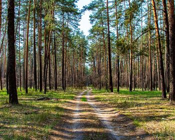
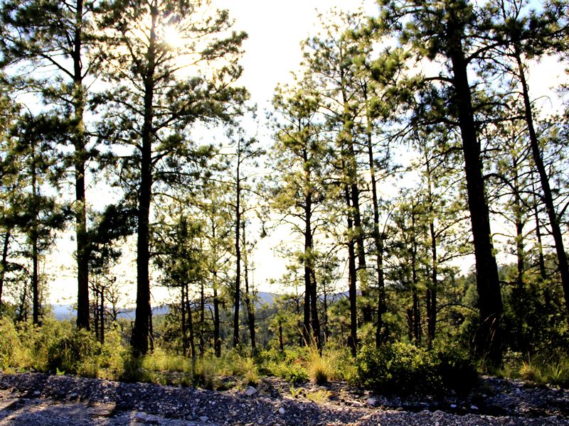
0.257 acres in the breathtaking Sacramento Mountains.
Water, Electric, and towering Ponderosa Pine Tree's on this gorgeous 0.257 acre property. Secure your future on this property for just down today.
Escape the daily hustle and bustle and come live your off grid dreams for just down. Whether you are looking for a long term investment or spot to take the family during the summer, look no further.
Live to hunt? You are in the right place. Hunt exotic Elk and Wild Turkey on the outskirts of Timberon.
Purchasing Options:
down, for 50 months and doc fee
Call or Text anytime for questions or to purchase this property.
Cash Discount: options require a document prep fee.
Zoning: Residential - 800 square foot minimum to build. Mobile homes and camping in a tent are not allowed. A travel trailer/RV may be used for up to 30 days. If it is connected, it can be used up to 180 days per year.
HOA/POA: No.
Timberon Water & Sanitation charges for water. Water lines available on the road, just need a meter which is F&S fees are charged yearly as well and they are R045832
Coordinates: 32.6585816, -105.6890615
Access: Dirt road
Sewer: Septic can be installed
Water: Timberon Water & Sanitation does charge for standby water. Water lines available on the road, just need a meter which is
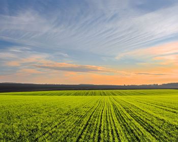
Property Tax: Timberon Subdivision lies about 88.8 miles north of El Paso Texas and 43.5 miles South Southeast of Alamogordo, New Mexico. Alamogordo was a 2005 finalist for the All-America City Award, America's original and most prestigious community recognition award. Alamogordo is the commercial and governmental center for the county. It is a thriving center of 35,000+ residents.
Key Features close to the Timberon, New Mexico area include:
LINCOLN National Forest: Elevations range from 4,000 to 11,500 feet pass through five different life zones from Chihuahuan desert to subalpine forest.
WHITE Sands National Monument: White Sands is New Mexico's number one National Monument attraction. Here, great wave-like dunes of gypsum cover nearly 300 square miles of desert. The dunes are ever changing, growing, cresting, then slumping, but always advancing.
CARLSBAD Caverns National Park: There are several tours available at the National Park both guided or self directed.
SKI Apache: America's southernmost major ski area. It is the ultimate winter playground for skiers and snowboarders of all skill levels.
Timberon
Timberon lies nestled in the Sacramento Mountains in South Central New Mexico and averages out at an altitude of about 7000 feet above sea level. We are surrounded by the 300,000 acre Lincoln National Forest to the north and east, while the military has McGregor Range to south and west.
The development of Timberon covers approximately 9,000 acres and is located next to Oliver Lee's historic Circle Cross Ranch. The best way to get to Timberon is to take the beautiful, paved Scenic Byway out of Cloudcroft towards Sunspot. This is about a 30 to 45 minute drive. Looking over Timberon by the Mountain Times. The golf course is a long and challenging nine holes.
There is an extensive road system that goes throughout Timberon, meandering all over the different subdivisions of the development...up and down hills, through valleys and meadows, and in and out of ravines. The roads within Timberon must be treated as if you were driving through the National Forest...the road conditions can change with the seasons.
Timberon is a part of the frontier of the Sacramento Mountains. There is "Nothing Fancy" on the frontier. You can, however, lose yourself in the beauty and solitude of the area. Timberon is like being in the National Forest, but with convenient facilities available to live comfortably and activities for you to participate in.
Call or Text anytime for questions or to purchase this property.
Some of these photos are from the surrounding area.
DISCLAIMER: Any information provided in this communication is believed to be accurate, but in no way guaranteed. Buyer is responsible for verifying all information with the County as to what can and can't be done with the property. Buyer will need to work with the County to obtain the proper permits if needed. Buyer will also need to confirm the availability of any utilities needed or serviced on the property. Seller makes no warranties or representations about the land, its condition, or what can be built on the property. If/when you visit any of our properties, you are visiting at your own risk and release TLP - (and anyone associated) from any and all claims or liabilities.