Oak Hill Forest
Byam Road : Bethel, VT 05032
Windsor County, Vermont
Land Description
Oak Hill Forest is well suited to the development of a private, year-round homestead with features that include:
Large property footprint with mountaintop terrain and a stream along its road frontage, allowing a diverse hiking experience;
Quiet potential home site near property's center, with developed access and fine views;
Easily accessible to nearby towns and Interstate 89.
Oak Hill Forest, located in Bethel, Vermont, is tucked into a classic, narrow Vermont hollow. Formed by Gilead Brook, this valley watershed, locally known as simply “The Hollow”, begins in the Northfield Mountain Range just west of the land. The property is on Byam Road, a dead-end road near the end of Gilead Brook Road and 3.7 miles from Route 12 just north of Bethel Village. Both roads do not see much traffic, so this scenic valley is a quiet location.
Bethel is a crossroads town where Route 12 (north-south) meets Route 107 (east-west). Bethel's main street is 8 miles from the land and 3 miles from Interstate 89, and offers basic services. Seven miles to the north, Randolph is a larger, vibrant community bolstered by the presence of the Chandler Center for the Arts, Gifford Medical Center, and Vermont Technical College. Twelve miles east, the Vermont Law School is set in the hamlet of South Royalton.
Via I-89, Burlington, Vermont is 1.25 hours northwest, Hartford, Connecticut is 3 hours south, and Boston is 2.5 hours southeast.
Byam Road is ±1 mile long; it begins toward the end of Gilead Brook Road and ends at the base of the Northfield Range. The property has ±0.6 miles of frontage along Byam Road; a feeder stream of Gilead Brook runs along the road. Byam Road is a gravel, town-maintained road with electric and telephone service roadside. Midway along the road frontage is an access road that leads 600' into the land to a large clearing. This access road is well constructed and would serve as a solid driveway leading to a future home site.
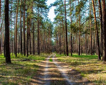
Internal access exists as a comprehensive web of woods trails that lead to each of the property's farthest ends, an excellent foundation to establish a recreational trail network.
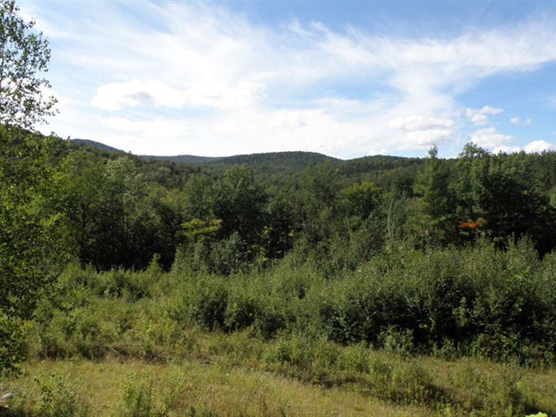
One of the property's finest attributes is its large clearing at the end of the access road between 1,200' and 1,300' ASL (above sea level) in elevation. This site is easily buildable and offers scenic views to the north, west and east down the Gilead Brook Valley. The terrain at this location is moderately sloping, offering the ability to create a large open meadow with tree clearing.
The property includes the top of Oak Hill (elevation of 1,880' Asl) located at the southeastern corner of the land. Oak Hill is a “U” shaped mountain, creating an oxbow north of its ridge, with the land at its center and the property's eastern, southern and western sides each running to Oak Hill's “U” shaped height of land.
The property's terrain is variable with more gentle slopes at its center and steeper slopes leading to the ridges and along the easternmost section of the road frontage (as you approach the land from Gilead Road). The lowest elevation (1,000' Asl) is where the Gilead Brook feeder stream leaves the property, creating an elevation change of nearly 900'. Given that the property is situated at the top of the watershed (at the height of the land), there are no streams running through the property. Soils are generally well drained and productive.
The property was acquired by the current owner in 2008 and, since then, the land has been managed for the production of forest products. In 2009 and 2010, most of the property was managed with various silvicultural treatments, producing the current resource that has variable stocking levels and diameter sizes. The harvesting created abundant natural regeneration.
The species composition is common for the area and includes the maples, red spruce, hemlock, white ash, the birches and miscellaneous other common hardwoods and softwoods.
The 2020 forest management plan identifies 7 forest stands and calls for additional silvicultural activities in 2020 and 2025; however, these scheduled activities can be delayed by the new owner by means of an amendment to the plan.
The property is located in a heavily-forested area, with the Northfield Range just to the west. These conditions create habitat where large game mammals such as moose, black bear, white-tailed deer, coyote and fisher cats are common.