Winooski River Forest
River Road : Moretown, VT 05660
Washington County, Vermont
Land Description
1) Location
The forest is located in central Vermont and is part of the larger Winooski Valley watershed. The property is surrounded by a predominately forested landscape, distinguished by its abundant natural resources, with fine homes dotting the hillsides and fertile farmland flanking the river valleys. This popular region is anchored by vibrant towns such as Montpelier, Waterbury, Stowe and Burlington, each offering an array of cultural and recreational pursuits as well as stable and established employment opportunities. Outdoor enthusiasts are drawn to the area for its close proximity to the Mad River Valley, home to Mad River Glen and Sugarbush, two well-known ski resorts. Also nearby is Stowe, another well-known destination for skiing, both downhill and cross-country.
Montpelier, the state capital, offers an eclectic mix of shops and restaurants; the property is only 6 miles from town. Waterbury is located about 6 miles to the northwest, while Burlington, one of Vermont's finest cities, is an easy 35-minute commute farther to the northwest via the interstate. For the weekend commuter, Boston, MA and Montreal, Quebec are within a three-hour drive of the property. Hartford, CT is approximately 3.5 hours to the south.
2) Access
The property benefits from quality access with year-round road frontage, facilitating forest management entry, recreational activities and future homestead options. Established internal roads provide access to the central portions of the property where views to the north and west are prominent, and home site development is possible. Nearby is Interstate 89, providing easy access for commuters.
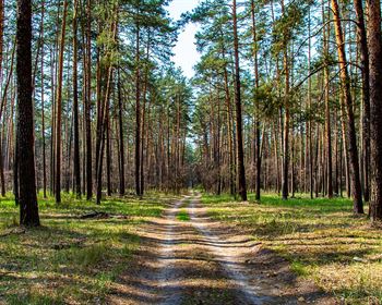
Four points of entry to the property exist from town-maintained roads: 275 of frontage off Henning Road, a right-of-way (Row) off Vermont Route 100B; nearly 4,700 of frontage along River Road (Class 3); and roughly 4,447 of frontage along Hog Hollow Road, which is primarily a legal town trail. On the western side of the property, the ROW off 100B leads to an internal access road that penetrates deep into the forest. Other deeded access points allow for limited rights of ingress and egress. Electric utilities are available along River and Henning Roads.
3) Site Description
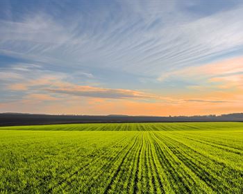
The forest offers varied terrain with gently-sloped ridgelines tipping to the northwest and to the northeast. The ridgelines give way to narrow valleys where small streams, flanked by dense softwoods, eventually drain into the Winooski River across from the propertys road frontage.
The land gently rises in elevation from the road frontage (elevation 500) to two ridgelines on the property. These two gently-sloped ridges, which rise to 1,100 in elevation, offer exceptional sites for future homestead development, with good forest aesthetics and the potential for fine views. One ridge, running north/south, is accessed from Hog Hollow Road and the other ridge, running east/west, is accessed from Vermont Route 100B via a private internal road.
The internal roads pass through mature white pine stands as they lead to various grassy, open areas which are well positioned along the road to capture views (with additional clearing) of the surrounding Winooski River landscape and distant peaks, including Camels Hump, the peaks in Bolton, and Mount Mansfield.
Soils are generally well drained and highly productive.
The Winooski River runs opposite the propertys road frontage along River Road and the access point along Route 100B.
4) Timber
Timber data in this report are based on a comprehensive and monumented timber inventory completed in June of 2019 for the purpose of establishing Capital Timber Value (Ctv). The timber data reveal a total sawlog volume of 6,722 MBF International scale (7.1 Mbf/Acre), with 16,769 pulpwood cords (17.8 cords/acre). Combined total commercial per acre volume is 32.1 cords, a figure above average for the region. Stumpage values were assigned to the volumes in June of 2019, producing a property-wide Capital Timber Value (Ctv) of acre).
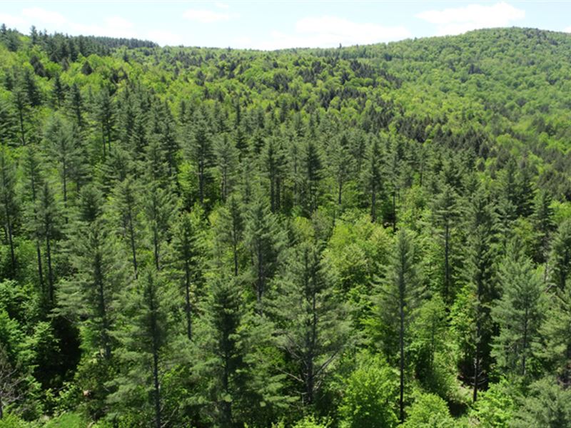
The species composition is nearly split between hardwoods at 54% of total volume and softwoods at 46%. Species composition for all products combined mirrors that commonly found in the area; however, with a higher percentage of white pine, given that several large forest stands were planted to pine in the 1950S, resulting in white pine holding 17% of volume. Other species include hemlock (25%), red maple (18%), the birches (12%, mostly yellow birch), sugar maple (10%). Remaining species consist of white ash, beech, spruce and miscellaneous hardwoods, completing the profile.
The sawlog volume breakdown is similar; however, white pine holds the largest volume followed by hemlock, the maples, yellow birch, red spruce and white ash (see graph to right). Previous forest management has had a noticeable impact on reducing the American beech component.
The white pine sawlogs are, on average, larger in diameter, and occupy the mos t gentle sites along and near the interior road access areas.
Average diameter for all products combined is 13.5, while the average sawlog diameter is 15.5. Average diameter for the main species are white pine 20, sugar maple 14, red maple 14.5 and hemlock 16. The pine and hemlock volumes have reached financial maturity. The hardwood component generally remains in an asset appreciation growth phase.
Aside from the recent areas treated by a shelterwood harvest, forest density is generally represented by fully-stocked stands. The average Basal Area (Ba) is 103 ft2 on 185 stems/acre. Stem quality is quite good. Acceptable Growing Stock BA is 78 ft2. The previously-thinned stands are currently in a free-to-grow state with no thinning activity required. The pine resource can be harvested anytime.