Wooded Peninsula On Trinity Lake
Trinity Center, CA 96091
Trinity County, California
Land Description
Call or Text anytime for questions or to purchase this property. Please reference the Property ID Number: Ca_Trinity_00001
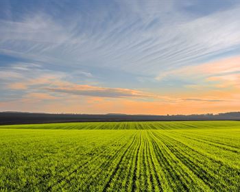
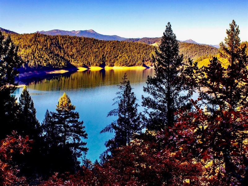
58.2 Acre Wooded Peninsula on Trinity Lake bordering the Shasta-Trinity National Forest on all sides of the property.
The Shasta-Trinity National Forest is the largest National Forest in California. It encompasses more than 2,210,000 Acres and includes Trinity Lake, the Trinity Alps and Mount Shasta with an elevation of 14,179 feet.
This one-of-a-kind property puts you in the center of abundant fishing, hunting, outdoor recreation and water sports.
Trinity Lake consists of 17,280 surface Acres, is 19 miles in length and there are 145 miles of shoreline. The maximum depth is 416 feet.
Trinity Lake is known for having calm and ‘glassy' waters, which make it ideal for water sports such as water skiing and wakeboarding. It was previously known as Clair Engle Lake and is sometimes still presented as such on some maps.
Trinity Lake is a great area to relax and has fish for every kind of angler. Fish included here are Largemouth and Smallmouth Bass, Rainbow Trout, Brown Trout, Kokanee Salmon, the landlocked Chinook (King) Salmon, White Catfish, Brown Bullhead, and Sunfish.
Trinity Lake also holds the California state record for Smallmouth Bass, weighing in at 9lbs 1oz, as well as the state record for Brown Bullhead, which was 4lbs 8oz.
The property is accessible only by boat, with the Trinity Center Public Boat Launch being only 6.14 Miles from the Property. The cost was per day when we had last checked. There is no time limit for parking at the boat launch.
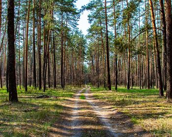
In addition to the recreation offered on the lake, this land is surrounded by hundreds of thousands of acres of the Shasta-Trinity National Forest.
The Shasta-Trinity National Forest is a diverse area for wildlife and nature alike - according to the Usda Forest Service, this forest contains around 35 different species of trees and is mentioned to be a great area for deer & bear hunting.
The property is in Hunting Zone B2. Find the various online resources we have gathered regarding hunting in Shasta-Trinity National Forest on our website.
The opportunity for recreation in the area is endless. The Shasta-Trinity National Forest is also a well known area by many Mushroom hunters who enjoy to find their own fresh Mushrooms to pick.
A personal use permit for up to 20 pounds of Mushrooms is free, valid for 30 days, and available once per season.
Commercial Licenses for Mushroom Hunting are also available.
In addition to those seeking fresh mushrooms, there also claims to be opportunity for those seeking places to prospect for gold in the area.
The property is in California Gold Region 6.
Due to the many gulches in the area where water runs off of the mountains into the Trinity Lake, this is said to be a very productive area for placer deposits.
Last but not least, the area is thriving with peaks big and small for trailblazers of all experience levels.
To the Northwest, in the Trinity Alps, you'll find Gibson Peak, Siligo Peak, Granite Peak, Black Mountain, Caribou Mountain, Sawtooth Mountain, Mount Hilton and Thompson Peak.
This property is also only 2 Hours away from the start of the trailhead to Mount Shasta, towering at 14,180 feet.
Parcel Size: 58.2 Acres
Elevation: 800 feet
Apn: -0
Hoa Fee: None
Property Taxes: / year
Title: Free & Clear
Conveyance: Warranty Deed
Approximate Distance to Nearby Cities & Points of Interest (Based on Trinity Center Public Boat Ramp - 6 miles by boat from the Property)
Minutes from the center of Trinity Center, California
Bordering Shasta-Trinity National Forest
1 miles to California State Highway 3
16 miles to Alpen Cellars
30 miles to Weaverville, California : Population 3,600
51 miles to Lake Shasta Caverns National Natural Landmark
64 miles to Redding, California : Population 91,808
73 miles to Redding Municipal Airport
95 miles to Oregon-California Border
131 miles to the Pacific Ocean : Clam Beac
226 miles to Sacramento, California : Population 495,234
Gps Coordinates
Northwest Corner: 40.28, -122.703137684931
Northeast Corner: 40.046, -122.694632963388
Southeast Corner: 40.893, -122.694808118639
Southwest Corner: 40.755, -122.702939986748
Center Point: 40.88128, -122.69836
Call or Text anytime for questions or to purchase this property. Please reference the Property ID Number: Ca_Trinity_00001