40.26 Acres with Amazing Views, Sw
Unassigned : Ash Fork, AZ 86320
Yavapai County, Arizona
Land Description
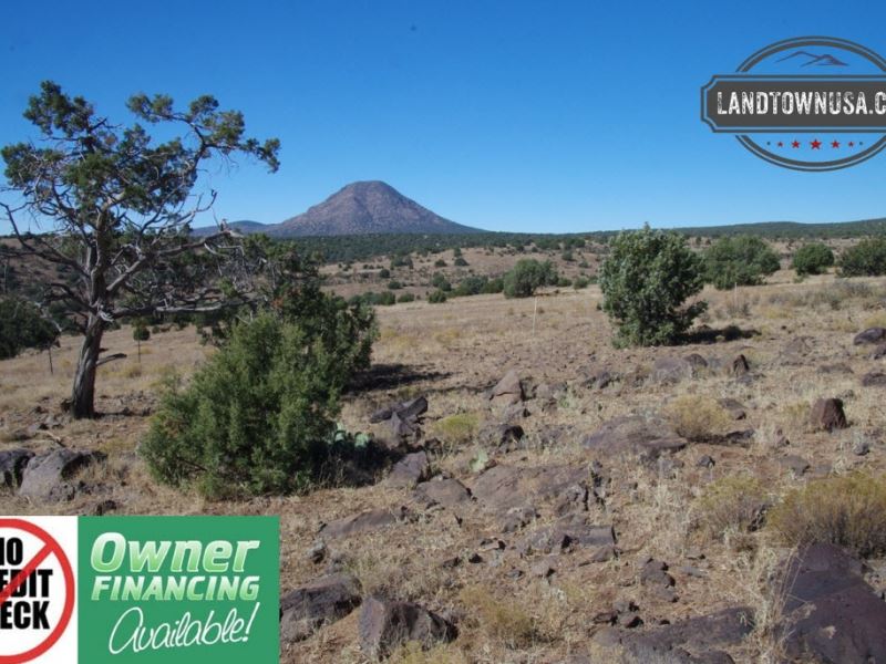
40.26 Acres with fantastic views of Picacho Butte, Lots of State Land nearby, property surveyed in January and all corners are marked. Property does have road access, 4 wheel drive vehicle required to access the property. Property is 14 miles west of Ash Fork, South of Interstate-40 Cash Discounted Price Debit/Credit card accepted. Seller Financed Price Seller Financing Terms Document Prep Fee + down payment then per month for 120 Months. Monthly payment includes principal & interest, monthly escrowed property taxes and monthly note servicing fee. There are no early payoff or prepayment penalties, No Credit Checks, Parcel Number 30218206 Acreage Size 40.26 Property Address Unassigned, Seligman, AZ 86337 GPS Coordinates 35.230454, -112.688964 Elevation 5,423 Feet Short Legal Description Juniperwood Ranch Unit 2 Lot 90 Annual Property Taxes Nearest City Ash Fork State AZ County Yavapai Subdivision Juniperwood Ranch HOA None HOA Dues Not Applicable Time TO Build No Limit on time to build Zoning RCU Residential Rural. Manufactured/Modular homes and single family houses are permitted. Great lot for camping, bring your Camper or Motorhome. GAS Ferrellgas out of Prescott, AZ or Valle, AZ service this area. Superior Propane out of Williams, AZ also services this area. Power would be solar or generator. TV or Internet would be by Satellite and phone would be cellular Waste Would be by Septic. R-Diamond Septic & Excavation out of Seligman, AZ services this area. Water Well or Holding Tank. Del Rio Drilling & Pumping out of Chino Valley, AZ services this area. Contact them regarding depth of well or water table. Terrain Level Conveyance Warranty Deed Driving Directions Driving directions to Juniperwood Ranch parcel 30218206 From Arizona I-40 west of Ash Fork, take Crookton Road exit 139 GPS N35.22929 W112.58588. Turn south off the exit and the road becomes the fronage road going east. Follow this approx. 0.75 miles to N. Arizona Road going south at GPS N35.22670 W112.57367 Follow N. Arizona Road southwest approx. 0.7 miles to a Y at N. Train Robbers Road. GPS N35.21883 W112.57972. Bear right at the Y and follow N. Train Robbers Road SW approx. 1.2 miles to the intersection of Antelope Run Road. GPS N35.20946 W112.59666. Follow Anteope Run Road west approx. 1.75 miles to W. Horse Soldiers Road on the right north GPS N35.20954 W112.62821 Turn north on W. Horse soldiers Rd and follw north then west for approx. 1.37 miles to y at GPS N35.21288 W112.64838. Go right west here and follow W. Volcano Trail 1.42 miles to an intersection north, at GPS N35.21350 W112.67311. Turn Right north here and go north 0.25 miles to GPS N35.21718 W112.67317. Turn left west here and go approx. 0.12 miles to a road on the right north GPS N35.21727 W112.67540. Follow this road NW approx. 1.05 miles to the parcel south property line at approx. GPS N35.22833 W112.68709. The parcel SE corner is GPS N35.22829 W112.68682