Pearly Lake Forest
Bowers Hill Road : Rindge, NH 03461
Cheshire County, New Hampshire
Land Description
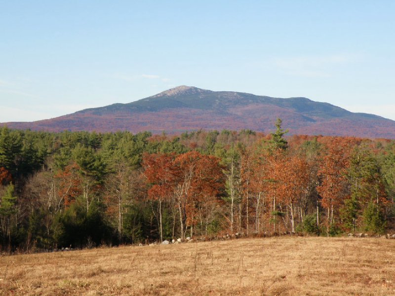
On the shores of Pearly Lake, this conserved forest offers sweeping views of
Mount Monadnock, well-managed timber, a generous building envelope, internal trails and scenic fields. Set in southwestern New Hampshire, known as the Monadnock Region, the area abuts the northern border of Massachusetts and is about halfway between Vermont and the seacoast. The rolling landscape of forests and farms is punctuated with small New England villages and numerous small lakes and ponds. The property is in the town of Rindge, home to Franklin Pierce University. Nearby, Mount Mondanock, the highest point in the county (3,165’ ASL) and considered “one of the most climbed mountains in the world” is visible from the property
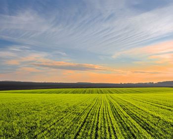
The property’s variable terrain, an interesting mix of flat, gently rolling and hilly, makes it suitable for an diverse range of land uses - continued long-term forestry, recreation, small scale agriculture and residential development. There is a total of 55 acres of field on the property. Near the center of the property, two fields, one 10.5 acres and the other 24.4 acres, are on two small “plateaus” and offer outstanding views of Mount Monadnock to the north. These fields are within the 150-acre designated building envelope, providing opportunity for building a home with a breathtaking view.
Pearly Lake (also known as Pearly Pond) is a 192-acre lake with some shoreline homes along the western and southern shoreline. The eastern shoreline, some of which is owned by Franklin Pierce University, remains largely undeveloped. The lake is 17 feet at the deepest point and averages 7 feet deep throughout. Sections of the property shoreline appear suitable for constructing a dock, which is allowed in the conservation easement. Wetlands account for 54 acres of the property, including the two beaver ponds (8-10 acres in total).
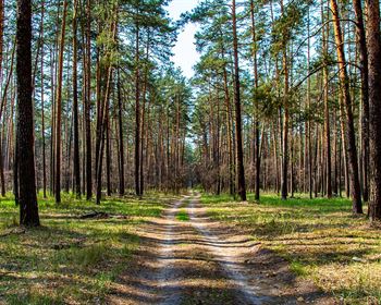
The forest supports a mix of white pine and hardwoods with medium stem quality and a pole to small sawlog diameter distribution. The forest has been sustainably managed for over twenty years, resulting in the majority of stands being fully stocked. With the exception of establishing three fields totaling 44 acres, there has been no other harvesting since 2005. Subsequent growth has resulted in a property-wide average stocking of approximately 26 cords/acre, well above the regional average and poised for another thinning in the near future. Based on the adjusted 2003 inventory, the rough timber value is the entire property is protected by a conservation easement that provides for one 5-acre house site within a 150-acre zone.